|
Golden Eagle Super Lasso
|
16.72 mi
3,214 ft |
 |
|
Toms Thumb Windgate Pass lolly
|
13.72 mi
3,788 ft |
|
|
Windgate Bell Loop
|
9.91 mi
2,090 ft |
|
|
Windgate Bell Loop
|
9.54 mi
2,070 ft |
|
|
Windgate Bell Loop
|
12.02 mi
2,297 ft |
|
|
Windgate Bell Loop
|
11.85 mi
2,313 ft |
|
| Bell Pass Toms Thumb Loop
|
12.62 mi
2,894 ft |
|
|
|
Tom's Thumb Loop off Windgate Pas...
|
13.4 mi
3,049 ft |
|
| Thompson Peak
|
13.19 mi
3,837 ft |
|
|
|
Tom's Thumb Loop off Windgate Pas...
|
12.68 mi
3,007 ft |
|
|
Tom's Thumb Loop
|
12.69 mi
3,109 ft |
|
|
Gateway - Thumb End - Bell
|
13.1 mi
2,922 ft |
|
|
Tom - Bell loop
|
12.58 mi
2,977 ft |
|
|
McDowell Mountains / Tom's Thumb
|
16.84 mi
3,897 ft |
|
|
Windgate Bell Loop
|
9.49 mi
2,070 ft |
|
|
Dixie Mine - Windgate Lasso Loop
|
16.18 mi
3,176 ft |
|
|
Thompson Peak Loop
|
13.28 mi
2,684 ft |
|
|
Adero Super Loop
|
19.62 mi
3,264 ft |
|
|
Windgate Bell Loop
|
9.5 mi
2,043 ft |
|
|
East End Peak - Loop from Gateway TH
|
14.22 mi
3,285 ft |
|
| Thompson Peak Rd - MSP
|
11.91 mi
3,594 ft |
|
|
| Windgate Bell Loop
|
10.82 mi
2,151 ft |
|
|
| Windgate Bell Loop
|
10.52 mi
1,995 ft |
|
|
|
Tom's Thumb Loop off Windgate Pas...
|
13.91 mi
3,224 ft |
|
|
Windgate Bell Loop
|
10.28 mi
2,126 ft |
|
|
Toms Thumb Bell Pass loop
|
13.01 mi
3,143 ft |
|
| Gateway - East End - Tom's Thumb ...
|
11.56 mi
2,935 ft |
|
|
|
Adero Super Duper Lupe
|
23.6 mi
4,116 ft |
|
|
Adero Super Loop via 104th St
|
22.44 mi
4,328 ft |
|
| Gateway/Bell/Windgate/Desert Park...
|
11.85 mi
2,342 ft |
|
|
| Desert Park Gateway Loop
|
7.37 mi
921 ft |
|
|
|
Adero Super Loop
|
20.24 mi
3,661 ft |
|
|
Windgate-Thumb-East End-Bell Loop
|
12.89 mi
2,983 ft |
|
|
Tom's Thumb Loop off Windgate Pas...
|
13.1 mi
3,107 ft |
|
| McDowell Sonoran Preserve Loop
|
16.71 mi
4,775 ft |
|
|
| Tom's Thumb Trail South via 104th...
|
14.56 mi
3,380 ft |
|
|
|
Windgate Bell Loop
|
10.26 mi
2,217 ft |
|
|
Bell Pass-Gateway Loop
|
9.33 mi
1,999 ft |
|
|
Micky D Loop
|
13.61 mi
3,148 ft |
|
|
Adero Super Loop
|
19.93 mi
4,069 ft |
|
|
Adero Super Loop
|
20.24 mi
4,083 ft |
|
|
Toms Thumb-Bell Pass loop
|
13.7 mi
3,209 ft |
|
|
Toms Thumb attempt
|
7.17 mi
1,271 ft |
|
| Tom's Thumb Loop off Windgate Pas...
|
13.44 mi
3,410 ft |
|
|
|
Tom's Thumb Loop off Windgate Pas...
|
14.31 mi
3,583 ft |
|
|
Windgate Bell Loop
|
10.74 mi
2,277 ft |
|
|
Windgate Pass Trail - MSP
|
7.84 mi
1,631 ft |
|
|
Tom's Thumb Loop off Windgate Pas...
|
14.42 mi
3,322 ft |
|
|
Windgate Bell Loop
|
10.11 mi
2,302 ft |
|
|
Mcdowell stroll
| 2021-01-26 |
jillyonanadventure |
|
3.64 mi
369 ft |
|
| Adero Super Loop
|
18.75 mi
3,333 ft |
|
|
|
Gateway Paradise Levee Loop Plus
|
4.45 mi
522 ft |
|
|
Levee Paradise Gateway
|
3.07 mi
335 ft |
|
|
Thompson Peak from 104th St
|
13.2 mi
3,629 ft |
|
| Gateway to Tom's Thumb
|
11.97 mi
2,849 ft |
|
|
|
Gateway - Lookout - Desert Park Loop
|
14.19 mi
3,064 ft |
|
|
Gateway - Lookout - Desert Park Loop
|
14.5 mi
3,107 ft |
|
| Windgate Bell Loop
|
9.11 mi
2,137 ft |
|
|
|
Thompson Peak from Gateway
|
14.51 mi
3,860 ft |
|
| Windgate Bell Loop
|
9.27 mi
2,026 ft |
|
|
| Windgate Bell Loop
|
9.16 mi
2,114 ft |
|
|
| Thompson Peak from Dixie Mine TH
|
13.47 mi
3,790 ft |
|
|
| Windgate Bell Loop
|
9.73 mi
2,149 ft |
|
|
| Windgate Bell Loop
|
9.29 mi
2,022 ft |
|
|
| Windgate Pass Trail - MSP
|
7.75 mi
1,636 ft |
|
|
| Lookout Trail - MSP
|
12.75 mi
3,006 ft |
|
|
| Tom's Thumb Loop off Windgate Pas...
|
13.59 mi
3,534 ft |
|
|
| Tom's Thumb Loop off Windgate Pas...
|
12.91 mi
3,366 ft |
|
|
| Thompson Peak from 104th St TH
|
13.11 mi
3,764 ft |
|
|
| Thompson Peak-East End via 104th St
|
20.37 mi
5,398 ft |
|
|
| McDowell Mountain Loop
|
33.05 mi
6,356 ft |
|
|
| Tom's Thumb Loop off Windgate Pas...
|
12.52 mi
3,114 ft |
|
|
| Desert Park Trail - MSP
|
6.07 mi
729 ft |
|
|
| Tom's Thumb Loop off Windgate Pas...
|
13.01 mi
3,339 ft |
|
|
| Tom's Thumb Loop off Windgate Pas...
|
12.39 mi
3,121 ft |
|
|
| Tom's Thumb Loop off Windgate Pas...
|
12.56 mi
3,114 ft |
|
|
| Thompson Peak from Dixie Mine TH
|
13.23 mi
3,763 ft |
|
|
| Tom's Thumb Loop off Windgate Pas...
|
13.24 mi
3,662 ft |
|
|
| Bell Pass Thompson Peak Windate Loop
|
16.97 mi
4,324 ft |
|
|
| Thompson Peak via Gateway TH
|
12.67 mi
3,717 ft |
|
|
| Micky D Loop
|
13.54 mi
3,157 ft |
|
|
| Bell Pass Trail - MSP
|
9.66 mi
2,139 ft |
|
|
| Double Bypass (Bell and Windgate)
|
9.82 mi
2,196 ft |
|
|
| Bell Pass Trail - MSP
|
7.15 mi
1,597 ft |
|
|
| Tom's Thumb Loop off Windgate Pas...
|
12.58 mi
3,139 ft |
|
|
| Paradise Trail - MSP
|
5.52 mi
609 ft |
|
|
| Tom's Thumb Loop off Windgate Pas...
|
12.73 mi
3,122 ft |
|
|
| Thompson Peak from Dixie Mine TH
|
13.54 mi
3,880 ft |
|
|
| Tom's Thumb Bell Pass Loop
|
12.21 mi
3,140 ft |
|
|
| Desert Park Trail - MSP
|
7.75 mi
1,046 ft |
|
|
| Tom's Thumb Loop off Windgate Pas...
|
13.16 mi
3,442 ft |
|
|
| Desert Park Windgate Gateway Hors...
|
5.26 mi
692 ft |
|
|
| Tom's Thumb Loop off Windgate Pas...
|
12.73 mi
3,218 ft |
|
|
| Bell Windgate Loop from 104th Street
|
10.03 mi
2,131 ft |
|
|
| McDowell Loop
|
14.73 mi
3,529 ft |
|
|
| Gateway CC and Saguaro Loops
|
4.83 mi
820 ft |
|
|
| Bell Pass Trail - MSP
|
7.07 mi
1,564 ft |
|
|
| Windgate Bell Loop
|
10.07 mi
2,189 ft |
|
|
| Desert Park Trail - MSP
|
5.74 mi
751 ft |
|
|
| MSP Gateway Windgate Toms Thumb
|
13.77 mi
3,305 ft |
|
|
| Windgate Bell Loop
|
9.44 mi
2,111 ft |
|
|
| Tom's Thumb Loop off Windgate Pas...
|
32.4 mi
4,736 ft |
|
|
| Tom's Thumb Loop off Windgate Pas...
|
12.48 mi
3,068 ft |
|
|
| Horseshoe Trail - MSP
|
2.74 mi
314 ft |
|
|
| Mcdowell and Drinkwater Peaks
|
8.56 mi
2,632 ft |
|
|
| Horseshoe TH to Tom's Thumb Trail
|
6.81 mi
1,187 ft |
|
|
| Gateway-Desert Park Loop
|
5.22 mi
678 ft |
|
|
| Horseshoe Trail to Gateway Saddle
|
1.84 mi
483 ft |
|
|
| Thompson via Bell Pass
|
13.19 mi
3,787 ft |
|
|
| Tom's Thumb Loop
|
11.92 mi
3,056 ft |
|
|
| Windgate Pass Trail - MSP
|
3.83 mi
1,408 ft |
|
|
| Gateway-Desert Park Loop
|
7.61 mi
1,032 ft |
|
|
| Bell Pass - Bell / 104th TH
|
3.07 mi
912 ft |
|
|
| Windgate Bell Loop
|
9.67 mi
2,198 ft |
|
|
| McDowell Meander
|
19.89 mi
5,720 ft |
|
|
| Desert Park Windgate Gateway Loop
|
5.57 mi
713 ft |
|
|
| Toms Thumb Bell Pass Loop
|
14.62 mi
3,499 ft |
|
|
| Windgate Bell Pass Loop
|
9.47 mi
2,014 ft |
|
|
| Desert Park Gateway Loop
|
6.92 mi
872 ft |
|
|
| Bell Pass Windgate Loop - MSP
|
9.4 mi
2,041 ft |
|
|
| Bell Pass Windgate Loop - MSP
|
9.36 mi
2,116 ft |
|
|
| McDowell Drinkwater Peaks
|
7.18 mi
3,071 ft |
|
|
| Crossover Trail - MSP
|
6.04 mi
1,319 ft |
|
|
| McDowell and Drinkwater Peaks
|
8.5 mi
2,619 ft |
|
|
| ParadiseGatewayDesertPark-MSP
|
11.38 mi
1,706 ft |
|
|
| 104th St to Tom's Thumb out & back
|
12.19 mi
3,622 ft |
|
|
| SuperLoop Windgate Bell Pass - MSP
|
12.65 mi
2,445 ft |
|
|
| SuperLoop Windgate Bell Pass - MSP
|
9.51 mi
2,139 ft |
|
|
| Gateway Loop and Spurs - MSP
|
5.97 mi
841 ft |
|
|
| SuperLoop Bell Pass Windgate - MSP
|
9.48 mi
2,153 ft |
|
|
| Mountain Spring to Windgate Pass
|
2.11 mi
677 ft |
|
|
| McDowell Mountain to Fountain
|
19.61 mi
1,675 ft |
|
|
| Tom's Thumb Loop off Windgate Pas...
|
11.7 mi
2,760 ft |
|
|
| Tom's Thumb Loop off Windgate Pas...
|
12.55 mi
3,101 ft |
|
|
| Drinkwater Peak
|
7.87 mi
2,359 ft |
|
|
| Tom's Thumb Loop off Windgate Pas...
|
12.91 mi
3,173 ft |
|
|
| Tom's Thumb Loop off Windgate Pas...
|
17.1 mi
3,800 ft |
|
|
| McDowell Peak
|
8.97 mi
2,649 ft |
|
|
| Bell Pass Trail - MSP
|
8.22 mi
1,963 ft |
|
|
| Thompson Peak from Dixie Mine TH
|
14.35 mi
3,748 ft |
|
|
| Gateway Big Loop Trail - McDowells
|
17.11 mi
4,227 ft |
|
|
 Route Editor

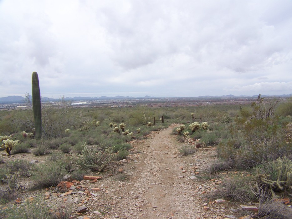
 This lasso loop hike in the McDowell Sonoran Preserve in northeast Scottsdale has a nice balance of physical exertion and expansive views of the McDowell mountain range. From the new Gateway access parking area, go 0.4 miles over the bridge until you see the amphitheater on your left. I prefer to travel clockwise from this point to have views of the McDowell ridgeline as I climb to the saddle. It's 1.7 miles to the saddle going clockwise and 1.9 miles heading counter-clockwise from this point. From the amphitheater, you can also take a 0.5-mile diversion on the Interpretive trail or make a short 0.3 loop on the Saguaro loop trail before you start the Gateway loop. The Interpretive trail is paved and has several seating areas and will open officially in September 2009 with numbered stops explaining features of the desert flora and fauna.
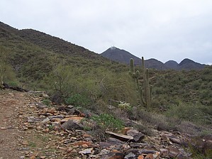


