 Route Editor

| Guide | ♦ | 312 Triplogs | 4 Topics |
details | drive | no permit | forecast | 🔥 route |
stats |
photos | triplogs | topics | location |
| 2.9k | 312 | 4 |
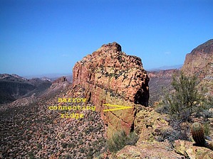
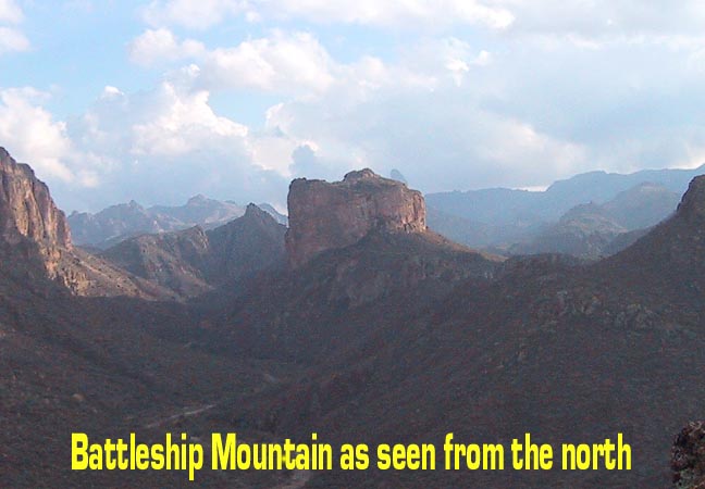
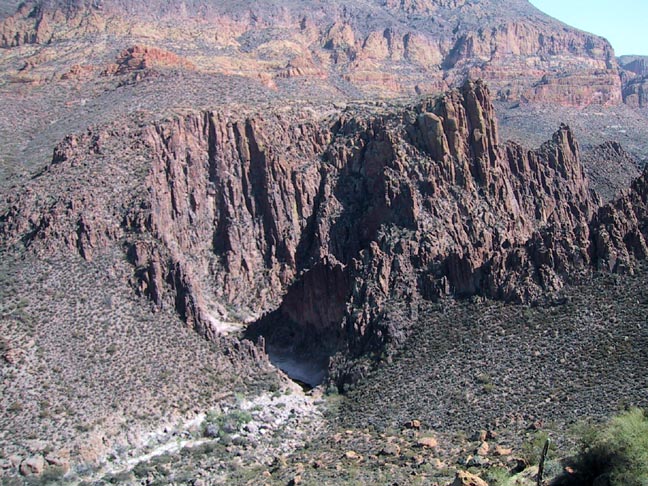
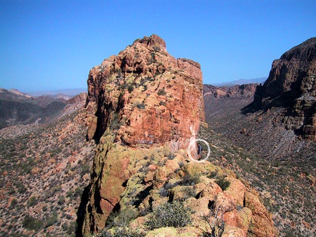
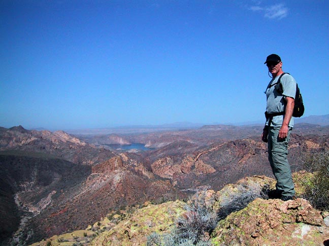
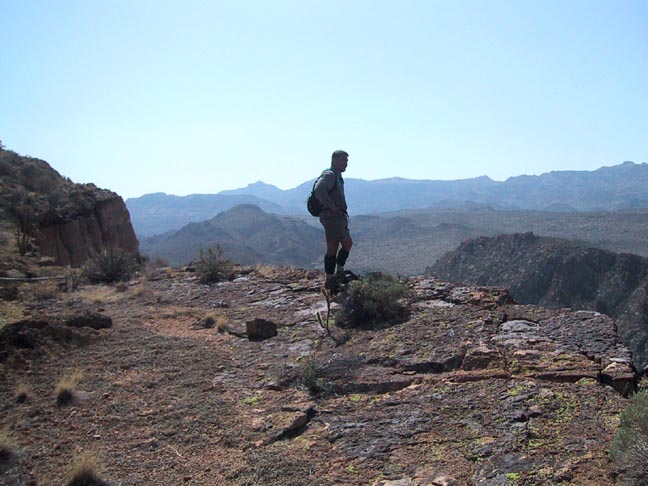
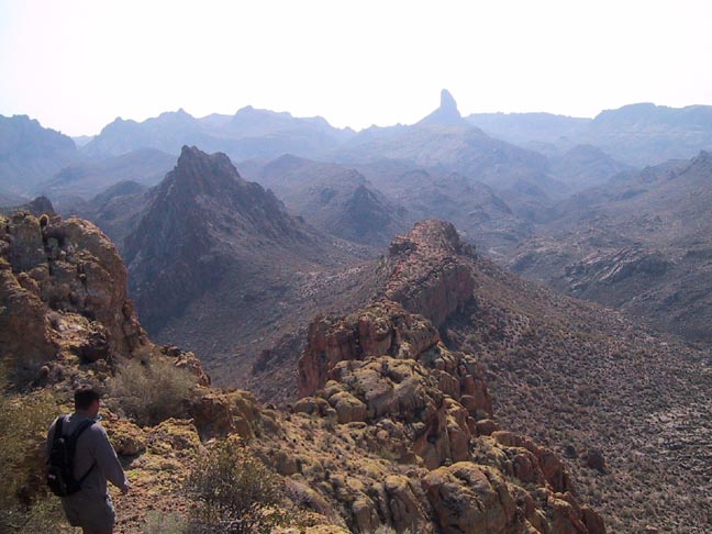
The Devil's Playground by Fritzski  This hike starts from First Water trailhead by taking the Second Water Trail #236 east to the Boulder Canyon Trail #103, where you then proceed south to a point abeam the southern tip of Battleship Mountain. Here you depart the trail and climb the mountain from the southern tip to the peak at the northern end. Reverse the route for your return. This hike starts from First Water trailhead by taking the Second Water Trail #236 east to the Boulder Canyon Trail #103, where you then proceed south to a point abeam the southern tip of Battleship Mountain. Here you depart the trail and climb the mountain from the southern tip to the peak at the northern end. Reverse the route for your return.This has undoubtedly been my most "epic" hike so far this season. From the moment you mount the southern tip of this massive formation, you can't believe what you're seeing. It is a veritable lunar landscape surrounded by breathtaking sheer drops in all directions. Make sure to pause here and take in the mind-blowing 360-degree panorama because the unreal ridge stretching out before you to the north beckons like a powerful magnet.
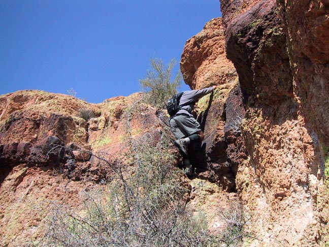
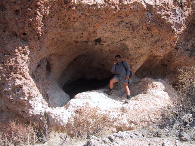
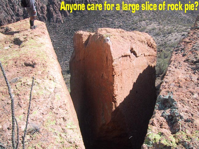
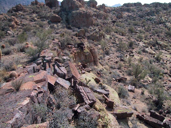
Battleship Mountain should be considered a difficult hike for advanced hikers only. Scrambling and bouldering skills are a must (1). To the individual not comfortable with heights, this hike has the potential to be a real-life nightmare. That being said, there is no technical climbing involved, and at no time did I feel like I was at any real risk of falling. "Exposure" is a term used by climbers to describe the degree of vulnerability in the event of a fall. Although there is some very real exposure to be encountered on this hike, the risk of falling itself is extremely minimal. Therefore, as is mostly the case, dealing with the element of exposure is more of a psychological battle than a physical one. DIRECTIONS: Depart First Water Trailhead on Second Water Trail heading east through Garden Valley. Just as you begin your descent into Boulder Canyon, you will get your first real glimpse of the Battleship Mountain monolith looming ahead. This fortress-like rock formation, being very long and narrow, is very appropriately named. Since the only sensible way aboard is over the stern, we must continue ahead to the Boulder Canyon Trail intersection and proceed south till you are abeam the southern tip. We chose a spot where the slope visibly mellows, but not all the way to the saddle directly south of the tip. The climb to the base of the cliff is very typical of most rock formations in the Superstitions. It involves making your way up a 45-degree slope of loose rock that has fallen away over the centuries, and although short, it is easily the least pleasant part of the hike. Once at the base of the low cliff, you will encounter a nice alcove that provides a shady spot for a quick "PowerBar" break before ascending the cliff. From facing the cave, head up to your right, then back left over the top of the cave, then pretty much scramble straight up to the top. As you emerge on top, it will pretty much take your breath away. A very flat alien landscape greets you with sheer drops on either side. The views down in to the Lower LaBarge Box are incredible. The massive, snaking ridge stretches out before you to the north and looks quite daunting indeed. This area presents some of the neatest camping sites I've seen anywhere, and the hike to this point is only moderate in difficulty. Since this southernmost "mesa" is awesome in itself, this is a great termination point for those less adventurous types. From the northern tip of the south mesa, you must negotiate a narrow connection that involves steep drops on either side. As you press on, you are continually presented with seemingly insurmountable obstacles, only to find at least one way to "solve the puzzle." At the base of the north peak, you are finally confronted with an insurmountable obstacle in the form of a vertical ridge of crumbling rock. Not to despair. The solution lies in descending to your left. Proceed along the affectionately named "Ball bearing Slope," then recommencing you're your climb to the actual peak from a northwesterly direction. False summits are a fact of life all along this hike, and the nasty phenomenon tends to rear its ugly head right to the end. But finally, after as much scrambling as hiking, you reach the top and the aching gluteals and tender palms are well worth it. The top resembles the Flatiron in many ways, including the fact that the peak itself stands over a flat protrusion forming the true prominence, which juts out boldly to the north in this case. The vertical drops approach as much as 500 feet in this area. The surprisingly large plateau is strikingly beautiful with eerie rock formations and bold colors. It begs to be thoroughly explored, so take plenty of time. There were absolutely no signs of any previous visitors anywhere on the mountain and the large cairn at the edge of the north precipice was our own testimonial "monument" (2). To return, merely reverse your route, but as a word of caution from experience, this is often easier said than done. Things look completely different in the opposite direction, so take careful note of any landmarks along the way as you go to help preclude the old "now, which way did we come up?" syndrome. Notes: (1) By scramble, I mean you must use your hands to climb or descend. I would consider bouldering to be slightly more difficult, involving a very short but steeper incline, but not requiring technical equipment due to a low degree of exposure. (2) I am in no way claiming any first ascent. Indeed, I have made an acquaintance with an individual claiming to have previously climbed it. I do, however, consider this very rarely trodden territory. Check out the Official Route and Triplogs. Note This is a moderately difficult hike. Leave No Trace and +Add a Triplog after your hike to support this local community. | ||||||||||||||||||||||||||||||||||||||||||||||||||||||||||||||||||||||||||||||||||||||||||||||||||||||||||||||||||||||||||||||||||||||||||||||||||||||||||||||||||||||||||||||||||||||||||||||||||||||||||||||


