This is a very short hike at a quarter-mile if that. You'd probably walk further going up into the stands at a Cardinals game if they sold out a game.
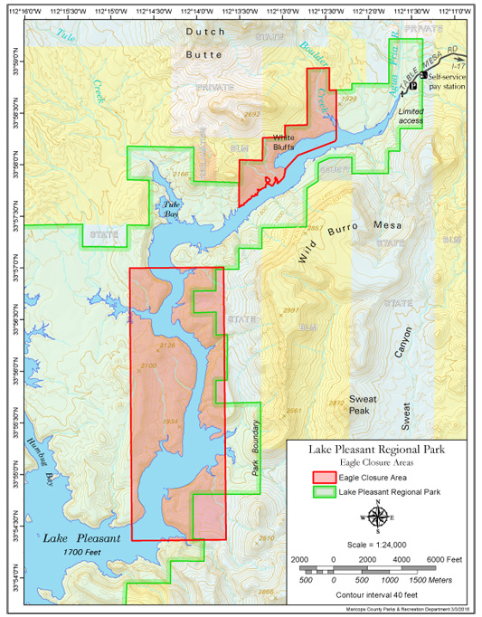
The drive in from the west takes you through some slightly interesting territory. It definitely requires four-wheel drive and probably more if it's muddy. You need a permit to even drive in the area, so you better stop by somewhere and get one! According to "Ruins Seldom Seen," the east approach requires a 2.5-mile hike, but you don't need any permits. There is a road from I-17, but the book states a building, and such makes it inaccessible. That may be true when the lake is present, wouldn't that be pleasant.
The hike is steep, but it's over in like five minutes, so get over it. The views are pretty fantastic. Multi-colored cliffs with an autumn splash of yellow leaves along with some green grass fields might get you thinking you're in a different part of Arizona. Go check it out, but plan on checking out some other local quick sites like Black Cave or a handful of springs scattered about the area.
WARNING! Hiking and outdoor related sports can be dangerous. Be responsible and prepare for the trip. Study the area you are entering and plan accordingly. Dress for the current and unexpected weather changes. Take plenty of water. Never go alone. Make an itinerary with your plan(s), route(s), destination(s) and expected return time. Give your itinerary to trusted family and/or friends.
 Route Editor

 This is a very short hike at a quarter-mile if that. You'd probably walk further going up into the stands at a Cardinals game if they sold out a game.
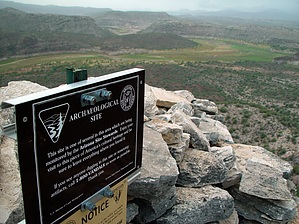


