username
X
password
register
for free!
help


Wood Canyon - Upper Rim, AZ

Guide 9 Triplogs  0 Topics
  5 of 5  
Fav
Wish
1
details
drive
no permit
forecast
map
stats
photos
triplogs
topics
location
155 9 0
Statistics
tap row or icons for details
Difficulty 3.5 of 5
Route Finding 3 of 5
Distance Loop 8 miles
Trailhead Elevation 2,795 feet
Elevation Gain 1,259 feet
Accumulated Gain 1,657 feet
Kokopelli Seeds 16.29
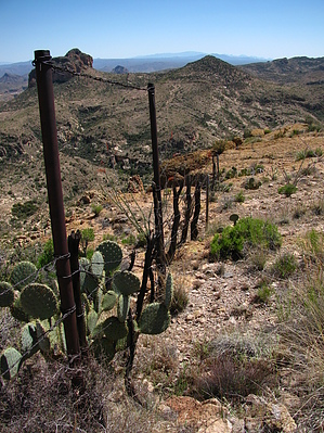
 Interest Off-Trail Hiking, Seasonal Waterfall, Seasonal Creek, Perennial Creek & Peak
feature photo
Photos Viewed All MineFollowing
4  2023-01-14
Picketpost TH to Upper Wood Canyon
hikerdw
14  2016-12-28 hikerdw
53  2014-02-05 kingsnake
2  2012-12-20 bmbeard
5  2010-12-14 sventre
13  2010-03-19 AZLOT69
19  2009-04-18 ssk44
38  2009-04-18 Grasshopper
Author
author avatar Guides 16,843
Routes 17,472
Photos 24
Trips 1 map ( 6 miles )
Age 28 Male Gender
Location HAZ, TrailDEX
Associated Areas
list map done
Globe Region
Historical Weather
Trailhead Forecast
Expand Map
Preferred Mar, Nov, Feb, Apr
Sun  6:02am - 6:43pm
2 Routes
 
2 Alternative


remove free decal offer

  
Guide Needed
Publish Full Detail Guide


Use +Add above to share photos and triplogs
Overview: Top-notch off-trail route with epic views and awesome rock formations from start to finish.

Happy

Trails!


  • guide related image guide related image guide related image
    guide related


Check out the Triplogs.
Leave No Trace and +Add a Triplog after your hike to support this local community.
WARNING! Hiking and outdoor related sports can be dangerous. Be responsible and prepare for the trip. Study the area you are entering and plan accordingly. Dress for the current and unexpected weather changes. Take plenty of water. Never go alone. Make an itinerary with your plan(s), route(s), destination(s) and expected return time. Give your itinerary to trusted family and/or friends.

 Permit $$
None


 Directions
or
 Road
High Clearance possible when dry

To hike
From the Phoenix area: For this 2WD-"high clearance" TH access- Take Hwy 60E to Superior,AZ; In Superior take Hwy 177 South for 2.6mls to dirt road intersection with signed Arnett Rd(FR230); Turn Right on Arnett Rd and proceed exactly .60mls to unsigned intersecting and "unmaintained" dirt road on Left; Turn onto this "unmaintained", sometimes rocky and rutted dirt road and proceed slowly in for 1.68mls to "easy to miss" unsigned, spur road on Right side; Turn Right here and head downhill for approx 100 yards to a pull-out area on Left side with fire ring; This is TH Parking and Start for this hike; Note: Also see attached Drive Route.
page created by ssk44 on Apr 19 2009 8:36 am
 90+° 8am - 6pm kills
helpcorrectionissue

end of page marker