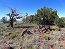
| Historic survey instrument structure |
| Historic survey instrument structure | 19 locations | Pioneer |
|
|||||||||||||||
Tripod structure used by historic surveyors to support instruments used in the survey of the area |
|||||||||||||||
| .: rcorfman :. | |
 |
|
Buckhorn Mountains Hi Pt 4565 | |
| .: FLYING_FLIVER :. | |
 |
|
Five Little Horns-Little Horn Mountains SE | |
| .: chumley :. | |
 |
|
Out west | |
| .: FLYING_FLIVER :. | |
 |
|
Buckhorn Mountains Hi Pt 4565 | |
| .: FLYING_FLIVER :. | |
 |
|
Buckhorn Mountains Hi Pt 4565 | |
| .: FLYING_FLIVER :. | |
 |
|
Sawyer Peak 4293 - Black Mtns - Tres Alamos | |
| .: FLYING_FLIVER :. | |
 |
|
East of Eagletails | |
| .: FLYING_FLIVER :. | |
 |
|
Double Eagle - Eagletail Mountains Wilderness | |
| .: FLYING_FLIVER :. | |
 |
|
New Water - Peak 3348 | |
| .: FLYING_FLIVER :. | |
 |
|
Harcuvar and Bullard | |
| .: FLYING_FLIVER :. | |
 |
|
Bald Mountain Benchmark | |
| .: FLYING_FLIVER :. | |
 |
|
Bald Mountain Benchmark | |
| .: FLYING_FLIVER :. | |
 |
|
Bald Mountain Benchmark | |
| .: FLYING_FLIVER :. | |
 |
|
Bald Mountain Benchmark | |
| .: FLYING_FLIVER :. | |
 |
|
Bald Mountain Benchmark | |
| .: chumley :. | |
 |
|
Double Eagle - Eagletail Mountains Wilderness | |
| .: MountainMatt :. | |
 |
|
Wagner Peak | |
| .: chumley :. | |
 |
|
Mohon Peak | |
| page 1, 2 |
|
|
|
|

| Information on this page has been gathered from member submissions. Effort has been made to avoid any infringement of copyright. Additionally, any use is anticipated to be within the "fair use" doctrine. If any copyright has been infringed, please notify the webmaster. The disputed information will be removed and your issue will be resolved. If you are a submitting member, please inform and discuss with HAZ if you think you are submitting any copyright issue. Please help us stay with the law. |