Including more than 50 of the Redwood Coast's most fascinating hikes, this one-of-a-kind guide leads readers through the dazzling array of geographic, historical, biological, and cultural diversity that makes this region unique. From the towering majesty of Redwood National Park to the sea caves and blowholes of Mendocino's shores to the wildflower meadows of Big Sur, the Redwood Coast offers abundant opportunities to satisfy cravings for nature at its best. Whether it's whale watching from rugged coastal bluffs, delving deep into ancient Redwood forests, or combing beaches for Neptune's treasures, Hiking the Redwood Coast will guide hikers through this land of stark contrasts, stirring history, and incomparable beauty.In addition to detailed directional cues, hike stats, and local information, this book provides comprehensive trail descriptions and GPS-quality, digitally designed route maps for each hike.
This volume features more than 40 of the Bay Area's greatest hikes, with detailed descriptions and superb maps for each trail. Each chapter also includes an elevation profile, difficulty rating, trail contacts, and much more. This is the best hiking guide available to the San Francisco Bay area.
Lace up your boots and sample more than 600 miles of hiking trails through the approximately 1,240,681 acres of rugged Idaho and Montana backcountry. Explore the wild and scenic Selway River, trek through red cedar and Douglas-fir forests, amble along the shores of backcountry lakes, or view elk, deer, and moose in the uplands and wet meadows of the Elk Summit. Veteran hiker and outdoor writer Scott Steinberg will introduce you to these trails and more. Use this guide for: up-to-date trail information, accurate directions to popular as well as less-traveled trails, difficulty ratings for each hike, detailed trails maps, and zero-impact camping tips. Whether you are a day-tripper or long-distance hiker, old hand or novice, you'll find trails suited to every ability and interest throughout the Selway-Bitterrroot Wilderness.
Stretching from the Feather River south to the Kern Plateau, the Gold Country foothills east to the high desert, the Sierra Nevada is one of the longest and highest mountain ranges in the continental United States. This four-season guide samples 96 of the best hikes in every quarter of this diverse range. No matter what section of the Sierra Nevada you are visiting, Hiking the Sierra Nevada has something for you. In Hiking the Sierra Nevada, lifelong Sierra Nevada enthusiast Barry Parr provides you with information on the best long and short hikes in this region, which includes Sequoia, Kings Canyon, and Yosemite National Parks, as well as some of the most spectacular roadless areas in the Sierra Nevada. Many of the hikes in this guide are accessible year-round and are within easy driving distance of major urban areas. With detailed hike descriptions, maps, and elevation profiles, Hiking the Sierra Nevada is the complete guide to hiking in America's far western mountains. Whether you are planning a week-long trip or just passing through, Hiking the Sierra Nevada will give you easy access to this magnificent mountain range.
Western Vancouver Island's geographical variety attracts more than 8,000 hikers per year, from less experienced hikers to the expert hikers capable of traversing such majestic, challenging areas as the stretch known as the Graveyard of the Pacific. Hiking the West Coast of Vancouver Island covers every major coastal hike in six major areas, from the remote beaches of the Juan de Fuca Marine Trail to the rugged surf-swept shore of Cape Scott. From planning the trip, to getting to and from the trailheads, to choosing the most scenic campsites, this is the one indispensable guide.
• Marianne Eiselt → Goose Lane Editions & TrailsCanada 2007
Hiking combines the physical health benefits of cardiovascular exercise with the mental health benefits of admiring the beauty of nature. New Brunswick offers a dizzying array of hiking challenges and a beauty beyond belief. In an expanded and updated 3rd edition of this popular book, veteran hikers Marianne and H.A. Eiselt take us from one end of New Brunswick to the other, along river valleys, through National Parks, around the coasts, and up and down mountains. Fully illustrated with photographs and detailed maps derived from satellite imaging, this comprehensive guide includes more than 60 trails, with descriptions of the physical details of the trail (length, difficulty, ascent, hiking time, etc.) as well as tips and sidebars describing local flora and fauna, places of interest, monuments, and landmarks. This new edition of the Eiselt's popular guide is the first in a series of new guides published by Goose Lane Editions in association with TrailsCanada. TrailsCanada is a project of Go for Green, a national organization that encourages Canadians to pursue healthy, outdoor physical activities that protect, enchance, or restore the environment.
Michael Haynes is Mr. Hiking in Nova Scotia. The 7th edition of his Hiking Trails of Nova Scotia sold 15,000 copies, and his eight-year series of CBC Radio spots has been so popular that people he meets on the trails recognize him by his voice. Eager to supply the best information about the delights (and possible hazards) of self-propelled excursions into the woods and mountains and along the shores of his province, he has now prepared Hiking Trails of Nova Scotia, 8th edition. The 8th edition of Hiking Trails of Nova Scotia is completely revised and updated. More than 30 of the 50 trails are new, and 25 of these new trails did not exist when the 7th edition was published. Haynes re-hiked and updated the descriptions of about 20 trails, and he charted the current condition of 7th-edition trails. Users will find the new 8th edition of Hiking Trails of Nova Scotia as trustworthy a guide as ever to hikes long and short, challenging and easy, in all corners of the province. As well as instructions for finding each trail and descriptions of the trails themselves, Hiking Trails of Nova Scotia, 8th edition, includes maps and synoptic information on length, time, difficulty, other uses, facilities, and the correct topographical map to use. New to this edition are trailhead GPS listings for all hikes, and, for those who carry cellphones as safety devices, information about the often-uncertain reception in Nova Scotia's mountains and woodlands. Also new to this edition are sidebars on plants, animals, historic sites, and other interesting features of the trails.
This is the third edition of this popular and definitive guide to the Sandia and Manzano Mountains outside of Albuquerque. As a former wilderness patrol for Cibola National Forest, Matthews's trail descriptions are anecdotal and full of first-hand information on plants and animals, history, geology, and management.
From the slickrock desert country of Arches and Canyonlands National Parks, to the glacier-carved peaks of the Wasatch and Uinta Ranges, to the broad and varied expanse of the Great Basin
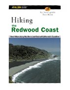 Hiking the Redwood Coast: Best Hikes along Northern and Central California's Coa
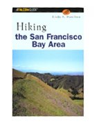 Hiking the San Francisco Bay Area: A Guide to the Bay Area's Greatest Hiking Adv
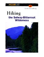 Hiking the Selway Bitterroot Wilderness
 Hiking the Sierra Nevada
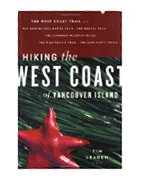 Hiking the West Coast of Vancouver Island
 Hiking Trails of New Brunswick, 3rd Edition
 Hiking Trails of Nova Scotia
 Hiking Trails of Southwestern Colorado (The Pruett Series)
 Hiking Trails of the Sandia and Manzano Mountains
 Hiking Utah, 3rd (State Hiking Series)

 Route Editor

