• Robert Blake David Mazel → Wilderness Press 1997
Jagged desert peaks, awesome gaping canyons, wildflower-dotted alpine meadows and more entice hikers and backpackers to adventure in central and southern Arizona. From short dayhikes to multi-day backpacking trips, this book features 84 routes for beginning to skilled backpackers (excludes Grand Canyon hikes).
• Jack San Felice → Millsite Canyon Publishing 1997
Experience the splendor of low and high desert mountain trails with desert wildflowers, cacti, wildlife, craggy peaks, unique rock formations, and majestic views, all centrally located within the Valley of the Sun's Squaw Peak Recreational Area. In addition to providing information about the valley's most popular trail, this guide tells about the history and geology of the Squaw Peak area. I know after reading Squaw Peak-A Hiker's Guide you will want to take to the trails. Complete with simple directions to trailheads, easy-to-follow trail maps, and b/w photos of trails and viewpoints. The best guide book on the Squaw Peak area.
A guide to day hiking the waters of central Arizona's canyons and forests. There are descriptions, directions, maps, and photos for each of 50 unique day hikes near Phoenix, Wickenburg, Prescott, Camp Verde, Sedona, Payson, and Globe. There is an easy guide for selecting easier, moderate, and challenging hikes, as well as special hikes to waterfalls and swimming holes. Over 8,000 copies have been sold over the past four years.
• Jack Carlson & Elizabeth Stewart → Clear Creek Publishing 2009
The complete and authoritative guide to the eastern Superstition Wilderness of Arizona. This thoroughly researched book contains never before published trips into the backcountry and authenticated background history of the area. Over 40 treks in and around the Wilderness. Clear and simple hike and horse ride directions. Easy-to-Use topographic and trailhead maps. Trips for everyone rated easy to very difficult. History of cowboys, homesteaders, and miners. GPS coordinates for trailheads and key points. B&W photos and maps throughout
• Jack Carlson & Elizabeth Stewart → Clear Creek Publishing 2012
Rugged mountains with towering hoodoos, hidden canyons, seasonal creeks and waterfalls, majestic deserts and wildflowers, prehistoric ruins, and prospector camps -- all in a National Forest Wilderness less than an hour from Phoenix. Weavers Needle, Superstition Mountain, Charlesbois Spring, La Barge Canyon, Red Tanks Canyon, Graden Valley, Peters Canyon, and Peters Mesa are special places that spring to life with this guide's colorful history of the Superstitions. More adventures can be found in the companion book, Superstition Wilderness Trails East.
More than 65 treks in and around the Wilderness
Clear and simple hike and horse ride directions
Easy-to-use topographic and trailhead maps
Trips for everyone -- rated easy to very difficult
Intriguing history and folklore of the Superstitions
68 Mapped Trails to Explore, Ranging from Half-mile Strolls to Full-day Hikes. Take A Hike reveals the little known places and hidden gems of the Finger Lakes Region of New York State. - Visit an old-growth forest. - Stroll along abandoned railroad beds and canal towpaths. - Hike the strenuous glacially sculpted hills. - Savor the vistas of wind and water sculpted drumlins overlooking Lake Ontario. - Gaze into a verdant lake-filled valley far below. - Ramble through a bog and a rich shrub fen. - Wander on winding boardwalks through swamps and wetlands. Walk the Finger Lakes Region with ease and confidence. Each trail is GPS mapped for accuracy. Directions and GPS coordinates are given for easily locating trailhead parking. With his guidebook you'll know the length of the hike, difficulty of the terrain, variety of uses allowed, type of trail surface, markings to look for, and even if your dog is welcome to hike with you for each of the 68 trails. This guide promises to reveal the undiscovered beauty of the Finger Lakes Region with many recently built trails. Take A Hike Today!
Second Edition - Fully Revised and Expanded Now Covers 60 Trails - Includes 25 New Trails The walks, rambles, strolls, and hikes in this book are designed for people who delight in exploring unique or little-known places. The trails lead through forests, fields, marshes, hills, and arboretums where you can enjoy the natural world. This book will help you learn more about Rochester, NY history, get much-needed exercise, introduce children to the joys of nature, or find new places to walk your dog. Don't stash it away in winter either. Many of the trails are good for cross-country skiing and snowshoeing. With this guide, you'll be able to explore the Rochester area with ease and confidence. Each of the 60 walks is rated for difficulty, type of terrain, and described by length and estimated time required. In addition, you'll know how to easily find the trails and parking. Whether young or young at heart, you can enjoy the adventures this guide brings to life.
On 38 different segments of this long trail, hikers, bicyclists, and equestrians can travel through hushed redwood forests and high, grassy meadows, enjoy lavish wildflower displays, and climb some of the area's tallest peaks. The trips described range in length from 3 to 13 miles and cover the 212 completed miles of the trail (the finished trail will be about 400 miles long). For each trip there is an area map, trailhead directions, and a complete trail description.
The Pacific Crest National Scenic Trail is a crown jewel in the National Trail System, but it's seldom fully enjoyed by the hikers who live nearest to it. Why? Because at 2,650 miles, it's just too daunting. Most guidebooks to the PCT focus on mile-by-mile descriptions of the entire trail, from Mexico to Canada-ideal for hikers with weeks or months to spend exploring significant portions of the trail. But such long-distance hikers comprise a tiny percentage of the entire hiking population. If you have limited time, The Best of the Pacific Crest Trail: Washington gives you the information you need to enjoy the beauty of the PCT- on a short day hike, an overnighter, or a week-long outing to explore the most remote areas of the trail.
This guide to walking and hiking in the Caribbean describes suitable walks for every grade of walker, from beginner to experienced. It covers easy walks to rugged hikes, all rated.
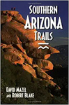 Southern Arizona Trails
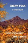 Squaw Peak: A Hiker's Guide
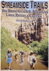 Streamside Trails - Day Hiking Central Arizona
 Superstition Wilderness Trails East
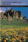 Superstition Wilderness Trails West: Hikes, Horse Rides, and History
 Take A Hike - Family Walks in New York's Finger Lakes Region
 Take A Hike! Family Walks in the Rochester (NY) Area (Second Edition) (Trail Gui
 The Bay Area Ridge Trail: Ridgetop Adventures Above San Francisco Bay
 The Best of the Pacific Crest Trail Washington: 55 Hikes
 The Caribbean: A Walking and Hiking Guide

 Route Editor

