The Halifax Regional Municipality encompasses the cities of Halifax, Dartmouth, and Bedford, and several towns and villages; lakes, rivers, and streams, part of the Shubenacadie Canal, and an intricate and beautiful coastline. Beautiful, well-tended, easily accessible trails throughout the region offer outdoor pleasure to all, and Trails of Halifax Regional Municipality outlines gentle excursions for people of all abilities. Michael Haynes has selected 25 representative trails. Haynes gives careful, detailed information about each in a "Trails-at-a-Glance" chart and in synoptic form at the head of each trail description. As well as describing the trail and illustrating it with maps and photographs, Haynes includes sidebars on features unique to the trail or region.
This completely updated version of Hiker's Guide to the Huachuca Mountains has easy-to-read maps and elevation profiles. The new title reflects use not just by hikers, but also mountain bikers and equestrians.
Over 130 miles of trail are covered, including the Huachuca Mountain Passage of the Arizona Trail.
From easy walks to challenging routes, this small but spectacular mountain range in Southeastern Arizona provides numerous opportunities to get out and enjoy all that nature has to offer. Let this guide show you the way!
This rich, enthusiastic guide to the Tucson, Rincon, Santa Catalina, and Santa Rita Mountains has been completely revised. Betty Leavengood's third edition of her bestselling Tucson Hiking Guide offers new routes and updated access information, detailed maps, and clear descriptions to area trailheads. This third edition includes: 37 hikes rated easy to difficult by mountain range; revised information on precautions for desert hiking; historical notes, photographs, and anecdotes; and detailed maps and descriptions with elevation/distance.
An illustrated, full color hiking guide to Utah's backcountry trails. Included are 92 trail maps and hundreds of exquisite color photographs taken along the trails in Utah's 5 national parks, 15 wilderness areas, and other less well known and less protected areas.
The newest addition to Westcliffe's series of wilderness area guidebooks profiles the state's 15 designated and 83 proposed wilderness areas. Illustrated by handy maps and Leland Howard's breathtaking photographs, the text couples Lynna Howard's wry wit with her meticulously crafted trail descriptions. The result is an eye-pleasing guide both functional to use and entertaining to read. Utah's several million acres of designated and proposed wilderness encompass deep sandstone canyons, thousand-foot-tall cliffs, high alpine terrain, and may more natural wonders- and this book helps outdoor adventurers tour them safely and intelligently.
• Cynthia Copeland Lewis → Mountaineers Books 2007
Search for frogs and turtles in a pond, stay in a cabin, visit a nature center, see waterfalls, or discover abundant wildlife. These are just a few of the new hikes families (and anyone looking for an easy outing) will enjoy in these completely redone guidebooks. Each outing highlights points of interest and opportunities for learning about nature on the trail. The hikes range in length from 1 to more than 5 miles round-trip, are rated easy to difficult for children, and feature optional turn-around points for tired feet.
Cape Cod, Martha's Vineyard, and Nantucket are justly known for their history, their beautiful beaches, and their superb waterways. But the Cape and Islands, crisscrossed by countless dirt roads and trails, are also beloved by walkers and hikers. Walking the Cape and Islands is the first comprehensive guide to the area's walking trails, covering the entire length of the Cape, from Bourne to Provincetown, as well as Martha's Vineyard and Nantucket. Most of the walks described in this book are on lands protected by federal, state, and local agencies, including Cape Cod National Seashore, Nickerson State Park, Martha's Vineyard Land Bank Commission, and Nantucket Conservation Foundation.Profiling over eighty of the areas best walking adventures, Walking the Cape and Islands is filled with details such as walk difficulty, length, and presence of Facilities such as restrooms. To further assess a walk's exercise potential, details on total steps and calories burned show readers what the average walker can expect to accomplish.>Best hike's lists help readers choose the ideal hike>Trail descriptions allow readers to assess each walk before they get there>Detailed trail maps provide accurate trail information>Trailhead directions take readers right to each walk's startWhether a visitor or resident, walking expert David Weintraub will guide readers to and along the best island walking in the United States.
• Robert F Crawford → University of Wisconsin Press 1997
Product Description
The sheer physical beauty and varied landscapes of eastern and central Wisconsin are best experienced on its walking trails. Walking Trails of Eastern and Central Wisconsin is a handy guide to trails that wind through the streets of old Milwaukee and the forests of the Kettle Moraine, across the Niagara Escarpment, along the shores of picturesque Door County, or up the sandstone mound at Lone Rock for a panoramic view of flatlands that once were the bed of glacial Lake Wisconsin.
A companion to the popular Walking Trails of Southern Wisconsin, this book describes more than 200 trails in 72 locations throughout five of the state's major regions. Bob Crawford provides maps and detailed instructions to make the trails easy to locate.
With each trail description you'll find:
* details about the route and terrain, as well as geographical, biological, or historical features of interest;
* regulations including open days and hours, and rules regarding dogs, trail bikes, cross-country skiing, and other activities;
* information about available restrooms, drinking water, nature centers, and other facilities at the site;
* a description assessing degree of difficulty--slope, width, maintenance, and other such factors--and a helpful rating of "walkability" on a scale from 1 to 5.
The only comprehensive guide to hiking locations in the eastern part of the state, this book also provides lists of trail locations that include playground equipment for kids and picnic facilities for those who want to make a day trip of their hiking outing. Appendices spotlight trails that boast historical significance, ice age features, picnic areas, and cross-country skiing opportunities.
• Robert F Crawford → University of Wisconsin Press 2000
Take a walk on the wild side with the completely updated version of this popular guide.
This edition now includes coverage of Lafayette and Vernon counties, plus new information on more trails, including ones at Avoca Prairie Savanna State Natural Area, Wildcat Mountain State Park, and Blackhawk Lake Recreational Area. Author Bob Crawford has also revised eleven trail maps in nine counties and updated material throughout the book, which now describes more than 150 trails at more than sixty locations.
These trails wind across southern Wisconsin--into forests and along shores, over glacial formations and around Native American earthworks--and showcase some of the most beautiful and interesting walking trails in the nation. Walking Trails of Southern Wisconsin retains its handy, pocket-sized format plus all the other features that made the first edition so successful:
o details about routes and terrain plus geographical, biological, or historical features of interest
o regulations including open days and hours, and rules regarding dogs, trail bikes, cross-country skiing, and other activities
o information about available restrooms, drinking water, nature centers, and other facilities at the site
o a description assessing degree of difficulty--slope, width, maintenance, and other such factors--and a helpful rating of "walkability" on a scale from 1 to 5
Crawford also provides information about nearby parks, preserves, glacial formations, historical sites, tourist attractions, and other points of interest for those who want to turn a hike into a day trip or weekend outing. Staying fit was never so easy nor so much fun.
A comprehensive field guide to viewing more than 300 waterfalls in northern California—from the Oregon border to the mountain ranges south of the Bay Area •Waterfalls reached by car, on foot, or by canoe or raft •Falls rated from one to five stars for their appeal •At-a-glance table for selecting waterfalls by scenic rating, form, how to access, best season, and waterfall type •Organized according to highway routes and popular day trip or vacation itineraries in each region On the road and seeking prime waterfall drive-up views? Feeling like a short stroll or longer hike to bask in a refreshing spray up close? Looking for a beautiful backdrop for a family picnic? Waterfall Lover’s Guide to Northern California will tell you where to find the falls that fit the occasion.To help you select, each waterfall is keyed for accessibility by car, on foot, by canoe, or raft, and rated for magnitude and aesthetic value. The Danielssons note which falls can be seen from the road, cast a rainbow from their base, pour directly into the Pacific Ocean, or spin wheels of water along their flow. MATT and KRISSI DANIELSSON are avid hikers who live in Marina, California. Matt, an editor for a technology publication, and Krissi, a freelance writer, are also the authors of A Bark in the Park: The 45 Best Places to Hike with Your Dog in the Shasta/ Rogue River Region.
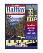 Trails of Halifax Regional Municipality
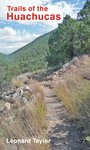 Trails of the Huachucas
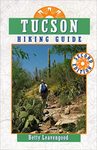 Tucson Hiking Guide (2nd Edition)
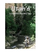 Utah's Incredible Backcountry Trails
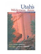 Utah's Wilderness Areas: The Complete Guide
 Vermont, New Hampshire, & Maine (Best Hikes With Kids)
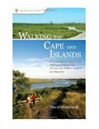 Walking the Cape and Islands: A Comprehensive Guide to the Walking and Hiking Tr
 Walking Trails of Eastern and Central Wisconsin (North Coast Books)
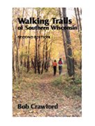 Walking Trails of Southern Wisconsin
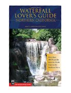 Waterfall Lovers Guide Northern California: More than 300 Waterfalls from the No

 Route Editor

