A clear, concise guide to Arizona's remote backcountry, including Grand Canyon National Park and Sedona. Book includes detailed directions with GPS waypoints, 86 custom maps and over 300 quality photos. All routes were driven by the author. Sport utility owners will enjoy 50 easy and moderate routes to incredible scenic backcountry locations. Serious 4-wheelers will love our difficult Jeep trails. We promote low impact driving and environmental responsibility. For complete trail listing and a look inside the book visit the FunTreks website.
Completely redone second edition has been expanded to 75 trails....25 all new. Book includes detailed directions with GPS waypoints, 83 custom maps and over 425 quality photos. All trails are south of Interstate 70 and were redriven by the author. Twenty-five trails are easy, 25 moderate and 25 difficult. Easy and moderate trails are suitable for most stock sport utility vehicles. For complete trail listing and a look inside the book visit the FunTreks website.
A clear, concise guide to northern California's remote backcountry. Book includes detailed directions with GPS waypoints, 85 custom maps and over 400 quality photos. All routes were driven by the author. Sport utility owners will enjoy 50 easy and moderate routes to incredible scenic backcountry locations. Serious 4-wheelers will love our difficult Jeep trails. We promote low-impact driving and environmental responsibility. For complete trail listing and a look inside the book visit the FunTreks website.
Completely redone "Northern" title replaces previous "Volume 2." Expanded to 45 trails...23 all new. Book includes detailed directions with GPS waypoints, 51 custom maps and over 240 quality photos. Sport utility owners will enjoy 30 easy and moderate routes to incredible scenic backcountry locations. Serious 4-wheelers will love our difficult Jeep trails. All trails are north of Interstate 70 and were driven by the author. Trails are near Denver, Bouldler, Loveland, Fort Collins, Estes Park, Idaho Springs, Vail, Kremmling, Grand Lake, Glenwood Springs and Steamboat Springs. (Note: Grand Junction trails have been removed and will appear later in a new western edition.) We promote low impact driving and environmental responsibility. For complete trail listing and a look inside the book visit the FunTreks website.
A clear, concise guide to southern California's remote backcountry. Book includes 75 trails with detailed directions, GPS waypoints, 86 custom maps and over 340 quality photos. Sport utility owners will enjoy 50 easy and moderate routes to incredible scenic backcountry locations. Serious 4-wheelers will love our difficult Jeep trails. All routes were driven by the author. Trails are near Los Angeles, Santa Barbara, Barstow, San Bernardino, Big Bear, Glamis, Truckhaven and Ocotillo Wells. Also included are the Mojave Road, Hungry Valley, Corral Canyon, Dumont Dunes, Last Chance Canyon, Sledgehammer Canyon, Calico Mountains, Superstition Mountain and Anza Borrego Desert State Park. We promote low impact driving and environmental responsibility. For complete trail listing and a look inside the book visit the FunTreks website.
This first volume in our Nevada series of Trails books features destinations in western Nevada, near the towns of Reno, Carson City, Virginia City, Tonopah and Hawthorne. Meticulous trail details instruct readers how to safely navigate hundreds of miles of the region's best scenic backroads and four-wheel drive trails. See ghost towns, numerous old mines and mill workings, old railroads and stage lines along 39 off-road routes. Directions include GPS coordinates and all trails are rated for difficulty, mileage, driving time, remoteness and more. Descriptions highlight ideal places to camp, hike, mountain bike, fish and sightsee. Histories recount days of the Wild West.
Includes: Tahoe Basin, Mammoth Lakes and Owens Valley With this book you can visit ghost towns north of Lake Tahoe, see the Mono Lake moonscape, or marvel at the transition from the desert floor of Owens Valley to Sierra Nevada glaciers-all in a single day's travel!
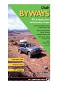
With trips along soaring mountains and remote plateaus to high-walled canyons and plunging river gorges, Utah Byways is the ideal guide for adventurous travelers who want to explore the state's extensive network of backcountry roads. This fully updated edition presents 65 trips in Utah's spectacular preserved areas such as Canyonlands, Capitol Reef, and Arches National Parks, Glen Canyon National Recreation Area, and the Grand Staircase-Escalante National Monument. Other adventures follow the routes of the Transcontinental Railroad and the Pony Express. Tony Huegel's glove-box-sized Byways books have been leading drivers to the hidden surprises found along unpaved backroads for more than 10 years. These books are for recreational drivers who want to use their four-wheel-drive or sport-utility vehicle beyond the pavement to explore, but who might not want to do hard-core or lengthy off-road driving. They are also for adventurers who use these trips as jumping-off points for muscle-powered exploration, such as hiking and mountain biking. Detailed descriptions are augmented with full-page photographs and two-color maps of each trip. Icons next to each description indicate options for non-driving activities along each route, such as biking, wildlife viewing, camping, hiking, visiting historic sites, and more. Trail-tested, how-to tips assist beginning and experienced backcountry drivers alike. This established and popular series has been completely redesigned with a field-friendly spiral binding and updated to include extensive GPS waypoints.
 Guide to Arizona Backroads & 4-Wheel Drive Trails: Easy, Mod
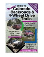
 Guide to Colorado Backroads & 4-Wheel Drive Trails, 2nd Edition
 Guide To Moab, UT Backroads & 4-Wheel Drive Trails
 Guide To Northern California Backroads & 4-Wheel Drive Trails
 Guide to Northern Colorado Backroads & 4-Wheel Drive Trails
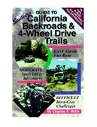 Guide to Southern California Backroads & 4-Wheel Drive Trails
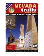 Nevada Trails Western Region
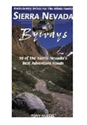 Sierra Nevada Byways: 50 Backcountry Drives For The Whole Family
 Utah Byways: 65 of Utah's Best Backcountry Drives

 Route Editor