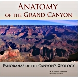
• W. Kenneth Hamblin → Grand Canyon Association 2008
The experience of seeing the Grand Canyon is difficult to describe but impossible to forget. Some people are content to see the massive chasm from a viewpoint along the rim; others want to see it from end to end and understand the natural processes that shaped this one-of-a-kind spectacle. It is for the latter that this book has been prepared. Anatomy of the Grand Canyon is not a geology textbook encumbered with language unintelligible to the average reader. Rather, it is a visual tour from the canyon’s rims, the Colorado River, and the air; from the beginning of the Grand Canyon at Lees Ferry, to its conclusion 277 miles downstream at the Grand Wash Cliffs. Though the panoramic photographs are magnificent, their higher purpose is to show important geologic information. Supported by text, diagrams, and maps that are easy to understand, these photographs tell an amazing story. Author-photographer W. Kenneth Hamblin has packed a lifetime of geologic study into a volume that is at once inspiring and instructive, and has given the reader access to the Grand Canyon’s most intriguing secrets. For them, the thrill of discovery awaits.
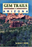
• James R. Mitchell, Bessie Simpson → Gem Guides Book Company 2001
Arizona is known the world over for its rich abundance and variety of geological treasures. Newly revised, the fourth edition of this best-selling guide updates the well-known sites and features twenty new locations for collecting rocks, minerals, crystals and fossils. Situated in landscape as diverse as the minerals themselves, these sites vary from arid desert to pine covered peaks. Includes over 90 collecting sites. Detailed text describes where to go and what to look for at each collecting area. Maps for each site lead the rockhound to an almost limitless supply of specimens. Black and white photographs picture the collecting areas. Color photographs highlight beautiful specimens. A new glossary makes it easier to locate that special specimen for your collection. Filled with expert advice based on years of experience, Gem Trails of Arizona is an invaluable guide for the rockhound just starting out. For the experienced collector who has searched for Arizona's mineral resources for years, it is an outstanding source for the best collecting sites throughout this scenic state.
• Lon Abbott → Mountain Press Publishing Company 2007
From the plunging depths of the Grand Canyon to jagged volcanic peaks, from Sedona's vibrant red rocks to the tapered slot of Antelope Canyon, Geology Underfoot in Northern Arizona introduces you to a land of contrasts. At twenty special sites in this timeless landscape, readers can see and sometimes touch evidence of an ancient supercontinent and colliding volcanic island arcs, mighty mountain ranges and tropical seas, thousand-foot sand dunes, a meteor with deep impact, swimming dilophosaurs, a spring that grows rock, and more. The Geology Underfoot series encourages you to get out of your car for an up-close look at rocks and landforms. Books in the series inform, no matter how much geology you know. They're also simply a good read, on-site or in the comfort of your home.
The only guide to the Grand Canyon that combines hiking and geology—unlocking the mysteries of the landscape, step by step. · Newest addition to the popular Hiking Geology series · Appendices cover additional geologic information for the non-geologist · Everything needed to plan the trip, including permits, lodging and camping, mule rides, and recommended day trips Etched on the Grand Canyon’s steep walls are stories of how this majestic landscape came to be: volcanic islands, stark deserts, and tranquil seas come and gone, and histories of plants and animals that have made this place their home. You’ll read this story up close on the trail with the help of Hiking the Grand Canyon’s Geology. In 18 excursions, there’s something for everyone: from the most popular rim-to-river trails (Havasu Canyon Trail) to gentle, half-day rim walks (Red Butte Trail) to rugged and remote, multi-day backpack trips (Lava Falls Route).
Hiking the Southwest's Geology: Four Corners Region takes curious hikers on a journey through time that explores the Colorado Plateau-an immense land of canyons, mesas, and isolated mountain ranges in the American Southwest. Divided into representative geologic provinces/areas, Hopkins specifies distinct geologic or scenic features and provides information about what makes each province unique. He describes each hike from the perspective of the geologic evolution of the landscape while exploring basic geologic concepts and providing a framework for understanding the major forces that have shaped the land. Hopkins' stunning color photography brings the Four Corners Region to life in dazzling detail.
• Halka Chronic → Mountain Press Publishing Company 1983
Roadside Geology of Hawai`i details the evolution of this volcanic island chain, from the origin of a hot spot and the tumultuous creation of each island to ongoing eruptions and the gradual death and erosion of old volcanoes. Residents and tourists alike will soon become experts on lava tubes and lava flows, ancient beaches and coral reefs, ephemeral black sand beaches and the occasional tsunami. Includes a chapter each on six easily accessible and populated islands: Hawai`i , Maui, Lana`i, Moloka`i, O`ahu, and Kaua`i. Each chapter begins with a general discussion of the rocks of that island, then proceeds with a seres of road guides that provide the local details.
• Stephen J Reynolds Julia K Johnson → Geological Society of America 2025
Nowhere in the country is the roadside geology better exposed than in the mountains and deserts of Arizona. With this photo-filled book as your guide, you will experience the rocky scenery of Arizona with a new appreciation, as you learn about colorful badlands in the Painted Desert, past environments preserved in Sedona's red and white sandstone cliffs, fossilized logs at Petrified Forest National Park, and the copper mined at Bisbee, Morenci, Bagdad, and elsewhere. Impressive gorges cut through the landscape, including those of the Little Colorado, Gila, and Salt Rivers, but the most spectacular gorge is the Grand Canyon, with its famous layered walls underlain by 1- to 2-billion-year-old rocks. Related ancient rocks are readily observed in parks on the outskirts of Phoenix, Tucson, and Prescott, and in the mountain ranges of central and southern Arizona. From the Colorado River's earliest stream deposits near Yuma to ancient sand dunes preserved in the walls of Canyon de Chelly in the Four Corners region, and from volcanic tuffs near Kingman to silver veins at Tombstone, Roadside Geology of Arizona crisscrosses the state to cover all its fascinating geologic history.
This new edition of Donald L. Baars’s classic The Colorado Plateau incorporates new text, maps, photographs, figures, tables, and bibliography to provide the most up-to-date geology of the red rock and canyon country of the Four Corners of Utah, Colorado, New Mexico, and Arizona. Baars’s comprehensive geological summary of the canyonlands is detailed enough to satisfy a geologist looking for an overview of the region yet clearly enough written to appeal to anyone interested in learning the scientific story behind this magnificent scenic area.
 Anatomy of the Grand Canyon: Panoramas of the Canyon's Geolo
 Gem Trails of Arizona
 Geology Underfoot in Northern Arizona
 Hiking the Grand Canyon's Geology
 Hiking the Southwest's Geology: Four Corner's Region
 Roadside Geology of Arizona
 Roadside Geology of Arizona, Second Edition
 The Colorado Plateau: A Geologic History

 Route Editor