• National Geographic Maps → Natl Geographic Society Maps 2007
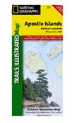
This Trails Illustrated topographic map for Apostle Islands National Lakeshore, and surrounding area in northern Wisconsin includes Devils Island, North Twin Island, South Twin Island, Rocky Island, Bear Island, Otter Island, Ironwood Island, Cat Island, Outer Island, Manitou Island, Oak Island, Stockton Island, Michigan Island, Hermit Island, Basswood Island, York Island, Sand Island, Eagle Island, Sand Point, Point Detour, Madeline Island, Big Bay State Park, Long Island, Chequamegon Point, Lake Superior, an island-to-island mileage chart, the city of Bayfield, Little Sand Bay, and much more. Includes UTM grids for use with your GPS unit.Scale = 1:50,000 Size: 25'' x 38''
• National Geographic Maps → Natl Geographic Society Maps 2005
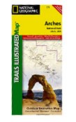
This map is updated to reflect road closings, new trails, and campground relocation, and includes detailed trail information, points of interest, trailheads, picnic areas, facitlities, and more. Included on the map are Arches National Park, The Highlands, Little Valley, Devils Garden, Lost Spring Canyon Wilderness area, Negro Bill Wilderness area, Scott M. Matheson Wetlands Preserve, Cache Valley, Delicate Arch, Broken Arch, Sand Dune Arch, Pine Tree Arch, Private Arch, Dark Angel, Double Arch, and more. The map also includes the Colorado River, the Windows Section, Petrified Dunes, and fascinating information about the park's geology, archaeology, history, and culture. Includes UTM grids for use with your GPS unit.Scale = 1:35,000 Size: 26'' x 38''
• National Geographic Maps → Natl Geographic Society Maps 2005
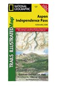
Coverage includes White River, San Isabel and Gunnison national forests. Maroon Bells â Snowmass, Hunter â Fryingpan, Mt. Massive, Collegiate Peaks and Spruce Creek wilderness areas. Aspen and Twin lakes. Roaring Fork River, Lake and Lincoln creeks. 14ers: Mt. Elbert, Mt. Massive, Castle and La Plata peaks. Willis, Fryingpan and Evergreen lakes. Taylor, Midway, and Independence passes. Ski Areas: Aspen and Buttermilk. 10th Mountain Huts: Tagert Hut, Wilson Hut, Barnard Hut, Markely Hut, McNamara Hut. Includes UTM grids for use with your GPS unit.Scale = 1:40,680
• National Geographic Maps → Natl Geographic Society Maps 2009
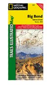
The map includes Big Bend National Park, Big Bend Ranch State Park, Black Gap Wildlife Management ARea, the Chisos Mountains, Sierra del Carmen, Sierra del Caballo Muerto, designated backcountry camping sites, park information, and more. Includes UTM tick marks for use with your GPS unit.Scale = 1:133,333 & 1:27,500 Size: 26'' x 38''
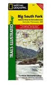
• National Geographic Maps → Natl Geographic Society Maps 2007
This Trails Illustrated topographic map for Big South Fork National River & Recreation Area in southern Kentucky and northern Tennessee is the perfect map for hiking, biking, exploring, climbing, camping, and sightseeing in this stunning area.
The map includes Daniel Boone National Forest, Big South Fork National River and Recreation Area, Scott State Forest, Cumberland River, Little South Fork, Big South Fork, and Clear Fork, New River, Lake Cumberland, Yahoo Falls Scenic Area, Blue Heron Area, Bandy Creek Campground, Leatherwood Ford, Honey Creek, Burnt Mill Bridge, Alum Ford, John Muir Trail, Bear Creek Overlook, and much more. Includes UTM grids for use with your GPS unit.
 Absaroka Beartooth Wilderness: Montana, Wyoming: Outdoor Recreation Map
 Allagash Wilderness Waterway North (Trails Illustrated Map #400)
 Allagash Wilderness Waterway South (Trails Illustrated Map #401)
 Apostle Isles National Lakeshore, WI - Trails Illustrated Map # 235
 Arches National Park, Utah - Trails Illustrated Map # 211
 Aspen & Independence Pass Area, Colorado Trails Illustrated Map # 127 (National Geographic Maps: Tra
 Baxter State Park / Mount Katahdin (Trails Illustrated Map #754)
 Big Bend National Park, TX - Trails Illustrated Map #225 (National Geographic Maps: Trails Illustrat
 Big South Fork National Recreation Area, KY/TN - Trails Illustrated Map # 241 (National Geographic M

 Route Editor


