• National Geographic Maps → Natl Geographic Society Maps 2001
This Trails Illustrated topographic map for South Dakota's Black Hills, Wind Cave National Park, Mt Rushmore, and surrounding area, is the perfect map for exploring this magical wilderness. The map includes Wind Cave National Park, Custer State Park, Black Hills National Forest, Norbeck Wildlife Preserve, Sylvan Lake, Stockade Lake, Legion Lake, Center Lake, Elk Mountain, Bison Flats, Limestone Canyon, and much more. Includes UTM tick marks for use with your GPS unit.Scale = 1:53,000 Size: 26'' x 38''
• National Geographic → Natl Geographic Society Maps 2011
Our new detailed recreation map for the Boston Harbor Islands National Recreation Area is a two-sided, waterproof map which covers all 34 of the harbor islands plus shoreline parks, downtown Boston, access and ferry interpretive information and neighboring communities. The front side contains both bathymetry and topography making it the perfect multi-functional map for kayaking, hiking, fishing, wildlife viewing and more. This beautiful map is a perfect souvenir to remember your trip to the park as well as a highly functional tool for those that recreate here frequently. Users will find clearly marked ferry terminals and routes, water taxi stops, boat ramps, moorings, beaches, historic sites, campgrounds, trails, forts, and hundreds of place names. A UTM and Latitude/Longitude grid, as well as compass rose, scale bar, and marine navigation markers (buoys, lights, and soundings) will keep you pointed in the right direction. The reverse provides even more detail, using high-resolution satellite imagery, revealing the historic structures, facilities, and terrain. Valuable park information, including recommended places to visit, history, regulations, and safety information will aid all travelers in making their island adventure safe and fun. Our Boston Harbor Islands map was developed in close collaboration with the Boston Harbor Islands Alliance, the non-profit interpretive agency that supports and promotes this unique park, and the members of the Boston Harbor Islands Partnership including: The National Park Service, The DCR (Department of Conservation and Recreation), U.S. Coast Guard, Mass Port Authority, Massachusetts Water Resource Authority, City of Boston, Boston Redevelopment Agency, Trustees for Reservations, and Thompson Island Outward Bound. Popular Places Included on the Map:Georges Island, Spectacle Island, Peddocks Island, Lovells Island, Bumpkin Island, Grape Island, Thompson Island, Little Brewster Island, Deer Island, World s End, Webb Memorial State Park, Nut Island, Boston Light, Graves Light, Boston Inner Harbor, Hingham Bay, Quincy Bay, Hull, Dorchester Bay, Marina Bay, Boston, Charlestown, Fort Warren, and Fort Independence. Key Features:Waterproof and tear-resistant Detailed bathymetry and topography for the entire harbor ideal for exploring the region by kayak, bike, and foot. Hundreds of points-of-interest, including the location of boat ramps, ferry terminals, campgrounds, and island attractions Thousands of place names Latitude/Longitude, UTM, and Magnetic Declination for use with GPS and Compass Public transportation, including Ferry Terminals, Water Taxi Stops, MBTA (T) Subway/Commuter Rail Stations Product Specs:Copyright 2011 NG Item #: TI00000265 ISBN: 9781566955751 UPC: 749717002654 Scale: 1:25,000 Folded Size: 4.25 x 9.25 Sheet Size: 26 x 38 MSRP: $11.95 This Map is Ideal For:First time visitors and frequent recreationists Tourists (as a guide and souvenir) Boaters and kayakers Hiking and cycling Wildlife viewing Historical enthusiasts
• National Geographic Maps → Natl Geographic Society Maps 2009
Located just north of Atlanta, the Chattahoochee National Forest contains the southern terminus of the Appalachian Trail along with an abundance of recreational opportunities for outdoor enthusiasts of all interests. This recreation map contains carefully researched trails, campsites, forest service roads, and points-of-interests. Useful UTM and Latitude/Longitude grids, mileage charts, and other navigation features make Brasstown Bald/Chattooga River the best map available for this section of the Chattahoochee National Forest. The West Side of the Map Includes: Chatuge Lake, Lake Burton, Brasstown National Wilderness, Chattahoochee Wildlife Management Area, Raven Cliffs Wilderness, Blood Mountain Wilderness, Cooper Creek Wildlife Management Area, Anna Ruby Falls Scenic Area, Tray Mountain Wilderness, Swallow Creek Wildlife Management Area, Lake Burton Wildlife Management Area, Southern tip of the Nantahala Wilderness, High Shoals Scenic Area, Unicoi State Park, Smithgall Woods- Dukes Creek Conservation Area, Hardman Farm HS, Mount Yonah, Blood Mountain Wilderness, and more.. The East Side of the Map Includes: Ellicott Rock Wilderness, White Rock Scenic Area, Warwoman Wildlife Management Area, Black Rock Mountain State Park, Chattooga Wild & Scenic River, Sumter National Forest, Tallujah Gorge State Park, Brasstown Creek State Heritage Preserve, Hartwell Reservoir, Lake Russell State Wildlife Management Area, and more... Approximately 4 1/4" x 9 1/4" folded; 27" x 39" fully openedScale = 1:70,000Map revised - 2009
• National Geographic Maps → Natl Geographic Society Maps 2006
Coverage includes the Pike, San Isabel and Arapaho national forests, Alma State Wildlife Area and the cities of Leadville, Como, Breckenridge, Climax and Alma. Also included are the Blue River, Turquoise and Robinson lakes, and Montgomery Reservoir. 14ers: Mt. Lincoln, Bross, Democrat, Cameron and Quandary peaks. Boreas, Mosquito, Hoosier, French, Georgia, Freemont and Searle passes. Ski areas: Breckenridge, Copper Mountain and Fairplay cross-country. 10th Mountain Huts: Jackal Hut, Vance's Cabin, Janet's Cabin, Fowler Hilliard Hut and Francie's Hut. Portions of the Continental Divide Trail and Colorado Trail are included on this map. Includes UTM grids for use with your GPS unit.Scale = 1:40,680
• National Geographic Maps → Natl Geographic Society Maps 2006
The map includes the entire national park area, with detailed trails and topographic information. Also included are portions of Grand Staircsae - Escalante National Monument, Bryce Ampitheater, Sunrise Point, Bryce Canyon Lodge, Black Birch Canyon, Rainbow Point, the Queens Garden Trail, and more. Includes UTM grids for use with your GPS unit.Scale = 1:35,000 Size: 26'' x 38''
• Trails Illustrated → National Geographic Maps 2013
• Waterproof • Tear-Resistant • Topographic Map
Coverage includes Gunnison and San Isabel national forests; Collegiate Peaks Wilderness; the cities of Buena Vista, Princeton, Rockdale and Winfield; Cottonwood, Hartenstein and Bear lakes; the Arkansas River; Cottonwood and Browns passes. 14ers: Mt Oxford, Belford, Harvard, Columbia, Yale, Missouri Mountain and Huron Peak. Includes UTM grids for use with your GPS unit.
• National Geographic Maps → Natl Geographic Society Maps 2009
This Trails Illustrated topographic map for the western portion of the Buffalo National River and surrounding area in north-central Arkansas, one of the few remaining rivers in the lower 48 states without dams. The Buffalo National River, West, includes sections of the river from the Upper Buffalo Wilderness and the Ozark National Forest, through Boxley Valley to the Little Buffalo River, then through to Woolum. Along the way are many hiking trails, Lost Valley, Villines Farmstead, Steel Creek, Henderson House, Kyles Landing, Erbie, Cedar Grove, Ozark, Pruitt, and Carver. Includes UTM grids for use with your GPS unit.Approximately 4 1/4" x 9 1/4" folded; 27" x 39" fully openedScale = 1:35,000Map revised - 2009
• National Geographic Maps → Natl Geographic Society Maps 2007
Surrounded by the Atlantic Ocean to the east, north, and south, Nantucket Sound to the southwest, and Cape Cod Bay to the west, Cape Cod is lined with beaches, and interlaced with paths and roads. National Geographic's Cape Cod map is the perfect companion for next trip down the Cape. Map coveage includes the mid and lower cape towns of: Provincetown, Truro, Wellfleet, Eastham, Orleans, Chatham, Brewster, Harwich, Dennis, and Yarmouth.The map details the Cape Cod National Seashore, Cape Cod Rail Trail, beaches, lighthouses, picnic areas, cycyling paths, walking trails, points of interest, museums and much more. Popular destinations like Nickerson State Park, Wellfleet Harbor, Provincetown Harbor, Massachusetts Audobon Society Sanctuary, and Monomoy National Wildlife Refuge are clearly shown.Like all National Geographic maps, the Cape Cod National Seashore, is updated regularly and printed on durable waterproof, tear-resistant material.Includes UTM grids for use with your GPS unit.Scale = 1:45,000 Size: 26'' x 38''
• National Geographic Maps → Natl Geographic Society Maps 2007
This two-sided map shows two worlds - the beautiful landscape in and around Carlsbad National Park and Wilderness area on one side, with the other side showing detail and trails in one of the world's most fascinating and accessible underground wonders. Above ground, the map includes Carlsbad Caverns National Park and Wilderness, portions of Lincoln National Forest, and the surrounding area. Hiking trails include Chihuahua Desert Nature Trail, Old Guano Road Trail, Rattlesnake Canyon Trail, Guadalupe Ridge Trail, Slaughter Canyon Trail and Slaughter Canyon Cave Trail, Yucca Canyon Trail, Usery Trail, and Rock Shelter Trail. The Caverns map features detailed trail information for both guided and self-guided tours, including detail that shows stalactites, stalagmites, columns, breakdowns, slopes, pools, bat guano, gypsum, and unexplored passages. Includes UTM grids for use with your GPS unit.Approximately 4 1/4" x 9 1/4" folded; 27" x 39" fully openedScale = 1:35,000Map Revised - 2007
• National Geographic maps → Natl Geographic Society Maps 2006
This two-sided map includes San Miguel Island, Santa Rosa Island, Santa Cruz Island, Santa Barbara Island, and Anacapa Island. The map combines beautiful cartography that shows the topology and natural features of each island, along with hiking trails, camping spots, rest areas, notable ship wrecks, marine reserves, and other features to help get you around each of the islands. Large scale insets of Santa Cruz's Scorpion Area, Santa Barbarbara Island, and Anacapa Island show trail detail, camping, picnic areas, and facilities. The map also includes a detailed description of each island, along with safety information, regulations and guidelines, hiking information and camping information. Includes UTM grids for use with your GPS unit.Scale = 1:25,000 & 1:50,000 Size: 26'' x 38''
 Black Hills - Northeast, South Dakota Trails Illustrated Map #751
 Boston Harbor Islands National Recreation Area
 Brasstown Bald / Chattooga River, Chattahoochee National Forest Trails Illustrated Map # 778
 Breckenridge & Tennessee Pass, Colorado - Trails Illustrated Map # 109
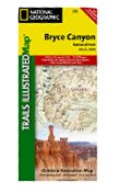 Bryce Canyon National Park, UT - Trails Illustrated Map # 219
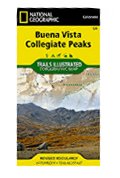 Buena Vista, Collegiate Peaks (National Geographic Trails Illustrated Map)
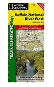 Buffalo National River West, AR Trails Illustrated Map # 232
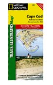 Cape Cod National Seashore, MA - Trails Illustrated Map # 250 (National Geographic Maps: Trails Illu
 Carlsbad Caverns National Park, NM Trails Illustrated Map #247 (National Geographic Maps: Trails Ill
 Channel Islands National Park, CA - Trails Illustrated Map # 252 (National Geographic Maps: Trails I

 Route Editor

