• National Geographic Maps → National Geographic Society 2001
This Trails Illustrated topographic map is the most comprehensive and complete recreational map for Hawaii Volcanoes National Park. In addition to the large primary map, there are insets showing the situation of the park on the island of Hawaii, a larger-scale map showing the most useful roads and trails, and a detailed view of the area surrounding Kilauea Caldera including trails. A guide to the parks main trails is listed in the map margins. Map is waterproof, tear-resistant, highly-detailed, and incredibly durable.
• National Geographic Maps → Natl Geographic Society Maps 1994
Coverage includes Uinta National Forest; Southern Wasatch National Forest; Twin Peaks, Lone Peak and Mt. Timpanogos Wildernesses; Spanish Fork, Soldier Summit, Cottonwood Heights, Kamas, Heber City and American Fork; Cottonwood, Mill Creek and Spanish Fork Canyons, Mirror Lake - West, Rockport Lake, Deer Creek, Currant Creek and Strawberry Reservoir. Includes UTM grids for use with your GPS unit.Scale = 1:70,000 Size: 26'' x 38''
• National Geographic Maps → Natl Geographic Society Maps 2007
20 Years of trail-tough maps that guide you to and through your favorite destinations.With over 165 titles available for America s favorite outdoor destinations, Trails Illustrated maps are the most trusted and popular recreation maps available. Continually setting the standard for accuracy, each map is crafted in conjunction with local land managers, and undergoes rigorous review and enhancement before being printed on waterproof, tear-resistant material. Each Trails Illustrated map contains detailed topographic information, clearly marked and named trails, recreational points of interest, and navigational aids. National Park series maps contain useful details for planning your visit. State series titles cover popular recreation areas, ideal for done-in-a-day activities. For detailed information regarding coverage, scale, features, and price use the map above to locate a Trails Illustrated title for you next outdoor excursion. Coverage includes San Juan and Rio Grande national forests; Weminuche Wilderness; Williams Creek; Big Meadows and Rio Grand reservoirs; Chicago Basin, Emerald, and Electra lakes; Wagon Wheel Gap, Wolf Creek, and Rockwood. 14ers: Sunlight Peak, Windom Peak, Mt Eolus; Piedra, Squaw and Molas passes; San Juan Mountains; San Juan, Rio Grande and Los Pinos rivers. Ski Area: Wolf Creek. Includes portions of the Continental Divide Trail and the Colorado Trail. Includes UTM grids for use with your GPS unit.Scale 1:63,360
Detailed topographic map for the northern half of the Wind River mountain range in Wyoming. Shows trails, distances, topography, roads, trailheads and much more. This map is waterproof
• National Geographic Maps → Natl Geographic Society Maps 1997
This two-sided map covers Wrangell - St. Elias National Park in its entirety, along with Tetlin National Wildlife Refuge, portions of Chugach National Forest, the Bering Glacier, Robinson Mountains, Chugach Mountains, Wrangell Mountains, and Kayak Island State Marine Park. Towns include Katalla, Mt. Hazelet, Cape Yakataga, Kennicott, McCarthy, Slana, and Glennallen. The map features two detailed insets. The first includes Yakutat Bay, Disenchantment Bay, Russel Fjord, Nunatak Fjord, the Malaspina Glacier. The second detailed inset shows the Kennicott and McCarthy areas, along with the Bonanza Ridge, Fireweed Mountain, and the Nizina River.Scale = 1:375,000 & 1:85,000 Size 26'' x 38''
• National Geographic Maps → Natl Geographic Society Maps 2008
Detailed and accurate topographic trail map for Yellowstone National Park. Includes a detailed road network and popular trails, complete with use restrictions, mileages, elevation gains, and difficulty ratings. Popular attractions and park services are clearly identified. UTM and Latitude/Longitude grids ensure ease of use with GPS or compass navigation.Scale = 1:126,720 Size: 26'' x 38''Printed on high-quality, waterproof, tear-resistant material that will last for years of use.
• National Geographic Maps → Natl Geographic Society Maps 2005
Coverage includes Stanislaus National Forest, Emigrant Wilderness, Carson Iceberg Wilderness, Toiyabe National Forest, Hoover Wilderness, Inyo National Forst, Yosemite Wilderness, Sierra National Forest, Ansel Adams Wilderness. Detail on Yosemite Valley and Tuolumne Meadows. Includes UTM grids for use with your GPS unit.Scale = 1:80,000 & 1:40,000 Size: 38'' x 26''
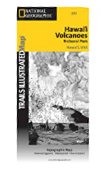 Trails Illustrated Waterproof Hawaii Volcanoes National Park Map
 Wasatch Front North, Utah - Trails Illustrated Map # 709
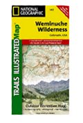 Weminuche Wilderness, Colorado - Trails Illustrated Map # 140 (National Geographic)
 Wind River Mountains Topographic Map - Northern Half
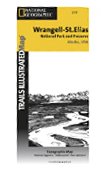 Wrangell/St.Elias National Park, AK - Trails Illustrated Map #249 (National Geographic Maps: Trails
 Yellowstone National Park Recreation Map
 Yellowstone National Park, WY - Trails Illustrated Map #201
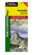 Yosemite National Park, CA - Trails Illustrated Map # 206

 Route Editor

