• National Geographic Maps → Natl Geographic Society Maps 2007
Coverage includes Bighorn National Forest, Highland Park, Meadowlark Lake, Kearny Lake Reservoir, Coffeen Park. Includes UTM grids for use with your GPS unit.Scale = 1:45,000 Size: 25'' x 38''
• USDA Forest Service → United States Department of Agriculture Forest Service 2006
The Coconino National Forest covers 1.8 million acres varying from enchanting semi-arid desert, magnificent ponderosa pine forests, to incredible views from alpine tundra. Elevations range from 2,600 feet in canyon bottoms to 12,643 feet at the top of the San Francisco Mountain.
Opportunities in the forest are as varied as the landscape. Whatever your taste for recreation or natural beauty, there's something here for you. There are scenic views of red rock canyons, stands of old-growth pine, streams, lakes, golden aspen in the autumn, deer, turkey and elk to hunt or photograph, and snow covered slopes to ski in the winter. Whether horseback riding, hiking, bicycling, driving, or skiing, you'll enjoy visiting the Coconino National Forest.
This USDA Forest Service map provides information on recreational uses, local plants and wildlife, trails, roads, streams, lakes, visitors centers, facilities available, campgrounds, and picnic areas. The map also displays color photographs of points of interest and activities. The map covers all of one national forest, and the scale is
• National Geographic Maps → Natl Geographic Society Maps 1998
This Trails Illustrated topographic map for Crater Lake National Park and surrounding area is the perfect map for hiking, biking, exploring, climbing, camping, and sightseeing in this beautiful area. This two-sided map includes Mazama Village, Crater Lake National Park in its entirety, portions of Umpqua National Forest, Rogue River National Forest, Winema National Forest, and Sky Lakes Wilderness, and Mount Thielson Wilderness. Trails include the Pacific Crest National Scenic Trail, Lightning Springs Trail, Bert Creek Trail, Bald Crater Loop Trail, Stuart Falls Spur Trail, trails within Sky Lakes Wilderness, as well as trails to Crater Peak, Lodgepole, Red Cone Springs, Grouse Hill, Mount Scott, and popular overlooks. The map also features a brief overview of the natural forces that formed the lake, as well as sections on backcountry regulations, trail regulations, featured recreation, and trail information for short-, medium-, and long hikes. Includes UTM grids for use with your GPS unit.Scale = 1:55,000 Size: 26''x 38''
• National Geographic Maps → Natl Geographic Society Maps 2001
Coverage includes White River and Gunnison national forests; Maroon Bells-Snowmass and Collegiate Peaks Wilderness areas; the cities of Gothic, Crested Butte and Taylor Park; Taylor River/Reservoir; East River; Spring Creek Reservoir; and Triangle and Pearl passes. Ski Areas: Crested Butte. Includes UTM grids for use with your GPS unit.Scale = 1:40,680
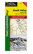
• National Geographic Maps → Natl Geographic Society Maps 2006
This Trails Illustrated topographic map for Death Valley National Park, which straddles the state lines of eastern California and western Nevada, is the perfect recreational map for this dramatic park, which encompasses the hottest, driest, and lowest places in the US. Within its three million acres you will find oceans of sand dunes, dramatic snow-capped mountains, spectacular geological formations, and breathtaking views. The map includes the entire national park area, with detailed trails and topographic information. The trails have been enhanced and road and trail mileage have been added to create a map that is an essential guide for the area. Includes UTM grids for use with your GPS unit.Scale = 1:165,000 Size: 26'' x 38''
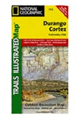
• National Geographic Maps → Natl Geographic Society Maps 2007
Coverage includes San Juan National Forest. Mesa Verde National Park, McPhee Reservoir and Recreation Area, House Creek Recreation Area, Durango Mountain Ski Area, Mancos State Park. Animas River, Colorado Plateau, La Plata Mountains. Towns: Cortez, Durango, Mancos. San Juan Skyway and Trail of the Ancients Scenic Drives. Includes UTM grids for use with your GPS unit.Scale = 1:63,360 Size: 26'' x 38''
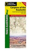
• National Geographic Maps → Natl Geographic Society Maps 2006
Coverage includes BLM - Escalante Resource Area, Dixie National Forest, Glen Canyon National Recreation Area; Box Hollow Wilderness Area, Death Hollow Natural Area and Wolverine Petrified Wood Natural Area; Boulder Town, Escalante and Devils Garden; Fiftymile Bench, Escalante Canyons and surrounding area, Escalante River and northwest Lake Powell. Includes UTM grids for use with your GPS unit.Scale = 1:75,000 Size: 26'' x 38''
 Classic Moab Trails
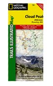 Cloud Peak Wilderness, Wyoming - Trails Illustrated Map # 720
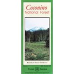 Coconino National Forest
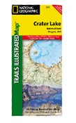 Crater Lake National Park, OR- Trails Illustrated Map # 244 (National Geographic Maps: Trails Illust
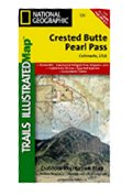 Crested Butte & Pearl Pass - Trails Illustrated Map # 131
 Death Valley National Park, CA - Trails Illustrated Map #221
 Durango & Cortez Area, Colorado - Trails Illustrated Map # 144
 Durango Colorado Trails Recreation Topo Map
 Escalante Canyons - Trails Illustrated Map # 710

 Route Editor


