The Flagstaff Trails Map depicts more than 200 miles of hiking, biking, and equestrian trails and 25 miles of Flagstaff Urban Trails (FUTS) in a 375-square mile area around Flagstaff, Arizona. Features include easy-to-read shaded topography, trail mileage, summary information for all 47 trails shown on the map, vertical profiles for 29 trails, and UTM coordinates for GPS users. Other information includes campgrounds, picnic areas, trailheads, wilderness areas, landmarks, and scenic views. Printed two sides in full color on durable, waterproof, tear-resistant synthetic paper. Unfolded size is 24 x 37 inches; folds down to 4 x 7.75 inches. The scale is 1:35,000.
• National Geographic Maps → Natl Geographic Society Maps 2004
Coverage includes Cherokee National Forest/Northern Districts; Greenville and Newport; and Sampson Mountain Wilderness Area. Boating Access Points: Nolichucky and French Broad Rivers. Scenic Drives: Foothills Parkway. Includes coverage of the Appalachian Trail. Includes UTM grids for use with your GPS unit and a trail mileage matrix.Scale = 1:63,360 Size: 26'' x 38''
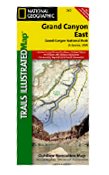
Grand Canyon East (#262) and Grand Canyon West (#263) combine to cover the entire Grand Canyon National Park and its bordering public lands. Both maps contain detailed and easy-to-read trail and road networks, locations of facilities, points of interest, and highly accurate terrain with thousands of feature names. Official Grand Canyon Backcountry Use Areas are shown, coded by degree of experience required. Suggested hikes and itineraries, important park regulations, safety tips and contact information make these maps an invaluable resource.
Grand Canyon East (#262) contains detailed coverage from the park's northeastern boundary at Glen Canyon to the highly visited areas just west of Grand Canyon village on the south rim (Colorado River miles 0 - 142).
• National Geographic Maps → Natl Geographic Society Maps 2010
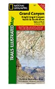
Grand Canyon, Bright Angel Canyon/North & South Rims (#261) replaces the previous Grand Canyon National Park Trails Illustrated map (#207). Completely redesigned and updated, Grand Canyon, Bright Angel, North/South Rim provides an enhanced scale and detail for the highest visitation area of the park surrounding the Grand Canyon South Rim Visitor Center and the Bright Angel Trail. (Colorado River miles 60-98).Designed with a wide range of visitors in mind, Grand Canyon Central features detailed and easy to read trails, accurate road network, campgrounds, scenic overlooks and points of interests, visitor centers and facilities, color coded bus stops with routes, plus park regulations, backcountry use areas, and contact information for local agencies. This well-balanced mix of detailed cartography and handy resource information makes all Trails Illustrated maps an invaluable resource for both planning and exploring the park. This map features an enhanced scale (35K) for increased detail in this high-use area of Grand Canyon National Park.FEATURES INCLUDED ON GRAND CANYON , BRIGHT ANGEL CANYON/NORTH & SOUTH RIMS:Colorado River miles 60-98, North and South Rim visitor centers, Grand Canyon Village, Grand Canyon / National Geographic IMAX, Tusayan, Grand Canyon Railroad Station, Bright Angel Trail (plus elevation profile), West Rim Trail, Kaibab Trail, Arizona Trail, Grand Canyon Lodge, and more.
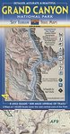
Beautiful, accurate, very detailed and best selling Grand Canyon map is now available in the 4th edition. Fine shaded relief and 100ft contours give a detailed & stunning view of the Canyon topography. Mileage info added to all trail junctions, plus cumulative mileage for select segments. Includes trail profile graphs. Thoroughly reviewed by Park Rangers. Detailed topographic & trail map of 308,000 acres in central Grand Canyon. 1:40,000 scale covers 8 USGS quads. 308 miles (495km) of trails shown with trail ratings, text descriptions & statistics. Most complete & accurate map of the area. Includes 100ft contours, shaded relief, UTM grid for use with GPS, hydrology with springs & drinking water (including a chart), backcountry use zones for permit planning, and other trip information. Printed on waterproof, tear-tough paper. This map covers the huge core of Grand Canyon National Park. This is the area where 99% of visitors travel and where 90% of overnight backcountry trips take place, and where most trails and reliable water sources are. The map does not cover the vast and more isolated western sections, nor the far NE corner. (Zoom into the inset maps above to see exact coverage.) Added a handy and concise bus map. All in all this is a very useful and legible map. Hope you like the new edition!
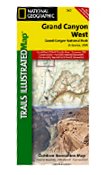
Grand Canyon West (#263) and Grand Canyon East (#262) combine to cover the entire Grand Canyon National Park and its bordering public lands. Both maps contain detailed and easy-to-read trail and road networks, locations of facilities, points of interest, and highly accurate terrain with thousands of feature names. Official Grand Canyon Backcountry Use Areas are shown, coded by degree of experience required. Suggested hikes and itineraries, important park regulations, safety tips and contact information make these maps an invaluable resource.
Grand Canyon West (#263) slightly overlaps with Grand Canyon East and contains detailed coverage from the high visitation areas just west of the Grand Canyon Visitor Center to the western boundary of the park at Lake Mead. (Colorado River miles 110-278).
• National Geographic Maps → Natl Geographic Society Maps 1997
Coverage includes BLM/San Juan Resource Area; Grand Gulch Primitive Area; Grand Flat, Northern Glen Canyon National Recreation Area, Valley of the Gods, Cedar Mesa, Snow Flat, Grand Flat and Comb Ridge; First, Fish and Owl Creek, Polly Mesa and San Juan River. Includes UTM tick marks for use with your GPS unit.Scale = 1:62,500 Size: 25'' x 37''
• National Geographic Maps → Natl Geographic Society Maps 2008
Coverage includes town of Lead, Sturgis, Fort Meade Recreation Area, Black Hills Experimental Forest, Deerfield LakeCoverage includes Caribou Targhee National Forest, Jedediah Smith Wilderness, Bridger Teton National Forest, John D. Rockefeller Jr. Memorial Parkway, and Gros Ventre Wilderness. Ski areas: Jackson Hole Mountain Resort; Snow King Mountain; Grand Targhee Resort. Towns: Colter Bay Village; Jackson. Includes UTM grids for use with your GPS unit.Scale = 1:80,000 & 1:31,680 Size: 26'' x 38''
 Everglades National Park Florida: Trails Illustrated (National Geographic Maps: Trails Illustrated)
 Flagstaff Trails Map
 Fontana and Hiwasee Lakes - Trails Illustrated Map #784 (National Geographic Maps: Trails Illustrate
 French Broad and Nolichucky Rivers, NC & TN - Trails Illustrated Map # 782
 Grand Canyon East: Trails Illustrated - National Park Maps
 Grand Canyon National Park. Bright Angel Canyon and North/South Rim (Trails Illustrated Map, #261)
 Grand Canyon Trail Map 4th Edition
 Grand Canyon West: Trails Illustrated - National Park Maps
 Grand Gulch, Utah - Trails Illustrated Map # 706
 Grand Teton National Park - Trails Illustrated Map # 202

 Route Editor

