• National Geographic Maps → National Geographic Maps 2010
Map coverage includes town of Lead, Sturgis, Fort Meade Recreation Area, Black Hills Experimental Forest, Deerfield LakeCoverage includes Caribou Targhee National Forest, Jedediah Smith Wilderness, Bridger Teton National Forest, John D. Rockefeller Jr. Memorial Parkway, and Gros Ventre Wilderness. Ski areas: Jackson Hole Mountain Resort; Snow King Mountain; Grand Targhee Resort. Towns: Colter Bay Village; Jackson. Includes UTM grids for use with your GPS unit.
• National Geographic Maps → Natl Geographic Society Maps 2010
One of two new Trails Illustrated maps for the Green Mountain National Forest offering the most detailed and up-to-date map for the forest. These carefully researched maps were developed in co-operation with local land managers and agencies. Green Mountain National Forest covers more than 400,000 acres that stretch across nearly two-thirds the length of Vermont. Each map contains easy to read trails, numbered forest service roads, campsites, access points, scenic points-of-interests, and important facilities. Like all Trails Illustrated maps our new Green Mountain National Forest titles are both highly durable and environmentally friendly. Each map is printed in the United States, at a certified green printer, using low V.O.C. inks on waterproof, tear-resistant material. Proceeds from the sale of Trails Illustrated Maps go to support the National Geographic Society s nonprofit mission to increase global understanding and promote conservation of our planet through exploration, research, and education.Coverage Highlights: Breadloaf, Bristol Cliffs & Joseph Battell Wilderness Areas, Long Trail National Recreation Trail, Robert Frost Interpretive Trail,Connecticut River BywayWilderness Coverage: Breadloaf, Bristol Cliffs, Joseph BattellOther Attractions: Moosalamoo National Recreation Area, Middlebury Gap Scenic Route, State Parks, Ski Areas, Heritage Sites, Winter Recreationand Sports Areas, Hiking Trails, Mountain Biking, Campgrounds, Fishing, Cross-Country Skiing and Support Centers, Overlap withTrails Illustrated White Mountains CoverageMap Scale is 1:70,000.
• National Geographic Maps → Natl Geographic Society Maps 2010
One of two new Trails Illustrated maps for the Green Mountain National Forest offering the most detailed and up-to-date map for the forest. These carefully researched maps were developed in co-operation with local land managers and agencies. Green Mountain National Forest covers more than 400,000 acres that stretch across nearly two-thirds the length of Vermont. Each map contains easy to read trails, numbered forest service roads, campsites, access points, scenic points-of-interests, and important facilities. Like all Trails Illustrated maps our new Green Mountain National Forest titles are both highly durable and environmentally friendly. Each map is printed in the United States, at a certified green printer, using low V.O.C. inks on waterproof, tear-resistant material. Proceeds from the sale of Trails Illustrated Maps go to support the National Geographic Society s nonprofit mission to increase global understanding and promote conservation of our planet through exploration, research, and education.Coverage Highlights: Big Branch, George Aiken, Glastenbury, Lye Brook & Peru Peak Wilderness Areas, Appalachian Trail, Long Trail National Recreation TrailWilderness Coverage: Big Branch, George Aiken, Glastenbury, Lye Brook, Peru PeakOther Attractions: White Rocks National Recreation Area, State Parks, Ski Areas, Harrison & Somerset Reservoirs, Heritage Sites, Winter Recreationand Sports Areas, Hiking Trails, Mountain Biking, Campgrounds, Fishing, Cross-Country Skiing and Support CentersMap Scale is 1:70,000.
• Trails Illustrated → Natl Geographic Society Maps 2007
Coverage includes Lincoln National Forest, Lonesome Ridge WSA, Devils Den Canyon WSA, McKittrick Canyon WSA, Guadalupe Mountains Wilderness. Includes UTM grids for use with your GPS unit.Scale = 1:35,000. Size: 26'' x 38''
• National Geographic Maps → Natl Geographic Society Maps 1999
Coverage includes Gunnison National Forest, and the cities of Gunnison, Almont, Pitkin, Ohio, and Parlin; East, Gunnison. and Taylor rivers; Gold and Tomichi Creek; Henry Lake; and Gunsight Pass. Includes UTM grids for use with your GPS unit.Scale = 1:40,680
• National Geographic Maps → Natl Geographic Society Maps 2000
The map includes the entire national park area, including the summit area, the wilderness area, and the Kipahulu area. Included are Red Hill, Magnetic Peak, Pa Ka oao, Halali'i, Ka Moa O Pele, Pu'u Naue, Pu'u Mamane, the Kahikinui Forest Reserve, Kipahulu Forest Reserve, Hana Forest Reserve, Ka'apahu, and much more. Ideal for recreation activities in this spectacular area, including hiking, camping, sightseeing, climbing, photography
Coverage includes Wasatch-Cache National Forest; the entire High Uintas Wilderness and surrounding backcountry; Hoop, Brown, Moon, Crystal, Little Lyman and Atwood lakes; Paradise Park, Cedar View, Upper Stillwater and Whitney reservoirs; Red Knob, Squaw, Smith Fork, Anderson, and Thompson passes. Includes UTM grids for use with your GPS unit.
• National Geographic Maps → Natl Geographic Society Maps 2008
Coverage includes Patoka Lake State Reservoir, Harrison Crawford State Forest, Ohio River, Yellowbank State Wildlife Management Area, Brown County State Park, Martin State Forest, insets of Two Lakes and German Ridge. Towns include Tell City, Bloomington, Mitchell, Paoli, Orleans, French Lick. Includes UTM grids for use with your GPS unit.Approximately 4 1/4" x 9 1/4" folded; 27" x 39" fully openedScale = 1:70,000 & 1:35,000Map revised - 2008
• National Geographic Maps → Natl Geographic Society Maps 2003
Coverage includes Arapaho and Pike national forests, Mount Evans Wilderness, Idaho Springs, Georgetown, Montezuma, Keystone, Clear Creek, Chicago Lakes, and Summit Lake. 14ers include: Mt Evans, Mt Bierstadt, Grays and Torreys peaks. Also includes Loveland, Webster, Juniper and Guanella passes. Ski Areas: Arapaho Basin, Loveland and Keystone. Includes UTM grids for use with your GPS unit.Scale = 1:40,680
 Grand Teton National Park ? Jackson Hole ? Teton Valley ? Wyoming ? Idaho ? Outdoor Recreation Map
 Grand Teton National Park: Trails Illustrated - National Park Maps (Trails Illustrated Maps)
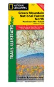 Green Mountains National Forest, Moosalamoo NRA/Rutland. Trails Illustrated Map #747 (National Geogr
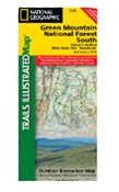 Green Mountains National Forest, White Rocks NRA / Manchester. Trails Illustrated Map #748 (National
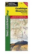 Guadalupe Mountains National Park, TX - Trails Illustrated Map # 203 (National Geographic Maps: Trai
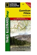 Gunnison & Pitkin Area, Colorado- Trails Illustrated Map #132 (National Geographic Maps: Trails Illu
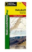 Haleakala National Park, HI Trails Illustrated Map # 227 (National Geographic Maps: Trails Illustrat
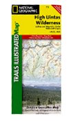 High Uintas: Trails Illustrated - Recreation Maps
 Hoosier National Forest Trails Illustrated Map # 770 (National Geographic Maps: Trails Illustrated)
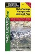 Idaho Springs & Loveland Pass, Trails Illustrated Map # 104

 Route Editor

