• National Geographic Maps → Natl Geographic Society Maps 2006
This Trails Illustrated topographic map for Isle Royale National Park, north of the Upper Peninsula of Michigan in Lake Superior, is the perfect map for hiking, paddling, boating, biking, exploring, climbing, camping, and sightseeing in this beautiful area. nnThe map includes Isle Royale, Washington Island, Grace Island, Johns Island, Thompson Island, Amygdaloid Island, Belle Island, Passage Island, Windigo, Minong Ridge, Greenstone Ridge, Feldtmann Ridge, Malone Bay, Siskiwit Lake, Lake Richie, Chickenbone Lake, Moskey Basin, Rock Harbor, and much more. Includes UTM grids for use with your GPS unit.Scale = 1:50,000 Size: 26'' x 38''
• National Geographic Maps → Natl Geographic Society Maps 2005
This Trails Illustrated topographic map for Joshua Tree National Park and the surrounding area in California is the perfect recreational map for this fascinating land of surreal geologic features shaped by strong winds, unpredictable torrents of rain, and climatic extremes. The map includes Joshua Tree National Park in its entirety, the Little San Bernardino Mountains, Nexie Mountains, Lost Horse Valley, Quail Springs Historic Trail, Black Rock Canyon, Hidden Valley, Pinto Basin, Chuckwalla Valley, Cottonwood Mountains, Pinto Mountains, Cottonwood Spring Nature Trail, and more. The trails have been enhanced and road and trail mileage have been added for additional accuracy. Includes UTM grids for use with your GPS unit.Scale 1:80,000 Size: 26'' x 38''
The Kaibab National Forest is part of the largest contiguous ponderosa pine forest in the United States. Bordering both the north and south rims of the Grand Canyon, the 1.6 million acres of the Kaibab has the distinction of being divided by one of Nature's greatest attractions. Headquartered in Williams, Arizona, the South Kaibab covers 1,422 square miles and the North Kaibab stretches over 1,010 square miles. Elevations vary on the forest from 5,500 feet in the southwest corner to 10,418 feet at the summit of Kendrick Peak on the Williams Ranger District. All the way from north-central Arizona into Utah, you'll find enough breathtaking views, outstanding forest scenery, unusual geologic formations, and just plain fun to keep you satisfied for days!
Kaibab National Forest: North Kaibab Ranger District provides information on recreational uses, local plants and wildlife, surface management, trails, roads, streams, lakes, visitors centers, facilities available, campgrounds, and picnic areas. The map also displays color photographs of points of interest and activities. The map covers the ranger district of the Kaibab National Forest which is north of the Grand Canyon, and the scale is generally
• National Geographic Maps → Natl Geographic Society Maps 1999
Coverage includes Gunnison National Forest; West Elk and Raggeds wilderness areas; Paonia State Recreation Area; the city of Somerset; Beaver Reservoir, Gunnison River; Irwin and Lost lakes; and Gunsight, Minnesota, Ohio, Angel, Castle, and Kebler passes. Includes UTM grids for use with your GPS unit.Scale = 1:40,680
• National Geographic Maps → Natl Geographic Society Maps 1996
Coverage includes Chugach National Forest, Kenai National Wildlife Refuge and Wilderness, Soldotna and Sterling; Skilak, Tustumena and Kenai lakes, Turnagain Arm. Detail maps of the Swanson River and Swan Lake canoe routes. Resurrection, Johnson and Moose passes, and Seward Highway Scenic Byway. Includes rated mountain bike trails.Scale = 1:105,600 Size: 26'' x 37''
• National Geographic Maps → Natl Geographic Society Maps 2008
Coverage includes San Isabel, Gunnison and Rio Grande National Forests; La Garita Wilderness; Cochetopa Hills; Cebolla Creek State Wildlife Area; Dome Lakes State Wildlife Area; O'Haver Lake; Vouga Reservoir; Devils Lake; Saguache Creek; Black Mountain Lake; cities of Creede, Cathedral, Monchego Park. 14er: San Luis Peak, Monarch, Slumgullion, Cochetopa, Marshall, Halfmoon and San Luis passes. Jon Wilson Yurt, Rambouillet Yurt. Includes portions of the Continental Divide Trail and the Colorado Trail. Includes UTM grids for use with your GPS unit.Scale = 1:66,667 Size: 26 x 38 inches
• National Geographic Maps → Natl Geographic Society Maps 2004
Coverage includes Mt Marcy, High Peaks, Dix Mountain, Jay Mountain and Sentinel Range Wilderness Areas; Adirondack Mountain Reserve; Hurricane Mountain Primitive Area; Vanderwhacker Mountain Wild Forest; and the Northville-Lake Placid Trail from Blue Mountain Wild Forest to Lake Placid. Also includes Ray Brook, Newcomb, Elizabethtown, and Keeseville. Includes UTM grids for use with your GPS unit and a trail mileage matrix. This map was produced in cooperation with the Adirondack Mountain Club (ADK). Scale = 1:75,000 Size: 26'' x 38''
• National Geographic Maps → Natl Geographic Society Maps 2007
Coverage includes the Pike and San Isabel national forests, Buffalo Peaks Wilderness Area, and the cities of Fairplay, Leadville, Malta, and Granite. Also included are the Twin Lakes and Clear Creek reservoirs, Mt Massive Lakes, a segment of the Arkansas River, and Breakneck, Weston and Browns passes. 14ers: Mt Sherman. Portions of the Continental Divide Trail and Colorado Trail are covered on this map. Includes UTM grids for use with your GPS unit.Scale = 1:40,680
 Isle Royale National Park, MI - Trails Illustrated Map #240 (National Geographic Maps: Trails Illust
 Joshua Tree National Park, CA - Trails Illustrated Map # 226 (National Geographic Maps: Trails Illus
 Kaibab National Forest Map
 Kaibab National Forest Map
 Kebler Pass & Paonia Reservoir Area, Colorado - Trails Illustrated Map #133
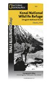 Kenai NWR & Chugach National Forest, Alaska - Trails Illustrated Map #760 (Trails Illustrated Maps)
 La Garita & Cochetopa Area, Colorado - Trails Illustrated Map # 139
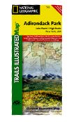 Lake Placid, High Peaks - Trails Illustrated Map # 742 (National Geographic Maps: Trails Illustrated
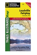 Leadville & Fairplay, Colorado - Trails Illustrated Map # 110

 Route Editor