Coverage of the Long's Peak area of Rocky Mountain National Park includes Roosevelt National Forest, Indian Peaks Wilderness, Paradise Park Research Natural Area, McGregor Ranch Conservation Easement. Towns: Estes Park; Allenspark, Meeker Park. Includes UTM grids for use with your GPS unit.
• National Geographic Maps → Natl Geographic Society Maps 2009
Located just north of Kalispell in Montana's northwest corner, Glacier National contains an abundance of recreational opportunities for outdoor enthusiasts of all interests.This detailed topographic recreation map contains carefully researched trails, campsites, forest service roads, and points-of-interests, for the Many Glacier section of the park. Two additional maps for the North Fork and the Two Medicine regions of the park along with a comprehensive Glacier National Park Trails Illustrated map are also available. An enhanced scale of 1:50,000, useful UTM and Latitude/Longitude grids, mileage charts, and other navigation features make the North Fork sectional the best map available for the western side of the park. The North Side of the Map Includes: Waterton Lakes National Park, Lower, Middle, and Upper Waterton Lakes, Blakiston Falls, Prince of Wales Hotel, Upper Kintla Lake, Continental Divide Trail, Goat Haunt, Pacific Northwest Trail, and more.. The South Side of the Map Includes: Cosley Lake, Glenns Lake, Ipasha Glacier, Chaney Glacier, Lake Josephine, Lake Sherburne, St Mary Lake, Many Glacier Hotel, Swiftcurrent Pass, Continental Divide Trail, Pacific Northwest Trail, and more... Like all Trails Illustrated Maps, the Glacier Sectionals are printed on a highly durable waterproof, tear-resistant material designed to stand up to elements. Proceeds from the sale of all National Geographic Maps go to support the National Geographic Society's mission to increase global understanding and promote conservation of our planet through exploration, research, and education. Approximately 4 1/4" x 9 1/4" folded; 27" x 39" fully openedScale = 1:50,000Contour Interval = 50 feetMap revised - 2009
• National Geographic Maps → Natl Geographic Society Maps 2005
Coverage includes White River and Gunnison national forests. Raggeds and Maroon Bells Snowmass wilderness areas. Redstone, Marble, Placity and Woody creeks. Crystal River, Snowmass Lake and Roaring Fork River. 14ers: Snowmass Mountain, Pyramid, N. Maroon, Maroon and Capitol peaks. Schofield, McClure, Anthracite, Buckskin East, and West Maroon passes. Ski areas: Snowmass. Includes UTM grids for use with your GPS unit.Scale = 1:40,680
• National Geographic → Natl Geographic Society Maps 2009
One of the most-visited urban forests in the U.S., with approximately 5.8 million visitors annually, the Tonto National Forest spans almost 3 million acres of diverse terrain just outside of Phoenix, AZ. Tonto encompasses a wide variety of vegetation ranging from cactus-studded desert to pine-forested mountains, and numerous recreational opportunities throughout the year.Our four new Trails Illustrated maps are the most detailed and up-to-date for the forest, carefully researched and developed in co-operation with local land managers and agencies. Each map contains easy to read trails, numbered forest service roads, campsites, parking, access points, scenic points-of-interest, and important facilities. Features on the Mazatzal & Pine Mountain Wilderness Map include:- Agua Fria National Monument- Verde Wild & Scenic River- Arizona and Great Western Trails- Bartlett & Horseshoe Reservoirs- Black Canyon National Recreation Trail- Portions of Coconino and Prescott National Forests- Locations of Public Facilities and Fee Areas- Motorized and Non-Motorized Trails- Equestrian & Multiple Use Trails- Mogollon Rim Area and Mazatzal Mountains- Mazatzal & Pine Mountain Wilderness Areas- Tonto Natural Bridge State Park- Payson, Cave Creek, Mesa and Tonto Basin Ranger Districts- Agency Contact and Recreation InformationLike all Trails Illustrated maps our new Tonto National Forest titles are both highly durable and environmentally friendly. Each map is printed in the United States, at a certified green printer, using low V.O.C. inks on waterproof, tear-resistant material. Proceeds from the sale of Tonto National Forest Trails Illustrated Maps go to support the National Geographic Society s non-profit mission to increase global understanding and promote conservation of our planet through exploration, research, and education.Scale: 1:70,000 (1 = 1.10 Miles)
• National Geographic Maps → Natl Geographic Society Maps 2008
Trails are classified by use - hiking, horse and hike, mountain bike, shared use, or motorized - and includes a trail chart showing trail name, location, and allowed use.Detailed coverage for all of the Mojave National Preserve in Southeastern California.Scale = 1:125,000 Size: 26'' x 38''
• National Geographic Maps → Natl Geographic Society Maps 2003
Within the park, there is detailed coverage of Mount Rainier and its many glaciers, Eagles Roost, Cataract Valley, Mystic, Emmons Overlook, Indian Bar, Maple Creek, Snow Lake, Paradise River, Jackson, and many other camping areas. A detailed inset gives you a close-up view of the peak and trails leading to its glaciers . The trails have been enhanced and road and trail mileage have been added to create a more usable map. UTM grids have also been added to make it more usable with your GPS.Scale = 1:55,000 & 1:27,500
• National Geographic Maps → Natl Geographic Society Maps 2003
Coverage includes Jefferson National Forest. Towns: Wytheville, Galax, Marion, Damascus, Abingdon. Wilderness Areas: Lewis Fork, Little Dry Run, Little Wildon Creek. Major Trails: Appalachian National Scenic Trail, VA Creeper Trail, VA Highlands and Iron Mountain Horse Trails. Other Highlights: Grayson Highlands, Hungry Mother, and New River Trail State Parks. Includes UTM tick marks for use with your GPS unit and a trail mileage matrix. Scale = 1:75,000 & 1:35,000. Size: 26'' x 38''
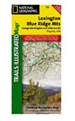 Lexington & Blue Ridge Area, Virginia - Trails Illustrated Map #789 (National Geographic Maps: Trail
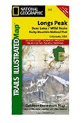 Longs Peak, Bear Lake/Wild Basin Rocky Mountain National Park, Colorado, USA
 Mammoth Cave National Park, KY - Trails Illustrated map # 234
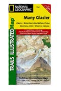 Many Glacier - Glacier National Park Trails Illustrated Map # 314
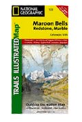 Maroon Bells, Redstone, Marble - Colorado Trails Illustrated Map # 128 (National Geographic Maps: Tr
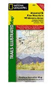 Mazatzal & Pine Mountain Wilderness. Tonto NF. Trails Illustrated Map # 850
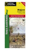 Mojave National Preserve, CA - Trails Illustrated Map # 256 (National Geographic Maps: Trails Illust
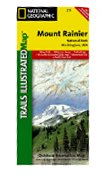 Mount Rainier National Park, WA - Trails Illustrated Map # 217 (National Geographic Maps: Trails Ill
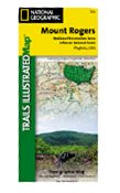 Mount Rogers National Recreation Area Trails Illustrated Map # 786 (National Geographic Maps: Trails

 Route Editor


