• National Geographic Maps → Natl Geographic Society Maps 2001
Within the park, there is detailed coverage of Mount Olympus, Tshletshy Ridge, Hurrican Ridge, Huelsdonk Ridge, Bailey Range, camping areas, facilities, ranger stations, nature trails, waterfalls, boat launches, and much more. Also included are the Mount Skokomish Wilderness, Ozette Lake, Lake Pleasant, Lake Crescent, Lake Mills, and Olympic National Forest. The map is full of detailed trail information, points of interest, trailheads, picnic areas, facitlities, and more. Includes UTM grids for use with your GPS unit.Scale = 1:100,000 Size: 26'' x 38''
• National Geographic Maps → Natl Geographic Society Maps 2006
This Trails Illustrated topographic map for Organ Pipe Cactus National Monument, straddling southern Arizona, and northern Sonora, Mexico, is the perfect recreational map for this beautiful Sonoran desert wilderness. The map includes the entire Organ Pipe Cactus national monument area, with detailed topographic information. Included on the map are the Ajo Range, the Ajo Mountain Drive, Arch Canyon, Bates Mountains, Cipriano Hills, the Puerto Blanco Mountains, and much more. Includes UTM grids for use with your GPS unit.Approximately 4 1/4" x 9 1/4" folded; 27" x 39" fully openedScale = 1:50,000Map revised - 2006
• National Geographic Maps → Natl Geographic Society Maps 2004
Included are Prairie Creek Redwoods State Park, Harry A Merlo State Recreation Area, Humboldt Lagoons State Park, Yurok Indian Reservation, Smith River National Recreation Area, Six Rivers National Forest, Siskiyou Wilderness, the North Fork Smith River Botanical Area, the Broken Rib Botanical Area, and Klamath National Forest. The trails have been enhanced and road and trail mileage have been added to create a more usable map. Includes UTM grids for use with your GPS unit.Scale = 1:70,000 Size: 26'' x 38"
• Trails Illustrated Maps → Natl Geographic Society Maps 2008
Coverage includes Rocky Mountain National Park, Arapaho and Roosevelt National Forest, Never Summer Wilderness, Arapaho National Recreation Area, and the cities of Granby and Estes Park. Revisions to this map include easy-to-read trail mileage and markers, hiking-only and hike and horse trails are easily distinguished, Federal, State and Private lands are clearly marked, and the Continental Divide Trail is highlighted. Revisions to this map include easy-to-read trail mileage and markers, hiking-only and hike and horse trails are easily distinguished, Federal, State and Private lands are clearly marked, the Continental Divide Trail is highlighted, and the map is keyed to the updated Rocky Mountain National Park Dayhiker's Guide. Includes UTM grids for use with your GPS unit.Approximately 4 1/4" x 9 1/4" folded; 26" x 38" fully openedScale = 1:50,000
• National Geographic Maps → Natl Geographic Society Maps 2008
This Trails Illustrated topographic map for Arizona's Saguaro National Park and surrounding areas to the east and west of Tucson, is the perfect map for hiking, biking, exploring, climbing, riding, camping, and sightseeing in this beautiful desert wilderness. The map includes Saguaro National Park, east and west, Saguaro Wilderness, Tucson Mountain Park, the Tucson Mountains, Tanque Verde Ridge, Hope Camp Trail, Yetman Trail, Signal Hill Picnic Area and Petroglyphs Trail, and much more. Includes UTM grids for use with your GPS unit.Scale = 1:35,000 Size: 26'' x 38''
• Trails Illustrated → Natl Geographic Society Maps 2008
Coverage includes San Isabel and Gunnison national forests; the cities of Garfield, Romley, St Elmo, Poncha Springs, Mt Princeton Hot Springs, and Hancock; the Arkansas River; Pomeroy, Hancock and Waterdog lakes. 14ers: Mt Princeton, Antero and Shavano. Ski Areas: Monarch. Includes UTM grids for use with your GPS unit.Scale = 1:40,680
• National Geographic Maps → Natl Geographic Society Maps 2005
Coverage includes San Rafael Reef; Green River, Huntington, Castle Dale; Muddy Creek and San Rafael River; Upper and Lower Black Box; the Chute; Cedar Mountain; the Wedge; Sids Mountain Wilderness Study Areas: San Rafael Reef, Crack Canyon, Muddy Creek, Devils Canyon, Sids Mountain, Mexican Mountain, Goblin Valley State Park; Cleveland-Lloyd Dinosaur Quarry. Includes UTM grids for use with your GPS unit.Scale = 1:90,000 Size: 26''x38''
• National Geographic Maps → Natl Geographic Society Maps 2004
Coverage includes Sangre de Cristo Mountains; Great Sand Dunes National Park and Preserve; San Isabel and Rio Grande national forests; Sangre de Cristo Wilderness; Arkansas Headwaters Recreation Area; San Luis State Park; San Luis Lakes; DeWeese Reservoir and Huerfano State Wildlife Areas; Blanca Wetlands; Rainbow Trail; Hayden, Medano and Mosca passes. 14ers: Blanca Peak, Crestone Peak, Crestone Needle, Kit Carson Mt, Challenger Point, Humboldt Peak, Ellingwood Point, Little Bear Peak and Mount Lindsey. Includes UTM grids for use with your GPS unit.Approximately 4 1/4" x 9 1/4" folded; 27" x 39" fully openedScale = 1:75,000Map revised - 2004
 Olympic National Park, WA - Trails Illustrated Map # 216 (Trails Illustrated Maps)
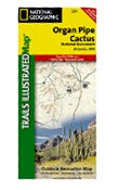 Organ Pipe Cactus National Monument, AZ Trails Illustrated Map # 224
 Ozark National Scenic Riverways (National Geographic Maps: Trails Illustrated)
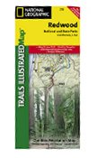 Redwood National Park, CA - Trails Illustrated Map # 218
 Rocky Mountain National Park Hiking Map
 Saguaro National Park, AZ - Trails Illustrated Map # 237 (National Geographic Maps: Trails Illustrat
 Salida, St Elmo, & Shavano Peak, Colorado - Trails Illustrated Map # 130
 San Rafael Swell, Utah - Trails Illustrated Map # 712
 Sangre de Cristo Mtns. Trails Illustrated Map #138 (National Geographic Maps: Trails Illustrated)

 Route Editor