The Sedona Trails Map depicts more than 200 miles of hiking and biking trails in Sedona's world-famous, breathtaking, red rock country. Features include easy-to-read shaded topography, trail mileage, summary information for all 94 trails shown on the map, vertical profiles for 60 trails, and UTM coordinates for GPS users. Other information includes campgrounds, picnic areas, trailheads, wilderness areas, landmarks, scenic views, and vortexes. Printed two sides in full color on durable, waterproof, tear-resistant synthetic paper. Unfolded size is 24 x 37 inches; folds down to 4 x 7.75 inches. The scale is 1:29,000.
This folded, waterproof, outdoor recreation map by Beartooth Publishing features thorough trail descriptions for 5 hikes and 5 mountain bike rides in the Sedona area on a topographic/shaded-relief map. Shows roads (paved and unpaved), trails, trailheads, ranger stations, visitor information centers, campgrounds, and park and forest boundaries. Scale is 1:40,000 and includes Village of Oak Creek, Oak Creek Canyon, Red Rock Secret Mountain Wilderness, Munds Mountain Wilderness (west section), Sycamore Canyon Wilderness (east section), and Red Rock, Slide Rock and Dead Horse Ranch State Parks.
• National Geographic Maps → Natl Geographic Society Maps 2006
Some highlights of the map include: Highest Peak in Continental U.S. - Mt. Whitney; Sequoia Grove boundaries; Giant Sequoia National Monument; John Muir, Golden Trout, Jennie Lake and Monarch Wilderness Areas; John Muir Trail and Pacific Crest Trail. Includes UTM grids for use with your GPS unit. 26 x 38 inches (approx). Scale = 1:80,000
• National Geographic Maps → Natl Geographic Society Maps 2008
Coverage includes Rio Grande and San Juan national forests; South San Juan Wilderness; Dipping Lakes and Spiler Lakes; Lost Lake; Platoro and Fuchs Reservoirs; South Fork and Conejos rivers; the cities of Del Norte, South Fork, Wagon Wheel Gap, Summitville, Jasper, Cumbres, Platoro; and the mountain passes of La Manga, Wolf Creek, Gunsight, Blowout, Silver, and Summit. Also includes portions of the Continental Divide Trail. Includes UTM grids for use with your GPS unit.Scale = 1:63,360 Size:26'' x 38''
2005, printed on waterproof and tear resistant material. Wind River Topographic Map from Elkhart Park to Big Sandy at scale of 1: 48,000. Include Backcountry regulations, trip planning Information. Print in 6 vivid colors.
• National Geographic → Natl Geographic Society Maps 2009
One of the most-visited urban forests in the U.S., with approximately 5.8 million visitors annually, the Tonto National Forest spans almost 3 million acres of diverse terrain just outside of Phoenix, AZ. Tonto encompasses a wide variety of vegetation ranging from cactus-studded desert to pine-forested mountains, and numerous recreational opportunities throughout the year.Our four new Trails Illustrated maps are the most detailed and up-to-date for the forest, carefully researched and developed in co-operation with local land managers and agencies. Each map contains easy to read trails, numbered forest service roads, campsites, parking, access points, scenic points-of-interest, and important facilities. Features on the Superstition & Four Peaks Wilderness Map include:- Arizona and Great Western Trails- Locations of Public Facilities and Fee Areas- Motorized and Non-Motorized Trails- Equestrian & Multiple Use Trails- Agency Contact and Recreation InformationLike all Trails Illustrated maps our new Tonto National Forest titles are both highly durable and environmentally friendly. Each map is printed in the United States, at a certified green printer, using low V.O.C. inks on waterproof, tear-resistant material. Proceeds from the sale of Tonto National Forest Trails Illustrated Maps go to support the National Geographic Society s non-profit mission to increase global understanding and promote conservation of our planet through exploration, research, and education.Scale: 1:70,000 (1 = 1.10 Miles)
Beartooth Publishing Superstition Wilderness Outdoor Recreation Map is a topographic, shaded relief trail map for campers, hikers, backpackers, equestrians, mountain bikers, 4WDers, and 2WDers.
The Superstition Wilderness, just outside of Phoenix, is a hikers and backpackers paradise, containing everything from desert canyons with haunting cliffs and spires to pine covered mountains. The contrast of desolate canyons and lush oasises of creeks, springs, and cottonwoods is staggering.
This map shows the entire Superstition Wilderness at a detailed 50 foot contour interval - an essential feature for hikers and backpackers. It also includes the entire Four Peaks Wilderness, Lost Dutchman State Park, Tonto National Monument, and Saguaro, Canyon, Apache, and Theodore Roosevelt Lakes.
The legend features divided US highways; divided state highways; primary highways; primary public access other paved roads; public assess 2WD improved dirt roads; public access 4WD unimproved dirt roads; residential, private, or forest recreation site, paved or dirt secondary roads; hikers only non-motorized trails; hikers and equestrians only non-motorized trails; hikers, equestrians, and mountain bikers only non-motorized trails; non-maintained unofficial secondary trails; trail mileage markers; Arizona Trail, forest service roads; forest service trails; trailheads; ranger stations; campgrounds; picnic areas; visitor information centers; Apache Trail rest stops; river put-ins and take-outs; boat launches; gates; national monument or state park boundaries; national forest boundaries; national forest ranger district boundaries; wilderness boundaries; and county boundaries.
Contour Interval = 50'
Size = 4.25" x 8" folded; 25" x 39" unfolded
2010 4th Version Above (6th, 8th & 10th on Amazon too)
2022 11th Version @ Beartooth Publishing
• National Geographic Maps → Natl Geographic Society Maps 1996
Coverage includes Carson National Forest, Taos, Rancho de Taos, Agua Fria, Black Lake, Valle Escondido, Penasco, Chacon, and Northern Pecos Wilderness.Scale 1:40,680 Size: 25'' x 37''
• National Geographic Maps → Natl Geographic Society Maps 2004
Coverage area includes parts of San Juan and Uncompahgre national forests; south San Juan Mountains; Lizard Head, Mt Sneffels and Uncompahgre wilderness areas; Calico National Recreation Trail; portions of the Colorado Trail; the trail networks at Coal Bank Pass and Silver Jack Reservoir; and the cities and surrounds of Telluride and Ouray. 14ers: Mt Wilson, El Diente Peak, Wilson Peak, Mt Sneffels, Uncompahgre Peak, Wetterhorn Peak, Redcloud Peak, Sunshine Peak. Includes UTM grids for use with your GPS unit.Scale = 1:63,360 Size: 26'' x 38''
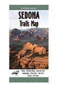 Sedona Trails Map
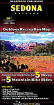 Sedona, AZ Outdoor
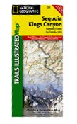 Sequoia and Kings Canyon National Park, CA - Trails Illustrated Map # 205 (Trails Illustrated Maps)
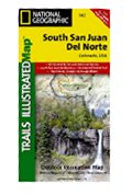 South San Juan & Del Norte, Colorado - Trails Illustrated Map #142
 Southern Wind River Range Hikng Map
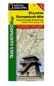 Staunton/Shenandoah Mountain, George Washington National Forest Hiking Map
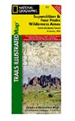 Superstition & Four Peaks Wilderness. Tonto NF. Trails Illustrated Map # 851
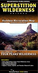 Superstition Wilderness Outdoor Recreation Map
 Taos Area Trails Illustrated Map # 730 (National Geographic Maps: Trails Illustrated)
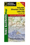 Telluride, Silverton, Ouray & Lake City, Colorado - Trails Illustrated Maps #141 (National Geographi

 Route Editor

