• National Geographic Maps → Natl Geographic Society Maps 2005
Coverage includes White River, San Isabel and Gunnison national forests. Maroon Bells â Snowmass, Hunter â Fryingpan, Mt. Massive, Collegiate Peaks and Spruce Creek wilderness areas. Aspen and Twin lakes. Roaring Fork River, Lake and Lincoln creeks. 14ers: Mt. Elbert, Mt. Massive, Castle and La Plata peaks. Willis, Fryingpan and Evergreen lakes. Taylor, Midway, and Independence passes. Ski Areas: Aspen and Buttermilk. 10th Mountain Huts: Tagert Hut, Wilson Hut, Barnard Hut, Markely Hut, McNamara Hut. Includes UTM grids for use with your GPS unit.Scale = 1:40,680
• National Geographic Maps → Natl Geographic Society Maps 2006
Coverage includes the Pike, San Isabel and Arapaho national forests, Alma State Wildlife Area and the cities of Leadville, Como, Breckenridge, Climax and Alma. Also included are the Blue River, Turquoise and Robinson lakes, and Montgomery Reservoir. 14ers: Mt. Lincoln, Bross, Democrat, Cameron and Quandary peaks. Boreas, Mosquito, Hoosier, French, Georgia, Freemont and Searle passes. Ski areas: Breckenridge, Copper Mountain and Fairplay cross-country. 10th Mountain Huts: Jackal Hut, Vance's Cabin, Janet's Cabin, Fowler Hilliard Hut and Francie's Hut. Portions of the Continental Divide Trail and Colorado Trail are included on this map. Includes UTM grids for use with your GPS unit.Scale = 1:40,680
• Trails Illustrated → National Geographic Maps 2013
• Waterproof • Tear-Resistant • Topographic Map
Coverage includes Gunnison and San Isabel national forests; Collegiate Peaks Wilderness; the cities of Buena Vista, Princeton, Rockdale and Winfield; Cottonwood, Hartenstein and Bear lakes; the Arkansas River; Cottonwood and Browns passes. 14ers: Mt Oxford, Belford, Harvard, Columbia, Yale, Missouri Mountain and Huron Peak. Includes UTM grids for use with your GPS unit.
• National Geographic Maps → Natl Geographic Society Maps 2001
Coverage includes White River and Gunnison national forests; Maroon Bells-Snowmass and Collegiate Peaks Wilderness areas; the cities of Gothic, Crested Butte and Taylor Park; Taylor River/Reservoir; East River; Spring Creek Reservoir; and Triangle and Pearl passes. Ski Areas: Crested Butte. Includes UTM grids for use with your GPS unit.Scale = 1:40,680
• National Geographic Maps → Natl Geographic Society Maps 2007
Coverage includes San Juan National Forest. Mesa Verde National Park, McPhee Reservoir and Recreation Area, House Creek Recreation Area, Durango Mountain Ski Area, Mancos State Park. Animas River, Colorado Plateau, La Plata Mountains. Towns: Cortez, Durango, Mancos. San Juan Skyway and Trail of the Ancients Scenic Drives. Includes UTM grids for use with your GPS unit.Scale = 1:63,360 Size: 26'' x 38''
• National Geographic Maps → Natl Geographic Society Maps 1999
Coverage includes Gunnison National Forest, and the cities of Gunnison, Almont, Pitkin, Ohio, and Parlin; East, Gunnison. and Taylor rivers; Gold and Tomichi Creek; Henry Lake; and Gunsight Pass. Includes UTM grids for use with your GPS unit.Scale = 1:40,680
• National Geographic Maps → Natl Geographic Society Maps 2003
Coverage includes Arapaho and Pike national forests, Mount Evans Wilderness, Idaho Springs, Georgetown, Montezuma, Keystone, Clear Creek, Chicago Lakes, and Summit Lake. 14ers include: Mt Evans, Mt Bierstadt, Grays and Torreys peaks. Also includes Loveland, Webster, Juniper and Guanella passes. Ski Areas: Arapaho Basin, Loveland and Keystone. Includes UTM grids for use with your GPS unit.Scale = 1:40,680
• National Geographic Maps → Natl Geographic Society Maps 1999
Coverage includes Gunnison National Forest; West Elk and Raggeds wilderness areas; Paonia State Recreation Area; the city of Somerset; Beaver Reservoir, Gunnison River; Irwin and Lost lakes; and Gunsight, Minnesota, Ohio, Angel, Castle, and Kebler passes. Includes UTM grids for use with your GPS unit.Scale = 1:40,680
• National Geographic Maps → Natl Geographic Society Maps 2008
Coverage includes San Isabel, Gunnison and Rio Grande National Forests; La Garita Wilderness; Cochetopa Hills; Cebolla Creek State Wildlife Area; Dome Lakes State Wildlife Area; O'Haver Lake; Vouga Reservoir; Devils Lake; Saguache Creek; Black Mountain Lake; cities of Creede, Cathedral, Monchego Park. 14er: San Luis Peak, Monarch, Slumgullion, Cochetopa, Marshall, Halfmoon and San Luis passes. Jon Wilson Yurt, Rambouillet Yurt. Includes portions of the Continental Divide Trail and the Colorado Trail. Includes UTM grids for use with your GPS unit.Scale = 1:66,667 Size: 26 x 38 inches
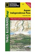 Aspen & Independence Pass Area, Colorado Trails Illustrated Map # 127 (National Geographic Maps: Tra
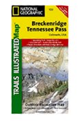 Breckenridge & Tennessee Pass, Colorado - Trails Illustrated Map # 109
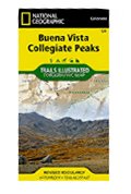 Buena Vista, Collegiate Peaks (National Geographic Trails Illustrated Map)
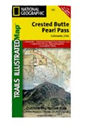 Crested Butte & Pearl Pass - Trails Illustrated Map # 131
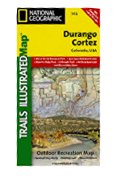 Durango & Cortez Area, Colorado - Trails Illustrated Map # 144
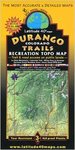 Durango Colorado Trails Recreation Topo Map
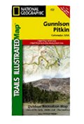 Gunnison & Pitkin Area, Colorado- Trails Illustrated Map #132 (National Geographic Maps: Trails Illu
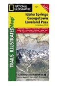 Idaho Springs & Loveland Pass, Trails Illustrated Map # 104
 Kebler Pass & Paonia Reservoir Area, Colorado - Trails Illustrated Map #133
 La Garita & Cochetopa Area, Colorado - Trails Illustrated Map # 139

 Route Editor

