 Route Editor

| Guide | ♦ | 26 Triplogs | 3 Topics |
details | drive | no permit | forecast | 🔥 route |
stats |
photos | triplogs | topics | location |
| 19 | 26 | 3 |
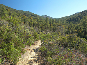
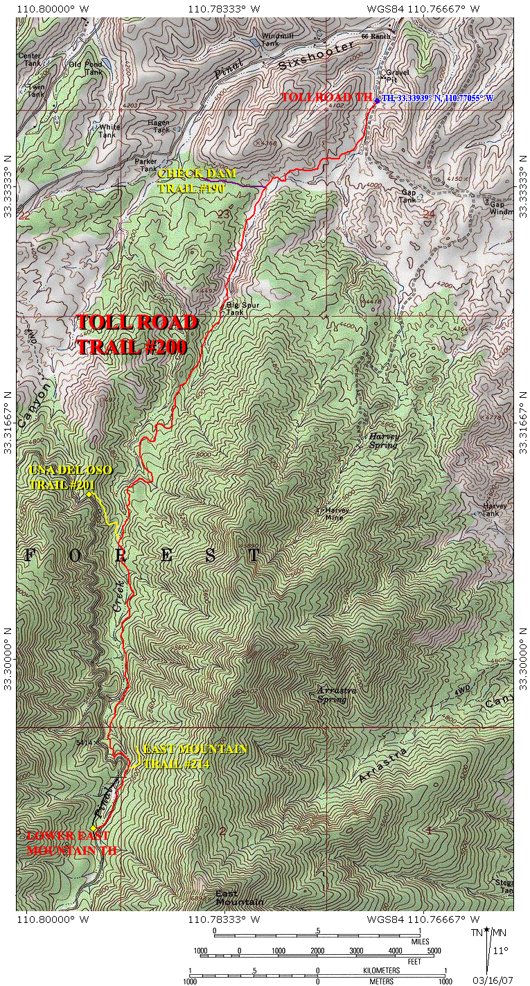
a heavy toll of greenery by PrestonSands   2026-02-09 2026-02-09The managing agency Tonto National Forest lists this trail as Closed. The Toll Road Trail #200 climbs the northern foothills of the Pinal Mountains south of Globe, Arizona. Starting in the high desert, this trail terminates in the tall pines of upper Pinal Creek canyon. The Toll Road Trail follows the route of an 1883 toll road that was built to provide access to the Pioneer Mining District on the south side of the Pinals. With three other trails connecting to it, the Toll Road Trail provides opportunities for loop hikes as well.
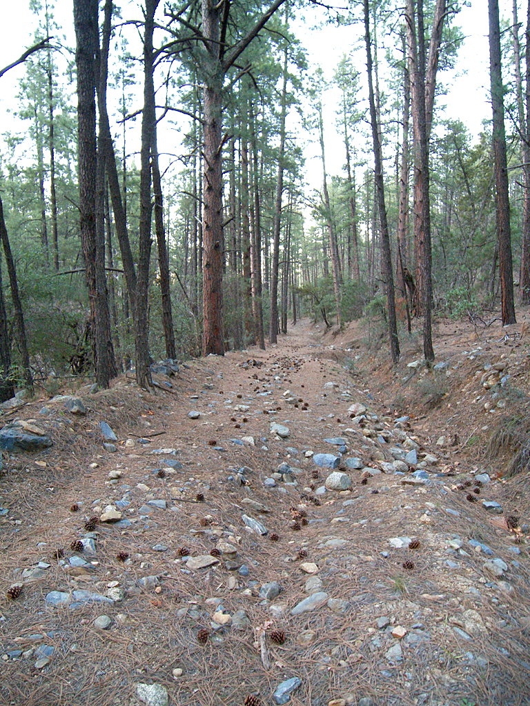
The Toll Road Trail exits the confines of the canyon and arrives in a little saddle around the 1.9-mile point. Now on a ridge, the trail offers up some great views of the velvety green Pinals, Globe, and the distant Sierra Anchas as it continues south. East Mountain and Pinal Peak tower 2200 and 3200 feet above you, respectively. You will encounter the first ponderosa at 2.6 miles and pass through a wire gate at 2.8 miles, as you approach Pinal Creek. The trail now drops into the bed of sycamore-lined Pinal Creek and enters a pleasant ponderosa pine forest. The Toll Road Trail meets up with the Una Del Oso Trail #201 at 3.0 miles (33.30841 N, 110.79222 W), before beginning a steady, mile-long climb up slopes of pale grey granite on Pinal Creek's eastern bank. Around mile 4 the trail crosses over to the west bank of Pinal Creek to loop around a little hillside, before crossing back to the east bank again. At 4.4 miles you will arrive at the junction with the East Mountain Trail #214 (33.29234 N, 110.79159 W). The last one-third of a mile to the Lower East Mountain Trailhead follows the old alignment of forest road 112, underneath a canopy of large ponderosas. The Toll Road Trail comes to an end where it meets forest road 112 on the west bank of Pinal Creek, after a 4.75-mile journey from the desert below. Gate Policy: If a gate is closed upon arrival, leave it closed after you go through. If it is open, leave it open. Leaving a closed gate open may put cattle in danger. Closing an open gate may cut them off from water. Please be respectful, leave gates as found. The exception is signage on the gate directing you otherwise. Check out the Official Route and Triplogs. Leave No Trace and +Add a Triplog after your hike to support this local community. One-Way Notice This hike is listed as One-Way. When hiking several trails on a single "hike", log it with a generic name that describes the hike. Then link the trails traveled, check out the example. | |||||||||||||||||||||||||||||||||||||||||||||||||||||||||||||||||||||||||||||||||||||||||||||||||||||||||||||||||||||||||||||||||||||||||||||||||||||||||||||||||||||||||||||||||||||||||||||||||||||||||||||||||||||||||||


