Route Editor

| Guide | ♦ | 9 Triplogs | 0 Topics |
details | drive | no permit | forecast | 🔥 route |
stats |
photos | triplogs | topics | location |
| 111 | 9 | 0 |
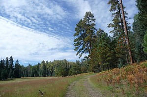
It's a cream puff ! by gpsjoe  This hike is a real cream puff that I did on a day of rest after an arduous hike the day before. It starts at the Hannagan Meadow campground, where the trailhead is found between campsites 6 and 7, and there is a small parking area that can handle 3 vehicles (maybe 4 if parked wisely). You can also walk over from the Lodge or highway 191. It would be a good choice for smaller children as well. This hike is a real cream puff that I did on a day of rest after an arduous hike the day before. It starts at the Hannagan Meadow campground, where the trailhead is found between campsites 6 and 7, and there is a small parking area that can handle 3 vehicles (maybe 4 if parked wisely). You can also walk over from the Lodge or highway 191. It would be a good choice for smaller children as well.From a pdf file on the Forest Service website: "This trail is here for your enjoyment due in large part to volunteer Don Yates. Yates worked as a campground host at the nearby campground and planned and constructed this trail over a three-year period."
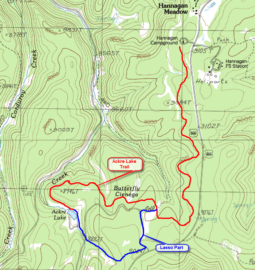
Arriving at the lake early, you have time to hike around it and explore the surrounding area a bit. I hiked the dirt roads nearby and mapped out a way to use them to make a lasso hike which provides a new set of views. The map below shows the trail and the lasso. As you would expect, hiking the lightly traveled dirt roads is also easy. GPS is not needed to hike the Aker Lake trail out and back, but it would be useful while hiking the dirt roads to make a lasso since you are confronted with several forks along the way and GPS (with the track loaded) will ensure you chose the correct one. The Aker Lake hike is listed in the October 2008 issue of Arizona Highways Magazine as 1 of 15 fall color hikes in Arizona.
Check out the Official Route and Triplogs. Leave No Trace and +Add a Triplog after your hike to support this local community. | |||||||||||||||||||||||||||||||||||||||||||||||||||||||||||||||||||||||||||||||||||||||||||||||||||||||||||||||