 Route Editor

| Guide | ♦ | 15 Triplogs | 1 Topic |
details | drive | no permit | forecast | 🔥 route |
stats |
photos | triplogs | topic | location |
| 56 | 15 | 1 |
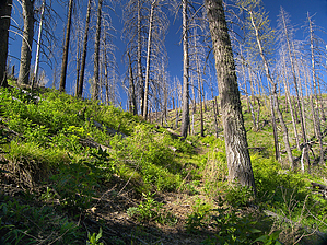
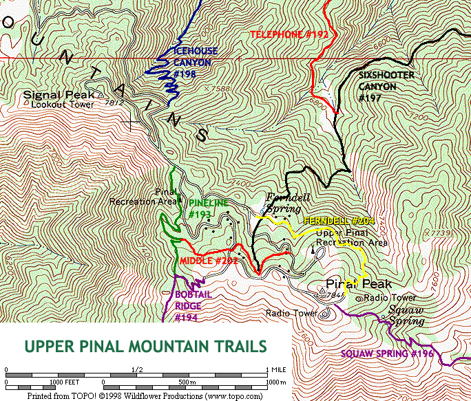
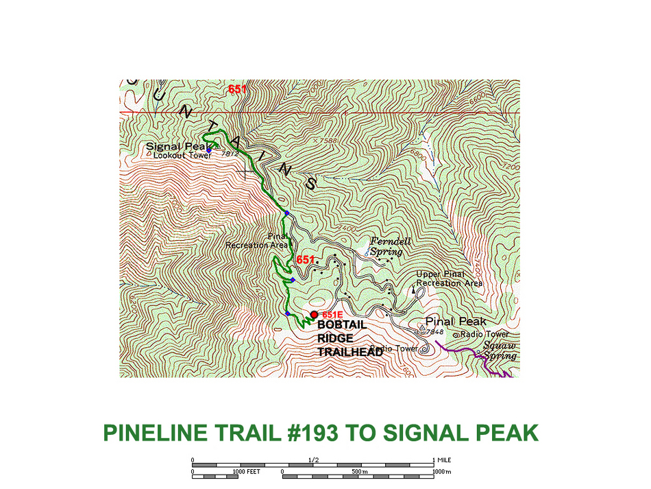
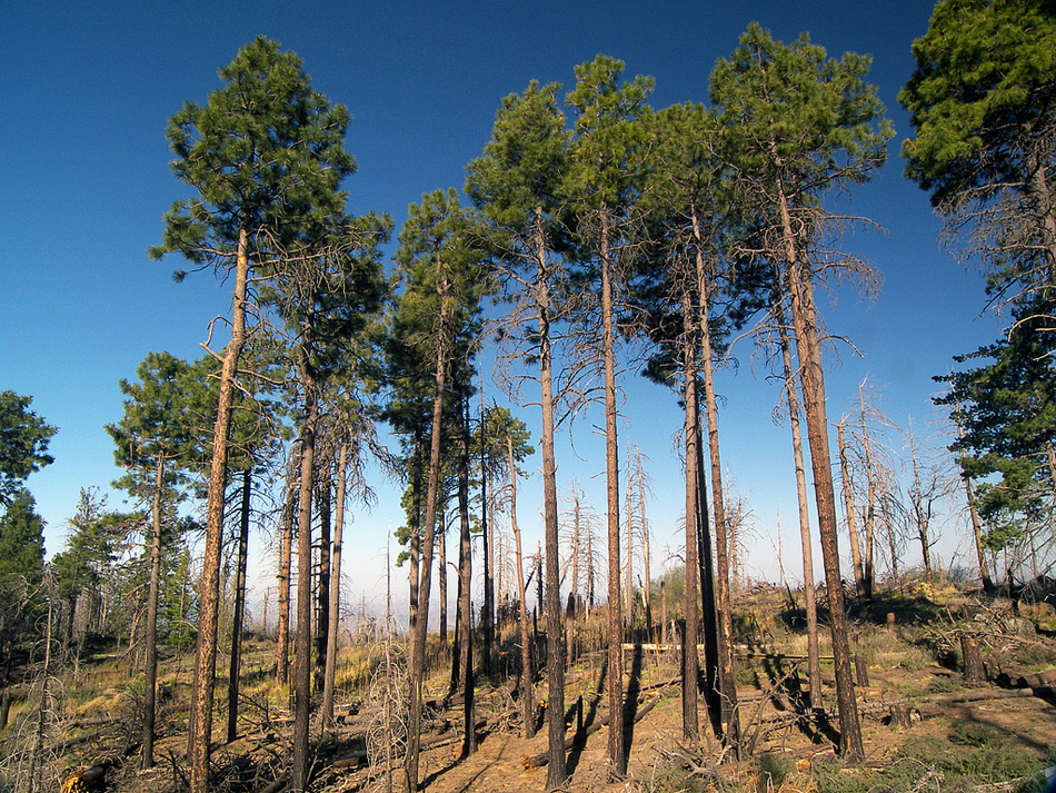
more sky island fun by PrestonSands  The Pipeline Trail #193 is one of several short trails on the top of Pinal Peak. The Pipeline, Middle, and Ferndell Trails serve as connectors between the three major trails that climb Pinal Peak. With elevations in the mid 7000's and a beautiful forest mix of pine, fir, and aspen, these trails, although short, offer a cool retreat in summer and vivid color in the fall. The Pipeline Trail #193 is one of several short trails on the top of Pinal Peak. The Pipeline, Middle, and Ferndell Trails serve as connectors between the three major trails that climb Pinal Peak. With elevations in the mid 7000's and a beautiful forest mix of pine, fir, and aspen, these trails, although short, offer a cool retreat in summer and vivid color in the fall.This hike describes a trek along the Pipeline Trail from the Bobtail Ridge Trailhead to the top of 7812-foot Signal Peak. Much of the hike along the Pipeline Trail requires some route-finding skills due to damage from the 2000's Peak Fire. However, those who are not looking for a route-finding challenge can bypass the Pipeline Trail altogether and hike up the fire road to the top of Signal Peak.
To reach the top of Signal Peak, turn left onto forest road 651 and follow it a short distance (0.1 miles) to a gated side road on the left. Hop over the gate and head northwest up the side road. Thick firs and bigtooth maples provide ample shade as the road climbs along the tops of Sixshooter and Icehouse Canyons on the north face of Signal Peak. After 0.6 miles, the road comes to an end at the fire lookout tower on top of Signal Peak. During the mid-1880s, the U.S. Army used Signal Peak as a link in its chain of mountain top heliographs that stretched across central and southeastern Arizona (a heliograph was a mirror that could communicate morse-code messages over long distances by reflecting sunlight). For some awesome views, climb the fire tower, or head over to the overlook a couple of hundred feet west of the summit, where there is an interpretive sign. Four Peaks, Superstition Mountain, Mt. Lemmon, and other peaks can be seen from Signal Peak. Head back the way you came, or take the FR651 back to your vehicle for an easier return trip. Gate Policy: If a gate is closed upon arrival, leave it closed after you go through. If it is open, leave it open. Leaving a closed gate open may put cattle in danger. Closing an open gate may cut them off from water. Please be respectful, leave gates as found. The exception is signage on the gate directing you otherwise. Check out the Official Route and Triplogs. Leave No Trace and +Add a Triplog after your hike to support this local community. One-Way Notice This hike is listed as One-Way. When hiking several trails on a single "hike", log it with a generic name that describes the hike. Then link the trails traveled, check out the example. | |||||||||||||||||||||||||||||||||||||||||||||||||||||||||||||||||||||||||||||||||||||||||||||||||||||||||||||||||||||||||||||||||||||||||||||||||||||||||||||||||||||||||||||||||||||||||||||||||||||||||||||||||||||||


