 Route Editor

| Guide | ♦ | 12 Triplogs | 0 Topics |
details | drive | permit | forecast | route |
stats |
photos | triplogs | topics | location |
| 517 | 12 | 0 |
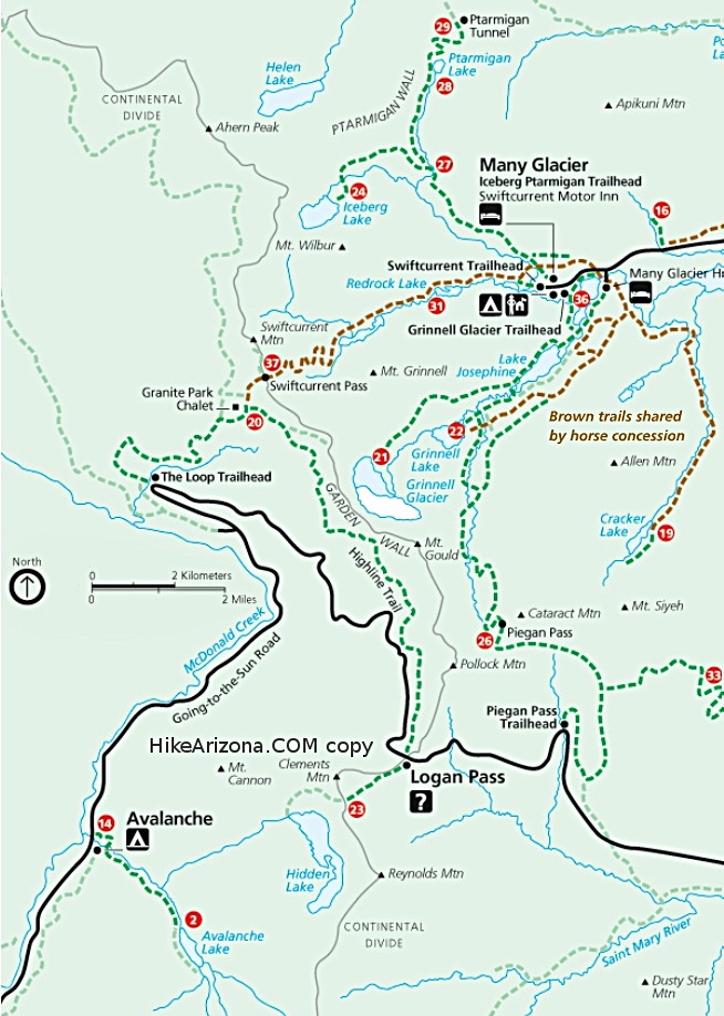
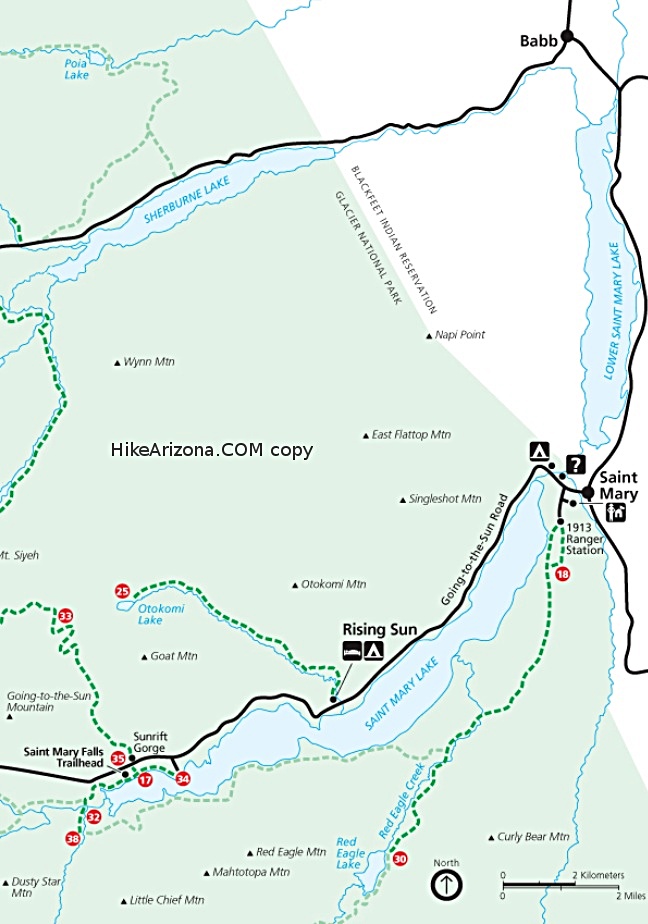
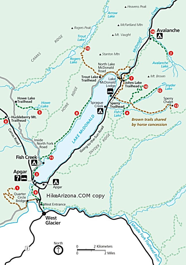
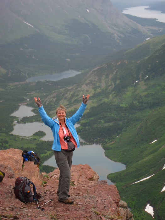
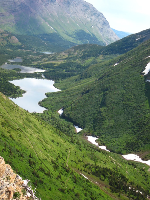
Spectacular views and a candy bar, too! by writelots This hike description details the trail starting at Granite Park Chalet and ending at the Swiftcurrent Motor Inn parking area, therefore the description will be given going downhill. It makes a beautiful semi-loop (with a shuttle) when hiked with the Highline Trail - however we were not able to complete the loop in this way due to record snowpacks in winter 201l. Instead, we began the hike on "The Loop" (officially called the Granite Park Trail). Intro While Granite Park Chalet is given as the "destination" on the Highline-Swiftcurrent loop, there is no reason to pick a single spot as a destination. These trails are their own reason for hiking: spectacular vistas, abundant wildlife, incalculable wildflowers and the park's namesake geological formations. The hike from the Chalet over Swiftcurrent Pass and down the Devil's Elbow is one of the most remarkable trails you'll find anywhere - and any distance you go, you're guaranteed to see something spectacular.
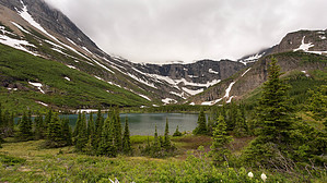
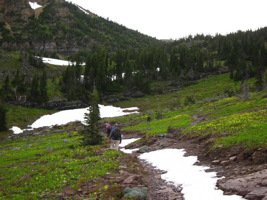
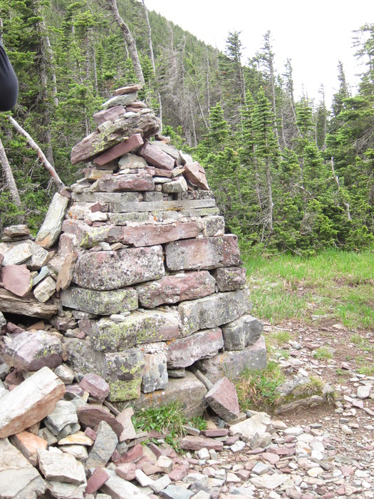
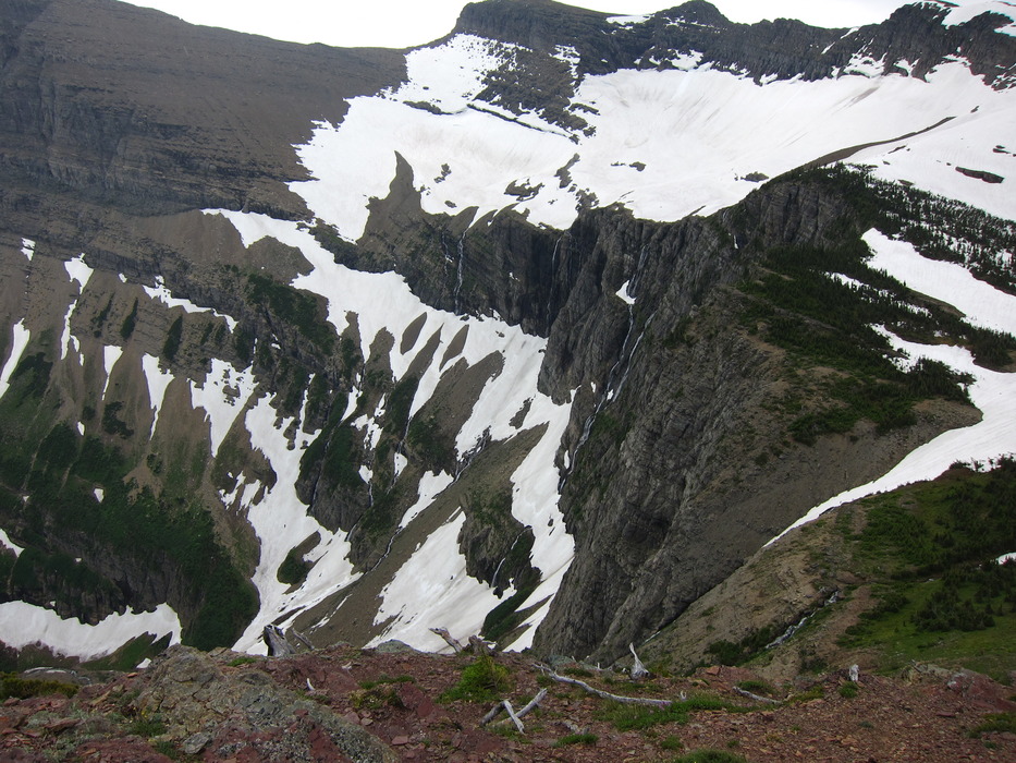
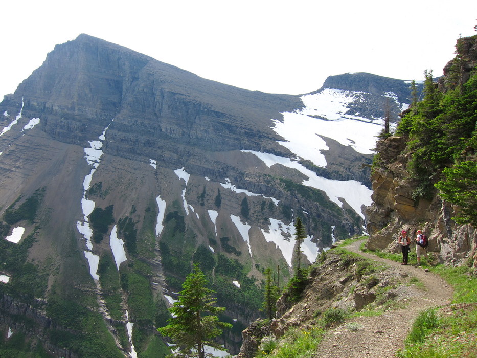
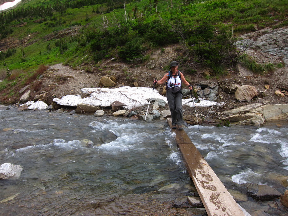
The trail begins just east of the Granite Park Chalet, at the junction of the Loop and Highline trails. It heads up the gentle rise behind the Chalet, slowly rising out of Granite Park itself amid fields of glacier lilies and tall evergreens. Soon you will get to a point where you can look back for an excellent view of the Chalet and Bear Valley below it. In a little over a mile is a small spur trail branching off to the north heading up to Swiftcurrent Lookout. This trail climbs another 1600' in only 1.4 miles to the Swifcurrent Lookout on Swiftcurrent Mountain. The lookout was built in 1934 after wildfires devastated the area east of the pass. As with so many Lookouts, the view is supposed to be magnificent. In a few hundred yards the trail reaches the summit of Swiftcurrent Pass. The views from the pass summit itself are not that great - it's a gentle, forested pass marked by a rather large rock cairn. However, as you continue on the trail, now heading gradually down hill, views east into the Swiftcurrent valley open up, and following a small use trail to the southeast will bring you to a spectacular point with views of the shimmering lakes in the U-shaped valley as well as the Swiftcurrent Glacier high above (although the feature was hidden in the snow when we visited). From here, the hike begins its descent in earnest. Early in the season, snowfields will be common here, many of them steep and leading to precipitous falls. It's a good idea to carry traction devices just in case when snow may be encountered. The benefit to these snowy times, however, are the spectacular waterfalls created by the melt in this steep valley. About a half an hour from the pass the trail wraps around the ridgeline it has been descending and if you're alert you'll catch a view of Windmaker Lake: this is the only point of the trail where you'll see this small, glacial gem. From here, the trail wraps back around to the southern face of the ridge and faces what hikers call the "Devil's Elbow", one long, gradual switchback carved into the rocky slope of the valley. If you've got vertigo, look out - although the trail is wide and the tread is clean, it's a long, long way down. (When we hiked this section, the elbow bent back right at a massive waterfall). Water coming down this wall is almost all melting off of the Swiftcurrent Glacier, which is spectacular in it's own right, but also contributes to the mystical cloudy blue of the glacial lakes. From the elbow, the descent gradually begins to smooth out until the trail reaches the head of Bullhead Lake. Through this area, the trail crosses and recrosses the meandering forks of Swiftcurrent Creek, and we found numerous small footbridges to help us keep our feet dry. The lake itself is described as "two lakes in one", connected by a short stretch of the Swiftcurrent Creek. The best photosof these lakes are from above, though, so make sure not to miss that opportunity when you have it. The area between Bullhead Lake and Red Rock Falls is a literal walk in the park. It is chock full of wildflowers and vistas, with more footbridges and even one suspension bridge to keep even the most jaded hiker entertained. The hike description from Redrock Falls to Swiftcurrent Motor Inn can be found here. Finishing at the parking area, you can look back to the entire hike from the pass and marvel at the kind of engineering that brought a trail to such a seemingly impossible location.
Check out the Official Route and Triplogs. Leave No Trace and +Add a Triplog after your hike to support this local community. One-Way Notice This hike is listed as One-Way. When hiking several trails on a single "hike", log it with a generic name that describes the hike. Then link the trails traveled, check out the example. | ||||||||||||||||||||||||||||||||||||||||||||||||||||||||||||||||||||||||||||||||||||||||||||||||||||||||||||||||||||||||||||||||||||||||||||||||||||||||||||||||||||||||||||||||||||||||||


