| Guide | ♦ | 17 Triplogs | 2 Topics |
details | drive | no permit | forecast | 🔥 route |
stats |
photos | triplogs | topics | location |
| 7 | 17 | 2 |
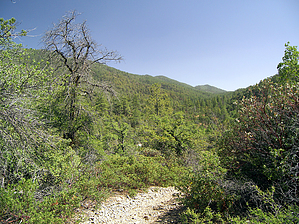
built by bears by PrestonSands  The Una Del Oso Trail #201 is a short little trail in the Pinal Mountains south of Globe. A former road, the Una Del Oso Trail, provides access to the middle section of the Tollroad Trail. The Tollroad Trail was a former toll road built in 1883 to connect Globe to the Pioneer Mining District on the Pinal Mountains' south side. In 1882, somewhere in the Una Del Oso/Tollroad Trail area, a robbery of a Wells Fargo pack train took place. Pinal Creek canyon is a peaceful area today, and wagons loaded with precious metals from two centuries ago have been replaced by hikers, bikers, and horseback riders, in this scenic mountain canyon. The Una Del Oso Trail #201 is a short little trail in the Pinal Mountains south of Globe. A former road, the Una Del Oso Trail, provides access to the middle section of the Tollroad Trail. The Tollroad Trail was a former toll road built in 1883 to connect Globe to the Pioneer Mining District on the Pinal Mountains' south side. In 1882, somewhere in the Una Del Oso/Tollroad Trail area, a robbery of a Wells Fargo pack train took place. Pinal Creek canyon is a peaceful area today, and wagons loaded with precious metals from two centuries ago have been replaced by hikers, bikers, and horseback riders, in this scenic mountain canyon.Beginning at the Una Del Oso trailhead along forest road 112, the Una Del Oso Trail leaves the road and the top of the ridge behind and begins descending into an oak and juniper woodland. On this stretch, Globe is visible in the distance, at the mouth of Sixshooter Canyon. High above to the south are the forested slopes of East Mountain and Pinal Peak. Across the canyon, the Tollroad Trail can be seen, snaking along the brushy green mountainside. The Una Del Oso Trail does seem to be popular with bears, as its name suggests, with many overturned rocks along the route. A few ponderosas are encountered among the manzanita and century plants as the trail makes a steady descent to Pinal Creek's pine-filled bottom. The trail soon arrives at the bottom of Pinal Creek, among water polished boulders of pale grey metamorphic rock. Pinal Creek may have water in it, depending on the time of year. Judging from the sycamores and cottonwoods in the stream bed, there must be at least some moisture present year-round. The Una Del Oso Trail crosses Pinal Creek and meets up with the Tollroad Trail on the east bank, among the ponderosa pines and white oaks. A sign marks the junction.
Check out the Official Route and Triplogs. Leave No Trace and +Add a Triplog after your hike to support this local community. One-Way Notice This hike is listed as One-Way. When hiking several trails on a single "hike", log it with a generic name that describes the hike. Then link the trails traveled, check out the example. | ||||||||||||||||||||||||||||||||||||||||||||||||||||||||||||||||||||||||||||||||||||||||||||||||||||||||||||||||||||||||||||||||||||||||||||||||||||||||||||||||||||||||||||||||||||||||||||||||||||||||||||||||||||||||||||
 Route Editor


