username
X
password
register
for free!
help
 This is likely a great time to hike this trail!  Check out "Preferred" months below, keep in mind this is an estimate.
  

Thomas Lake Trail #111, WA

Guide 7 Triplogs  0 Topics
  5 of 5  
Fav
Wish
0
details
drive
permit
forecast
route  
stats
photos
triplogs
topics
location
58 7 0
Statistics
tap row or icons for details
Difficulty 1 of 5
Distance One Way 3.3 miles
Trailhead Elevation 4,329 feet
Elevation Gain 200 feet
Kokopelli Seeds 3.97
feature photo
Photos Viewed All MineFollowing
Will recalculate on button tap!
3  2021-09-26 keepmoving
7  2021-09-07 keepmoving
9  2021-06-29 keepmoving
4  2020-11-02 keepmoving
15  2019-10-28 keepmoving
13  2018-11-15
Thomas Lake Trail - Cascade Crest / PCT Loop
keepmoving
7  2016-07-06 keepmoving
Author
author avatar Guides 16,843
Routes 17,472
Photos 24
Trips 1 map ( 6 miles )
Age 28 Male Gender
Location HAZ, TrailDEX
Associated Areas
list map done
Volcano Region
Historical Weather
Trailhead Forecast
Radar Map
Expand Map
Preferred Jul, Aug, Sep, Jun
Sun  5:33am - 6:38pm
Official Route & 4 Rts
 
1 Alternative


 Likely In-Season!
This 3.3 mile heavily used trail passes numerous lakes prior to its connection with the Pacific Crest National Scenic Trail #2000 within Indian Heaven Wilderness.


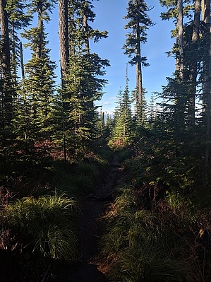
From the Thomas Lake Trailhead, beginning along Road 65, this trail climbs gently as it passes through a dense forest, coming to Dee, Thomas, and Heather Lakes at approximately 0.6 mile. The trail climbs to a meadow, then continues past Brader Lake and Naha Lake to Rock Lake and Little Rock Lake. It then turns south and passes Lake Umtux.
remove free decal offer
As the trail continues through the broad plateau meadow, it passes numerous unnamed ponds and tiny lakes. The trail descends into the timber, passing Lake Sahalee Tyee, and ends at Blue Lake with the junction of the Pacific Crest National Scenic Trail #2000.

Lake Sahalee Tyee lies in the shallow crater of an old volcano. This is an area where Native Americans built slow-burning fires in trenches, preserving berries for later use by drying them over the radiant heat.

2018-11-16 HAZ_Hikebot
  • Trail Map
    area related
    Trail Map


Check out the Official Route and Triplogs.
Leave No Trace and +Add a Triplog after your hike to support this local community.

One-Way Notice
This hike is listed as One-Way.

When hiking several trails on a single "hike", log it with a generic name that describes the hike. Then link the trails traveled, check out the example.
WARNING! Hiking and outdoor related sports can be dangerous. Be responsible and prepare for the trip. Study the area you are entering and plan accordingly. Dress for the current and unexpected weather changes. Take plenty of water. Never go alone. Make an itinerary with your plan(s), route(s), destination(s) and expected return time. Give your itinerary to trusted family and/or friends.

 Permit $$
no fees or permits reported

if incorrect tell us about it

Gifford Pinchot Forest
more info


 Directions
or
 Road


To hike
page created by HAZ_Hikebot on Mar 09 2010 7:00 pm
 90+° 8am - 6pm kills
helpcorrectionissue

end of page marker