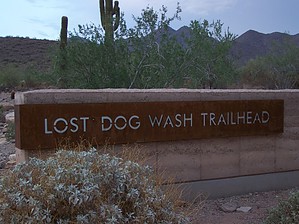
If you want to enjoy the Preserve side of the McDowell Mountains on the City of Scottsdale trails, this easy connector hike is a good starting place. Rather than weaving through several miles of suburbia on the Quartz trail to get to desert solitude, the Lost Dog Wash trail stays mostly hidden from the surrounding neighborhoods.
The trailhead has ample parking and an area for group education complete with new restroom facilities. The trail is well marked with mileage to the various connecting trails in the McDowell Preserves. Access is mixed-use approved for dogs on a leash and horses, and on any given day you will find hikers, joggers, and mountain bikers.
The path is a mix of firm sand and rocks as it crisscrosses the wash and climbs slowly to the overlook. You'll be surrounded by all the typical Sonoran desert flora, but the real scene-stealers are the stands of cholla along the way. Recently a rescued crested saguaro was planted near the trailhead.
You may use this trail to connect with the Sunrise trail at 0.2 miles or Ringtail trail at 0.5 miles, and after the short diversion to the overlook at 2.2 miles the trail ends at the Quartz trail at 2.6 miles.
This trail is a connector more than a destination unless the goal is a view of Camelback and the Phoenix mountains at Taliesin overlook. That's why I list this triplog as 2.2 miles one-way to the overlook rather than to continue 0.4 miles more to the trail end. As an after-work or early morning hike/jog, the logical goal is the overlook and the payoff is at sunrise/sunset.
The McDowell Sonoran Conservancy leads educational activities and guided hikes from this trailhead and publishes a short field guide to the Preserves.
WARNING! Hiking and outdoor related sports can be dangerous. Be responsible and prepare for the trip. Study the area you are entering and plan accordingly. Dress for the current and unexpected weather changes. Take plenty of water. Never go alone. Make an itinerary with your plan(s), route(s), destination(s) and expected return time. Give your itinerary to trusted family and/or friends.
Permit $$
None
Directions
Road
Paved - Car Okay
To hike 101 to Shea Boulevard. East on Shea to 124th Street. North on 124th Street to dead-end at the trailhead.
 Route Editor

 If you want to enjoy the Preserve side of the McDowell Mountains on the City of Scottsdale trails, this easy connector hike is a good starting place. Rather than weaving through several miles of suburbia on the Quartz trail to get to desert solitude, the Lost Dog Wash trail stays mostly hidden from the surrounding neighborhoods.