|
tap row or icons for details
|
| Difficulty |
|
2.5 of 5 |
| Route Finding |
|
2 of 5 |
| Distance Round Trip |
|
5.4 miles |
| Trailhead Elevation |
|
9,058 feet |
| Elevation Gain |
|
1,400 feet |
| Accumulated Gain |
|
1,700 feet |
| Avg Time Round Trip |
|
5 hours |
| Kokopelli Seeds |
|
13.9 |
| Backpack Yes | |
| | |
|
|
6 |
2025-08-24 | david_allen_3 |
|
|
14 |
2024-10-19 |
Snowy Kachina Aspen Wander |
chumley |
|
|
|
5 |
2022-10-15 |
|
|
|
30 |
2022-10-08 |
|
|
|
20 |
2022-10-08 |
|
|
|
11 |
2021-08-21 |
Humphreys Summit Trail #151 |
chumley |
|
|
|
4 |
2017-03-25 |
Aspen Nature Loop |
arizona_water |
|
|
|
15 |
2016-10-09 |
Humphreys from Hart Prairie |
chumley |
|
| | Page 1, 2, 3, 4 |
| |
|
|
list |
map |
done |
Flagstaff Region |
| | |
|
| |
|
|
Historical Weather |
| Trailhead Forecast | | |
|
 |
|
|
|
|
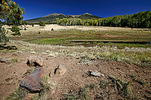
Seasons Early Summer to Autumn |
|
|
| | |
| |
Named Locations Coordinate Links
| |
|
|
Polar Aspen Alley - aka Aspen Corner
|
15.66 mi
1,497 ft |
 |
| Polar Aspen Alley - aka Aspen Corner
|
1.34 mi
230 ft |
|
|
|
Aspen Corner
|
0.23 mi
25 ft |
|
| I Hart to Hump
|
13.37 mi
4,056 ft |
|
|
| Aspen Nature Loop
|
1.71 mi
386 ft |
|
|
| Humphreys from Hart Prairie
|
13.78 mi
4,193 ft |
|
|
| | |
| |
|
|
Follow old jeep route below and/or above road. Stats are for out and back, below and above road.
|
 Route Editor