 Route Editor

| Guide | ♦ | 128 Triplogs | 1 Topic |
details | drive | no permit | forecast | 🔥 route |
stats |
photos | triplogs | topic | location |
| 1.4k | 128 | 1 |
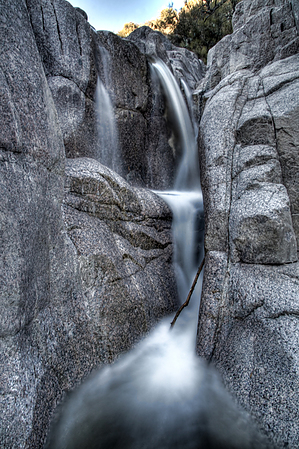
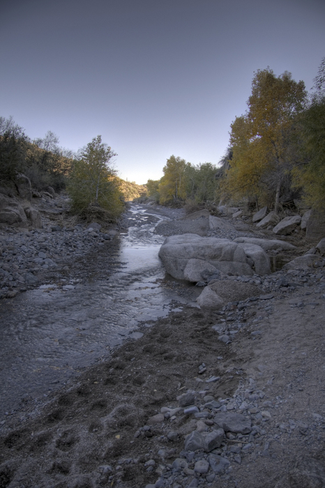
Reclaimed from the ATV crowd! by caddymob  I've had a thing for waterfalls lately, so I figured I should go to one of my old haunts and take some good pictures. The destination is Camp Creek where a nice granite waterfall awaits. This is one of the largest (~10 feet high) I have found near phoenix. This area used to be open to motor vehicles so when I was in high school we used to drive up to the base of the falls and camp out. Since the Cave Creek Complex Fire in 2005 this area has been closed to motor vehicles - it was a popular spot for ATVs. As much as I loved being able to drive up to the falls, it's a good thing the forest service closed it off - too many people, too much trash, and ATVs making trails everywhere. I've had a thing for waterfalls lately, so I figured I should go to one of my old haunts and take some good pictures. The destination is Camp Creek where a nice granite waterfall awaits. This is one of the largest (~10 feet high) I have found near phoenix. This area used to be open to motor vehicles so when I was in high school we used to drive up to the base of the falls and camp out. Since the Cave Creek Complex Fire in 2005 this area has been closed to motor vehicles - it was a popular spot for ATVs. As much as I loved being able to drive up to the falls, it's a good thing the forest service closed it off - too many people, too much trash, and ATVs making trails everywhere.The old access was from Bartlett Road north up the commonly known "12-mile wash" - if you go south it's 12 miles to the Verde River. 12-mile wash is actually called Camp Creek.
Make your way just over a mile from where you started down the wash until you reach Camp Creek. You can't miss it, Blue Wash intersects perpendicularly, and the canyon opens up. If you're lucky, there will be water, a good sign that the falls will be great. If you don't see water in Camp Creek don't worry - it goes underground depending on volume and many times the falls are still running. The intersection of Blue Wash and Camp Creek is at 33 52'21.87"N, 111 48'6.15"W. Here you'll turn left (Northeast) up Camp Creek. About a quarter-mile upstream, you'll find the falls. And for perspective, this picture - I'm 6"6'. Back out the way you came. Upstream of the falls is nothing special, and if you go too far you'll run into the Sears Kay Ranch. Not sure if they're friendly, but I always try to stay off private property 'round these parts... people have guns... The hike is less than an hour, easy, so depending on how much time you spend you should definitely go check out the Sears Kay Ruins just up the road from where you parked. Also, a quick stop on the way home is the World's Largest Kachina right at the entrance to Tonto Hills. Check out the Official Route and Triplogs. Leave No Trace and +Add a Triplog after your hike to support this local community. | |||||||||||||||||||||||||||||||||||||||||||||||||||||||||||||||||||||||||||||||||||||||||||||||||||||||||||||||||||||||||||||||||||||||||||||||||||||||||||||||||||||||||||||||||||||||||||||||||||||||


