 Route Editor

| Guide | ♦ | 24 Triplogs | 0 Topics |
details | drive | permit | forecast | route |
stats |
photos | triplogs | topics | location |
| 45 | 24 | 0 |
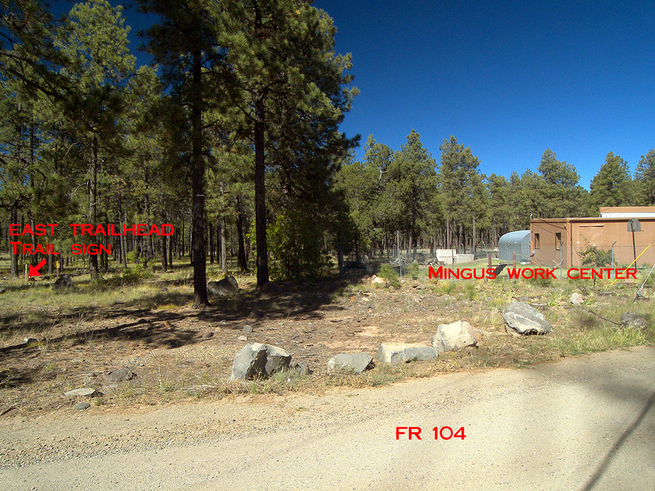
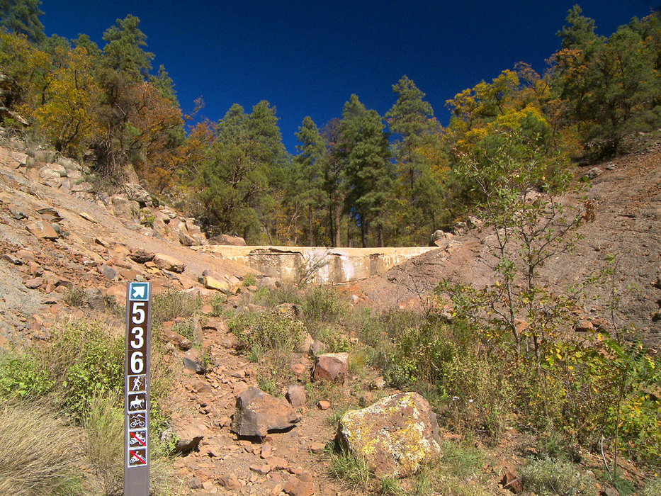
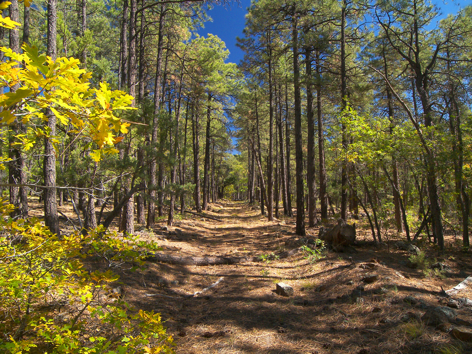
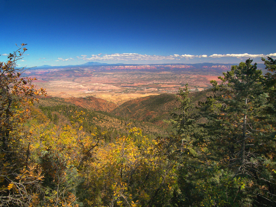
Maze on Mingus by PrestonSands  Overview OverviewThe Butterfly Trail is a primitive route that follows closed logging roads on the north end of Mingus Mountain. Its main attractions are secluded forest and distant views off the north side of Mingus Mountain. You can also use the Butterfly Trail as a connector between the Woodchute Trail and the View Point/North Mingus Trails. Despite the multiple trail signs and numerous cairns, this trail is tricky to follow, so I strongly recommend using a GPS unit or taking good mental notes to avoid getting lost. Two trailheads access this trail: the east trailhead at Mingus Work Center, and the west trailhead at Butterfly Spring along forest road 104. Both trailheads have a vertical brown signpost for trail #536. This description starts at the west trailhead. For an easier and less confusing adventure, just hike to the edge of Mingus and back from the east trailhead.
At the west trailhead (34.70581, -112.13939), there is a rocky path heading up a shallow drainage towards a concrete dam. A fiberglass signpost soon identifies the trail as #536. The trail crosses over to the east side of the dam and then continues north while staying near the bottom of the drainage. At about 0.25 miles (34.70798, -112.13796), a cairn and a signpost mark the point where the trail leaves the creek bottom and begins climbing the north slope of the canyon. The next quarter-mile is a confusing stretch of cairns and pink tape tied in trees. The cairned route comes upon an ancient logging road at around 0.5 miles (34.71087, -112.13646). A single piece of blue tape was hanging from a tree here when I hiked this route. Head east now, and follow the old logging road. At around 0.75 miles, the road comes within a hundred yards of the north rim of Mingus Mountain. The edge of the mountain is visible through the trees. Leave the road here to enjoy your own private viewpoint (34.71077, -112.13149). There are some great views of the Verde Valley and the Flagstaff area from the edge. Continuing from the viewpoint, the road begins curving to the south and arrives at a 4-way intersection with three other old logging roads at 1.4 miles (34.70295, -112.13078). A signpost for trail #536 now directs you to head southeast, along another old logging road. At 1.5 miles, you will come to a "T" intersection (34.70209, -112.12956). Turn left (north), away from the private property sign. You will encounter another logging road on the left at 1.6 miles: keep going straight. The forest closes in now, and the pines grow taller. Trail #536 meets trail #537 at a fork at 2.15 miles (34.70488, -112.12138). Stay right on trail #536. The logging road soon begins to flatten out, and the forest opens up to reveal the fenced enclosure of the Mingus Work Center. Behind it are a cell phone tower and forest road #104. The logging road disappears once it arrives at the Work Center. A lone fiberglass signpost for trail #536 marks the end of the Butterfly Trail (34.70146, -112.11924) on the south side of the Work Center. If you've made it this far, you can return the way you came or take the easy way back (forest road #104). Check out the Official Route and Triplogs. Leave No Trace and +Add a Triplog after your hike to support this local community. | |||||||||||||||||||||||||||||||||||||||||||||||||||||||||||||||||||||||||||||||||||||||||||||||||||||||||||||||||||||||||||||||||||||||||||||||||||||||||||||||||||||||||||||||||||||||||||||||||||||


