| Guide | ♦ | 168 Triplogs | 1 Topic |
details | drive | no permit | forecast | route |
stats |
photos | triplogs | topic | location |
| 463 | 168 | 1 |
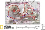
 This hike is an excellent location while staying in the Phoenix area. The greatest thing about this hike was that we did not see a single person once on the trail. The parking area has room for about 15 cars, but ours was the only one in the lot on a Saturday morning in March. This hike is an excellent location while staying in the Phoenix area. The greatest thing about this hike was that we did not see a single person once on the trail. The parking area has room for about 15 cars, but ours was the only one in the lot on a Saturday morning in March.Hike: From the parking area follow a dirt path past a ramada with a water fountain. This is the only water available on this hike. This dirt path leads to a paved road which is where I began the distance measure for this hike. The dirt trail continues, but the Rusty Angel trail is up the paved road.
Returning to the Palisade Trail you'll want to continue where you left off. The trail will start a gradual decline and head off in an eastward direction. This makes for a beautiful hike. At this point you will be hiking along a ridge with views to your left and right. In my opinion this was the best part of the hike. You have 360 degree views of the surrounding area. During this stretch you'll come across a couple of connector trails that connect to the Circumference Trail. These connector trails are fairly close together, making the second one seem kind of redundant, but they can be used to add variety to your hikes. However, the Palisade Trail will continue east, bypassing these connectors until ends at its intersecting with the Circumference Trail. At this point, you have hiked the Palisade Trail for a total of 1.56 miles (give or take the mileage of the lookout point). To return to the TH you have three options. You can always turn around and retrace your steps. You can make a right (south) onto the Circumference. This will add miles to your hike and provide several other options as you go. The most direct route in returning to the TH is by making a left (north) onto the Circumference Trail and following the Circumference back to the TH. In route you'll pass the connector trails that were mentioned earlier and at 2.18 miles you'll come to a juncture where the Basalt Trail starts. But just stay on the Circumference and you'll be back to your car in no time. 2014 Update: Formerly known as Rusty Angel Trail. Originally posted by midnightwaps on 2009-03-29. Revised on 2014-06-07 by mt98dew. Check out the Official Route and Triplogs. Leave No Trace and +Add a Triplog after your hike to support this local community. | |||||||||||||||||||||||||||||||||||||||||||||||||||||||||||||||||||||||||||||||||||||||||||||||||||||||||||||||||||||||||||||||||||||||||||||||||||||||||||||||||||||||||||||||||||||||||||||||
 Route Editor


