 Route Editor

| Guide | ♦ | 4 Triplogs | 0 Topics |
details | drive | no permit | forecast | route |
stats |
photos | triplogs | topics | location |
| 25 | 4 | 0 |
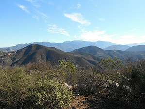
The sweet sound of traffic by azbackpackr At first the wide trail goes straight up the side of the hill. It goes through an open gate, with several signs saying to keep dogs on leashes, no horses, etc. Soon it starts switchbacking, following an old road. Reaching a paved section, bear to the left, and when pavement ends, bear right again. There are very helpful sign posts at several of the trail intersections that have been installed by a local Boy Scout troop. Nearing the summit there is no sign post for the last turn, which is to the left, to reach the top. But it's easy to see you are almost there. Arriving at the summit you'll find a very large rock cairn next to a metal box with a hikers' register inside.
This hike is listed as one-way to the summit. There are numerous side trails and also a hike to a water tank, which I have not detailed here. Round trip to the summit and back is about 3.4 miles. It's very good for a quick, steep, short workout, whether hiking or trail-running. For more information contact the Fallbrook Land Conservancy, PO Box 2701, Fallbrook, CA 92088. (760)728-0889. www.fallbrooklandconservancy.org Gate Policy: If a gate is closed upon arrival, leave it closed after you go through. If it is open, leave it open. Leaving a closed gate open may put cattle in danger. Closing an open gate may cut them off from water. Please be respectful, leave gates as found. The exception is signage on the gate directing you otherwise. Check out the Official Route and Triplogs. Leave No Trace and +Add a Triplog after your hike to support this local community. One-Way Notice This hike is listed as One-Way. When hiking several trails on a single "hike", log it with a generic name that describes the hike. Then link the trails traveled, check out the example. | ||||||||||||||||||||||||||||||||||||||||||||||||||||||||||||||||||||||||||||||


