 Route Editor

| Guide | ♦ | 12 Triplogs | 1 Topic |
details | drive | no permit | forecast | 🔥 route |
stats |
photos | triplogs | topic | location |
| 113 | 12 | 1 |
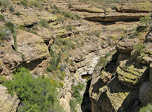
Canyons are inherently risky. Flash floods occur without notice on sunny days. Technical skills & surrounding topography knowledge required yet does not eliminate risk.
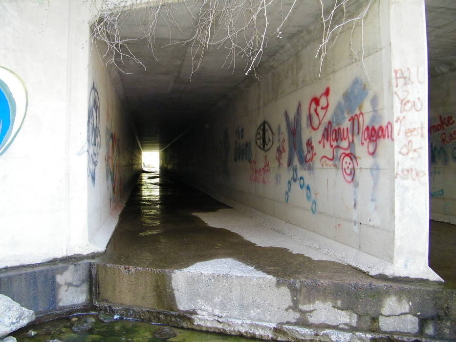
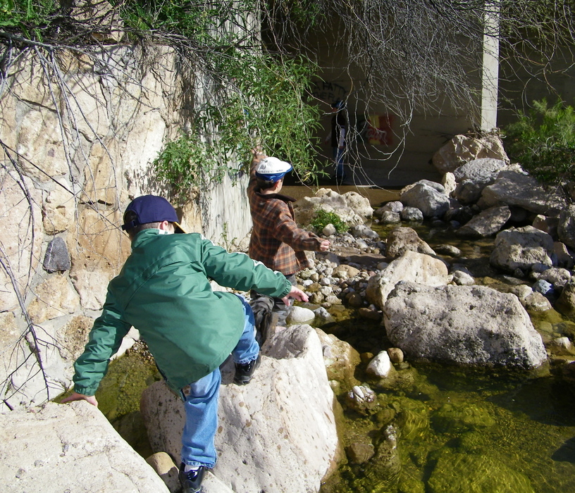
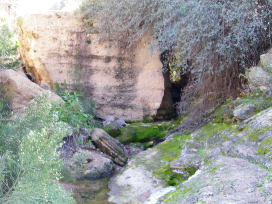
Great family winter camping spot by azdesertfather  Overview OverviewWhen most people in the Phoenix area think of camping, they think of heading out of the Phoenix area as far as possible...to find water, cooler temps, and places to go exploring. Once the (hopefully) rains come and the snow starts to melt, however, and the flowers start popping out of the ground, there isn't a better spot to take the fam than out to Mesquite Creek. Nice, quiet, water, and nearly a dozen good camping spots to be had, almost all fairly secluded from each other. What's more, it's right off AZ88, making it pretty easy to get to. Hike On my trip out with my son in February, we first went upstream. You only have to hike up a quarter mile before you find a concrete underpass for water to flow through. There are two of them right next to each other. Most of the time there are easily crossable. Coming out on the other side, you'll find a rock wall created (my guess) when they built the road and the underpass. At this point, you can veer off to the right along the rock wall, or continue going straight. If you go straight another quarter mile you will reach a huge corrugated metal drainage pipe, where again most of the time it should be passable. It's fairly dark in there but, as the highway underpass, you can see light out of both ends from any point inside. Out this way there is also a neat little mini-cave formed by boulders in the creek bed. We only went a few hundred feet this day beyond that before turning back, but theoretically, you could keep following the creek for miles.
Returning to the campsite we next headed downstream. When there is water you should find some good swimming holes. There is one spot out there less than a mile away from where the water (if running) can go pretty deep; on this particular day, it was 8 feet deep and clear. It's hard to time it just right, but if you can get out there when the water is clear and flowing and it's also really warm outside (maybe 85 degrees or warmer), then it could be really enjoyable to swim. If it's still too cold, little kids and big kids alike can enjoy taking up defensive positions on either side of the creek downstream and having rock wars ... grabbing stones and throwing them into the creek in front of the enemy to totally splash them! Like with all such areas, kids should be especially careful of boulders that appear stable in and around the creek but aren't... and one area that has slippery algae. On a few occasions, kids were falling and hitting boulders directly on their tailbones! Check out the Official Route and Triplogs. Leave No Trace and +Add a Triplog after your canyon trip to support this local community. | ||||||||||||||||||||||||||||||||||||||||||||||||||||||||||||||||||||||||||||||||||||||||||||||||||||||||||||||||||||||||||||||||||||||||||||||||||||||||||||||||||||||||||||||||||||||||||||||||||||||||||


