 Route Editor

| Guide | ♦ | 3 Triplogs | 0 Topics |
details | drive | no permit | forecast | map |
stats |
photos | triplogs | topics | location |
| 21 | 3 | 0 |
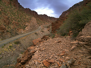
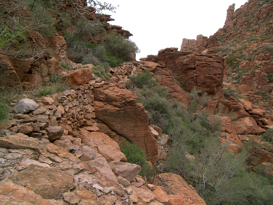
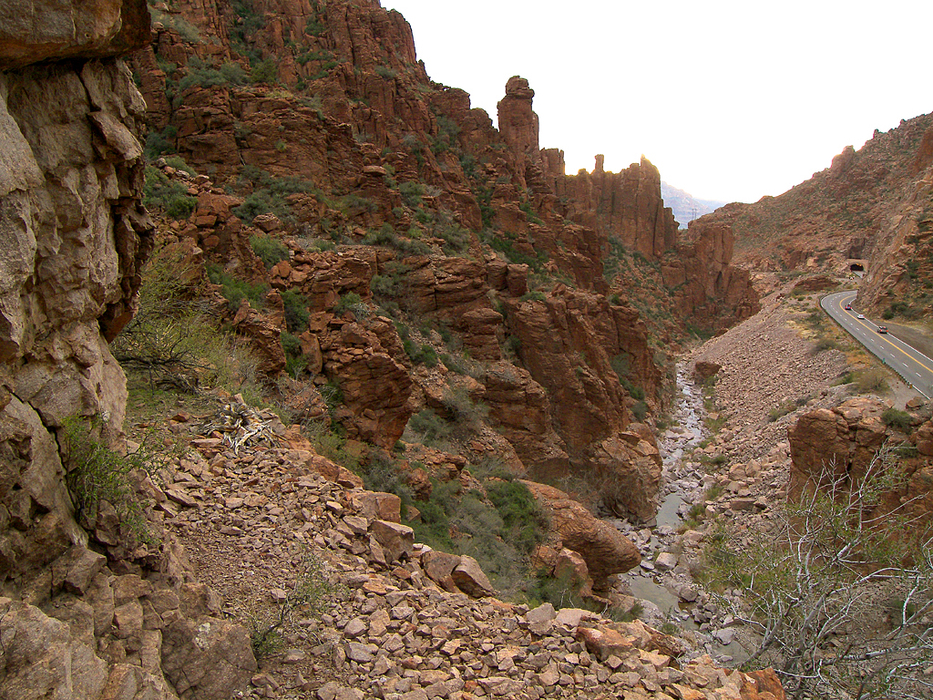
Cliffhanger by PrestonSands   HISTORY HISTORYEast of Superior, Arizona, lies Queen Creek Canyon, a spectacularly rugged gorge on the west end of the Pinal Mountains. Most people speed through its spire-filled depths without stopping to explore it. Those with sharp eyes, though, may notice a series of stacked rocks, supporting an ancient trail that clings to the canyon's cliffs, opposite the highway. These are the remains of the Bellamy Trail. Sometime during the first decade of the twentieth century, Tonto National Forest supervisor T.T. Swift assembled a crew to construct this trail, as a shortcut for those traveling between Superior and Globe. Roads did not yet exist between the two towns, and the only other route was the Stoneman Grade, which passed several miles north of Superior. The Bellamy Trail (or "Swift Trail", as it was sometimes known) served the travel needs of the area until 1922 when Highway 60 was completed between Superior and Globe. The current highway parallels much of the Bellamy Trail's route between Superior and Oak Flat. This hike describes the Queen Creek Canyon portion of the Bellamy Trail. Although it is almost completely overgrown, and some spots have been obliterated by rock slides, determined hikers can still travel its route along the cliffs, high above Queen Creek. Just know that if you choose to hike the Bellamy Trail, you will get torn and scratched mercilessly by thick, and often thorny vegetation. Other, more pleasant attractions along this hike include Queen Creek's seasonal waterfalls and pools, which may be flowing after rainy weather. Mileage listed in the statistics is the approximate length of the legally hike-able portion of the Bellamy Trail. Mileage on your hike may vary.
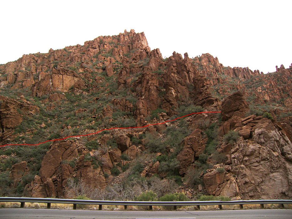
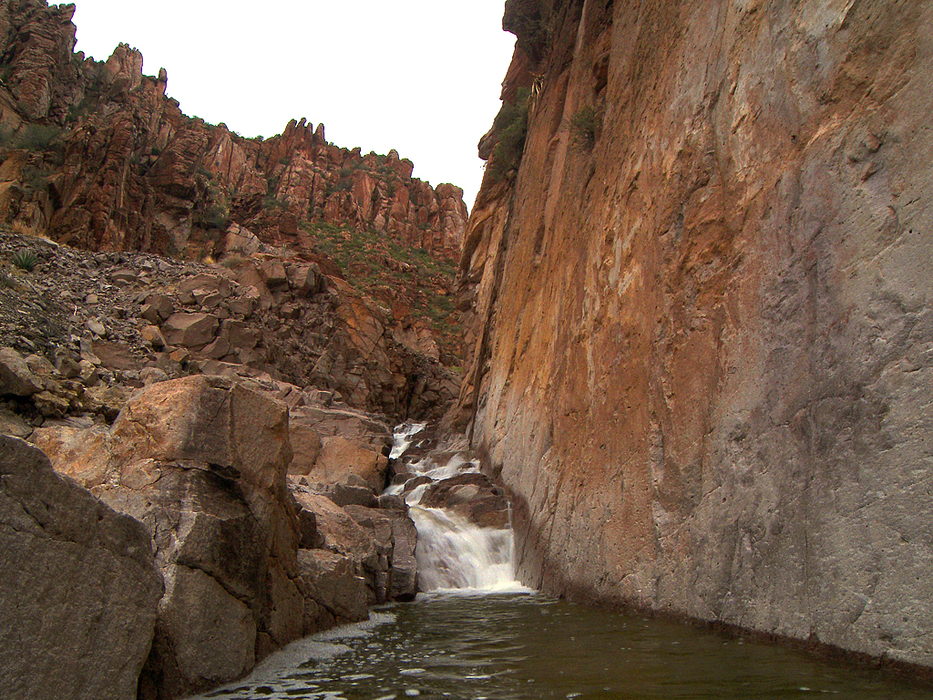
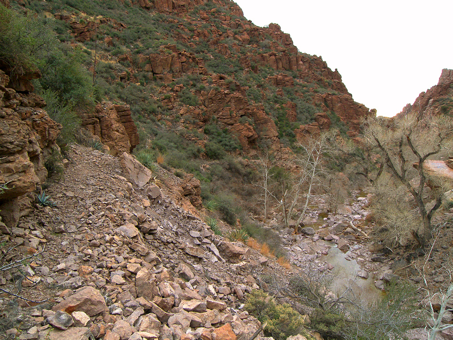
The highway pull-off at milepost 229 provides easy access to the canyon bottom. The easiest place to reach the Bellamy Trail is a little way up the creek. Scramble down the boulder-covered slope at milepost 229 to reach the canyon floor, and begin hiking up the creek. You will soon come to a 30 foot, seasonal waterfall in the narrow canyon bottom. Bypass it to the left. Weave your way up the canyon, past the many large boulders and sycamores. Just below another highway pull-off, at about 0.25 miles (33.30821 N, 111.07005 W), the Bellamy Trail will be visible about 30 feet above the creek, on the south wall of the canyon. Scramble up the slope to the trail. At this point, you can follow the Bellamy Trail east or west. A short way to the east, the trail descends to the floor of Queen Creek, where it gets lost in a tangled mess of brush. Following the trail west is the best option. As the Bellamy Trail heads west, it begins climbing higher on the south canyon wall, while Queen Creek Canyon grows ever deeper. Extensive stone work supports the trail, as it alternates between brushy mountain slopes and bare rock. In some places, the trail exists as a narrow shelf, above a one hundred foot sheer drop to the canyon floor. Very cool for some, and no doubt terrifying for others. Be careful. The Bellamy Trail eventually begins descending to the bottom of Queen Creek Canyon again, in the vicinity of the highway tunnel. Across the canyon, both the Queen Creek Tunnel and its predecessor, the Claypool Tunnel, are visible. Below the tunnels, Queen Creek Canyon is private property. If you've made it this far, it's time to turn around. Check out the Triplogs. Leave No Trace and +Add a Triplog after your hike to support this local community. | |||||||||||||||||||||||||||||||||||||||||||||||||||||||||||||||||||||||||||||||||||||||||||||


