Route Editor

| Guide | ♦ | 3 Triplogs | 0 Topics |
details | drive | no permit | forecast | route |
stats |
photos | triplogs | topics | location |
| 15 | 3 | 0 |
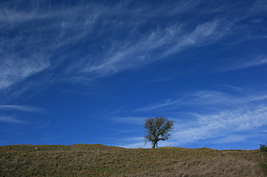
Granddaddy of the East Bay Regional Park system by JimmyLyding Much more recently in the 1930s it was foreseen that the East Bay would experience dramatic changes in land use: the large cities of Oakland and Berkeley would continue their inexorable growth eastward into the Oakland Hills; towns would turn into small cities; and hamlets would become booming bedroom communities. Thus, a movement arose to preserve the special outdoor areas in the East Bay, and the East Bay Regional Parks District was born. Robert Sibley Volcanic Regional Preserve was one of EBRPD's first parks. Robert Sibley was one of these early visionaries, and served as EBRPD's president and director from 1948 to 1958.
The views really open up on the Quarry Trail with great views of the large Round Top Creek drainage, Round Top, and Mount Tam and the bay in the distance. As you make your way towards Round Top the San Leandro Creek drainage comes into view to the southeast, and the upper portion of that area is one of the wildest areas in the Bay Area with a thick forest and very little easy ways to get there. The Quarry Trail ends at its junction with the Round Top trail. This trail circumnavigates Round Top. Go left (clockwise) to experience more views to the east including Mount Diablo, and after a short uphill stretch the trail begins a descent through a thick forest of Monterey pine (non-native), California bay (native), and eucalyptus (most certainly not native). The trail gradually flattens out and soon reaches its junction with the semi-paved road to the top of Round Top. Turn right on the road, and the summit is quickly reached after a lung-burning 400' over 1/3 mile. The summit is nothing spectacular with its profusion of towers and tall trees that block most views, but it's always nice to get to the top. Head back the way you came, and stay on the road back to its signed junction to the spur trail to the visitors center. Go past the outdoor visitors center, and make a right turn to reach the northern end of the parking area. This is where the Skyline trail begins, and you'll be back at the trail head in just under a mile. This section is fairly steep in stretches, and follows Round Top Creek under dense tree cover. There's an abandoned cabin or logging operation off to the right that sometimes can be seen. Much of this hike is on the Skyline trail/Bay Area Ridge trail. More on those two gems at a later date. Gate Policy: If a gate is closed upon arrival, leave it closed after you go through. If it is open, leave it open. Leaving a closed gate open may put cattle in danger. Closing an open gate may cut them off from water. Please be respectful, leave gates as found. The exception is signage on the gate directing you otherwise. Check out the Official Route and Triplogs. Leave No Trace and +Add a Triplog after your hike to support this local community. | ||||||||||||||||||||||||||||||||||||||||||||||||||||||||||||||||||||||||||||||||||