 Route Editor

| Guide | ♦ | 6 Triplogs | 0 Topics |
details | drive | no permit | forecast | 🔥 route |
stats |
photos | triplogs | topics | location |
| 10 | 6 | 0 |
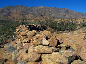
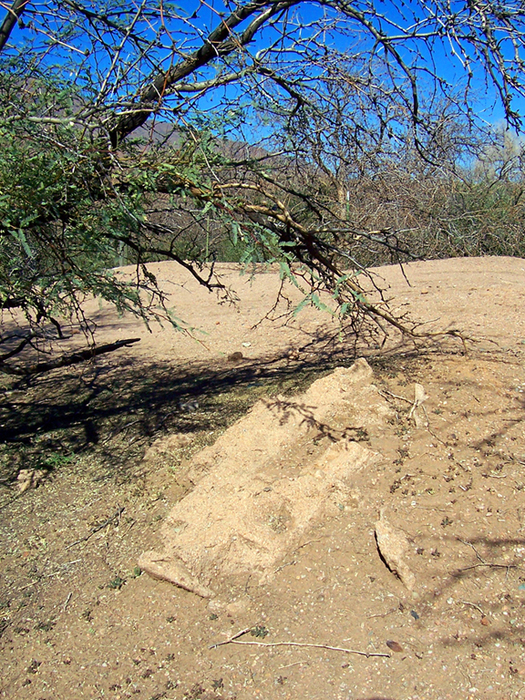
vanishing historic site by PrestonSands  Overview OverviewLocated on the west side of Tonto Basin at the base of Mt. Ord is the site of Camp Reno. Camp Reno was a small military fort operated by the U.S. Army from 1868-1870, in an attempt to control the Apache people of central Arizona. Unfortunately, there is little left to see at Camp Reno. A wooden sign identifies the site. A few piles of sand and some faint rock foundations mark the locations of the Camp's buildings. A long rock wall, which may be the remnants of the stockade that was built shortly before Camp Reno was abandoned, partially surrounds the site. Vegetation in the area is recovering from the 2005 Edge Fire.
In October 1867, soldiers from Fort McDowell began constructing a wagon road northeast into the Mazatzal Mountains. The route followed Sycamore Creek up to the Sunflower area, where two temporary camps, known as Camp Carroll and Camp O'Connell, were established. The wagon road then turned east, crested the Mazatzal Mountains at Reno Pass, and descended Reno Canyon to the site of another temporary fort near Reno Creek, in Tonto Basin. From there, the road continued up Tonto Creek, to a location known as Green Valley, where the permanent Camp Reno would be built. After ten months of hard work and numerous attacks from the Apaches, the wagon road was completed to Green Valley. Due to lack of manpower though, the Army abandoned its plan to build Camp Reno in Green Valley and declared the temporary camp on Reno Creek to be the new Camp Reno. The army constructed barracks, officer's quarters, a bakery, and other structures, mostly out of adobe. Camp Reno served as a base for army expeditions into the surrounding areas, and as a meeting place for the soldiers and the Apache. Tonto Apache leader Del Shay frequented the fort, and pursued peaceful relations with the Army at times, despite having been shot by them on two separate occasions. By 1870 the Army considered Camp Reno a failure and abandoned it that spring. Its isolated location in a harsh desert environment, along with a chronic shortage of soldiers, had proven too expensive and difficult for the Army to operate. In the century and a half following Camp Reno's abandonment, the desert has reclaimed the site, and the adobe structures have succumbed to the elements, dissolving into piles of sand. An archaeological study in the early 1990s produced a map of the site and small items such as brass coat buttons and bullets. Hike A one-mile long, rough and eroded 4 wheel drive road leads to the site from the Park Creek Road (forest road #409). High clearance 2wd will get you within a half-mile of Camp Reno. Those with cars may want to just park along Park Creek Road and hike from there. The mileage and time listed are for a round trip hike from forest road 409. Anyway, follow the right fork of forest road 409 northwest across the mesa. At 0.4 miles, the road drops off the mesa into a dry wash, then climbs a little hill covered in hackberry trees. At the one-mile point, the road arrives at a wooden sign marking the site of Camp Reno. Most of the building remnants lie within a few hundred yards of the sign. A little way to the west is the long rock wall, which forms a semi-circle through the mesquites. Other, newer foundations, probably related to ranching, can be found under the sycamores along Reno Creek a few hundred feet to the north. Somewhere in the area is the Camp's cemetery. When you have seen all there is to see (which isn't much), return the way you came. Check out the Official Route and Triplogs. Leave No Trace and +Add a Triplog after your hike to support this local community. | ||||||||||||||||||||||||||||||||||||||||||||||||||||||||||||||||||||||||||||||||||||||||||||||||||||||


