 Route Editor

| Guide | ♦ | 9 Triplogs | 0 Topics |
details | drive | no permit | forecast | 🔥 route |
stats |
photos | triplogs | topics | location |
| 57 | 9 | 0 |
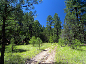
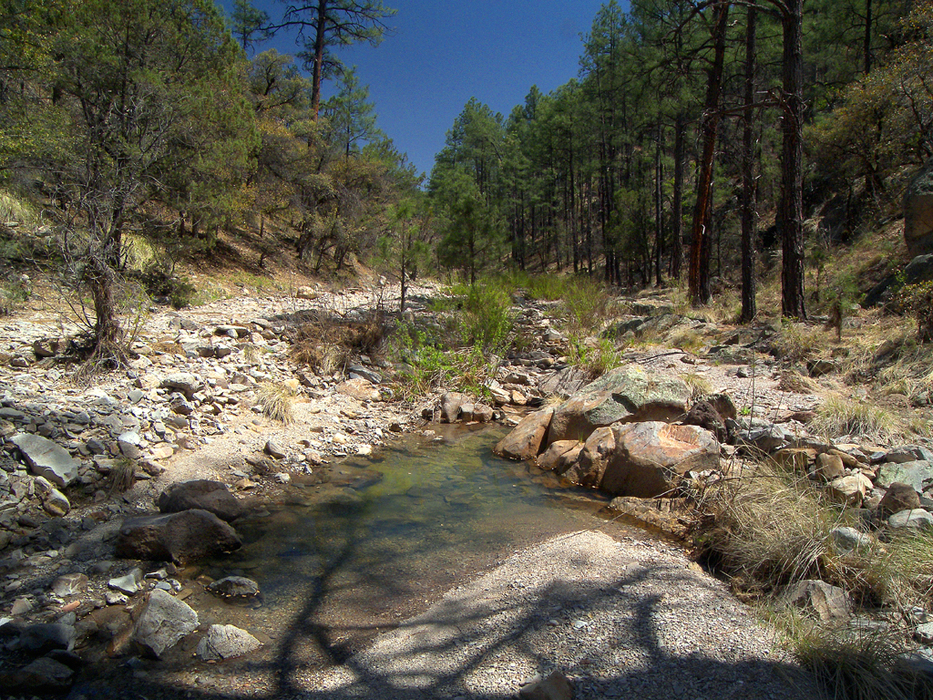
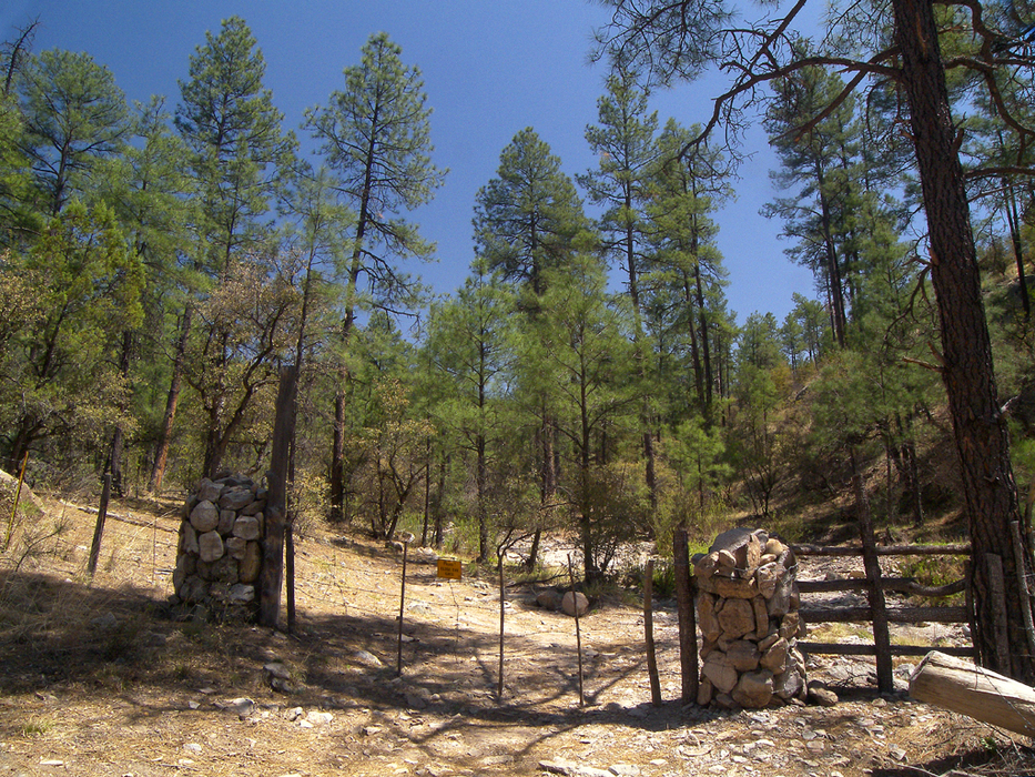
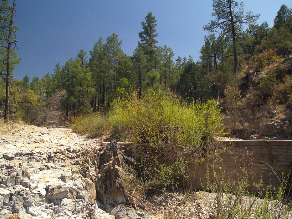
Coal is the goal by PrestonSands   Overview OverviewThis hike describes scenic Coal Creek canyon, which runs along the Arizona-New Mexico border, in the Big Lue Mountains. Specifically, this hike is along the upper portion of the creek, south of state highway 78. Coal Creek doesn't have a "destination", but rather offers an enjoyable hike along its seasonal watercourse, through ponderosa pine forest. Just let your time, energy level, and enthusiasm determine how much of the canyon you explore. The mileage listed in the statistics is for the hike described here. It may be possible, however, to follow Coal Creek to its headwaters at Maverick Hill, for a 14-mile round trip hike.
Is there any coal on Coal Creek? No. But there is pseudobrookite. Coal is not located anywhere near the volcanic country of the Big Lue Mountains. Perhaps Coal Creek's name stems from the black obsidian nuggets that can be found in the area. Most of the rock seen along this hike is a pale, almost whitish, Tertiary tuff (cemented volcanic ash). Hike Forest road 8345 comes in from the south to meet state highway 78 at mile marker 174, just a few hundred feet west of Coal Creek. There is ample parking here, and at the pull-off spot across the highway. Start following forest road 8345 south, as it parallels Coal Creek. After the first creek crossing, this four-wheel-drive road passes through a gate and rapidly deteriorates into a jeep trail. The jeep trail makes frequent creek crossings, and in many places, it just follows the rocky bed of Coal Creek itself, while gradually gaining elevation. Route finding is not an issue in the narrow canyon. The tuff derived rocks in the creek bed give off a metallic sound underfoot. Tall ponderosa pines are the predominant trees, with some alligator junipers and oaks mixed in. Cooler north-facing slopes hold Gambel oaks, while drier, south-facing slopes are covered in chaparral and white oaks. Willow thickets begin to line the creek in many places after the first mile. At the one mile point, a gate with rock posts marks the hike's crossing into New Mexico. Coal Creek crosses the border three more times upstream. Mile 1.4 finds a side canyon splitting off to the right, while forest road 8345, which is an ATV trail at this point, stays east to continue following Coal Creek. The hike passes an unexpected aspen grove at 1.8 miles, at a bend in the canyon, and soon after reaches the remains of Coal Creek Tank. The tank is dry and filled with rock. Beyond Coal Creek Tank, the canyon widens, and the pines grow taller. Although not on any maps, forest road 8345 (a trail at this point), continues up the canyon, and reportedly reaches its end about 5 miles upstream of the highway. I turned around at the 2.75-mile point, having satisfied my curiosity. If you choose to hike up Coal Creek to its headwaters near Maverick Hill, be sure to bring a topo map or GPS, as there are several side canyons branching off. Return the way you came. Water Scattered pockets of water can be found along Coal Creek during the spring, or during monsoon season, where bedrock forces it to the surface, but Coal Creek appears to be dry most of the year. Camping There are several small, open parks, and scores of fine, shaded campsites along Coal Creek, for those who choose to backpack. Gate Policy: If a gate is closed upon arrival, leave it closed after you go through. If it is open, leave it open. Leaving a closed gate open may put cattle in danger. Closing an open gate may cut them off from water. Please be respectful, leave gates as found. The exception is signage on the gate directing you otherwise. Check out the Official Route and Triplogs. Leave No Trace and +Add a Triplog after your hike to support this local community. | |||||||||||||||||||||||||||||||||||||||||||||||||||||||||||||||||||||||||||||||||||||||||||


