username
X
password
register
for free!
help


San Carlos River at Warm Springs Flat, AZ

Guide 11 Triplogs  0 Topics
  5 of 5  
Fav
Wish
25
details
drive
permit
forecast
route  
stats
photos
triplogs
topics
location
107 11 0
Statistics
tap row or icons for details
Difficulty 4 of 5
Distance One Way 2.6 miles
Trailhead Elevation 4,338 feet
Elevation Gain -720 feet
Kokopelli Seeds 3.8
 Interest Off-Trail Hiking, Perennial Waterfall & Perennial Creek
feature photo
Photos Viewed All MineFollowing
Will recalculate on button tap!
10  2018-09-15 FOTG
8  2018-02-10 The_N
16  2016-09-23 skatchkins
9  2016-05-01 MountainMatt
11  2014-07-04 skatchkins
18  2012-07-14 skatchkins
6  2010-05-01 joebartels
5  2010-05-01 ssk44
Page 1,  2
Author
author avatar Guides 16,843
Routes 17,472
Photos 24
Trips 1 map ( 6 miles )
Age 28 Male Gender
Location HAZ, TrailDEX
Associated Areas
list map done
Globe Region
Historical Weather
Trailhead Forecast
Radar Map
Expand Map
Preferred Mar, Nov, Apr, Oct
Sun  5:58am - 6:41pm
Official Route & 1 Rt
 
1 Alternative


remove free decal offer
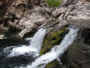
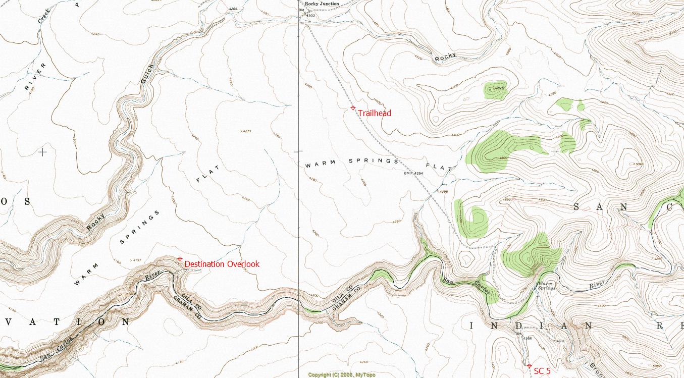
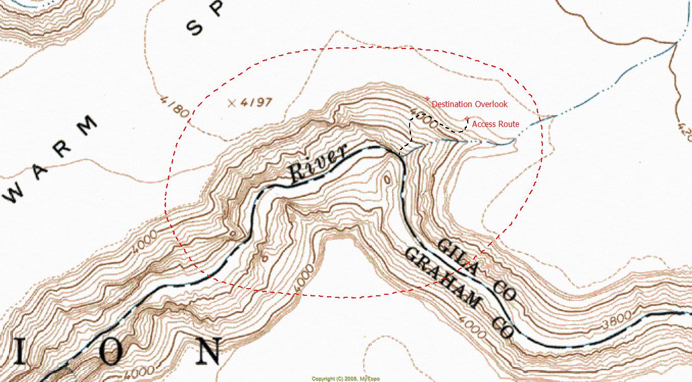
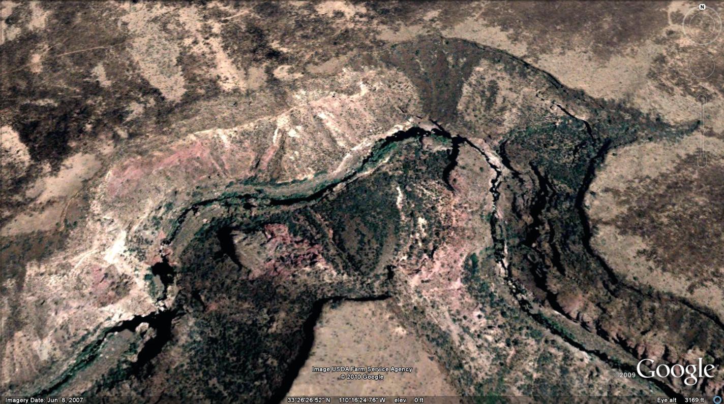
Crystal's Secret Gorge
by HAZ_Hikebot

  
Overview: The Lost World... Absolutely amazing destination, located deep within the San Carlos Indian Reservation. Truly a hikers playground with a gorgeous river canyon, numerous large waterfalls, deep-water swimming holes, alcoves, a 3C technical slot segment (can be bypassed), and a beautiful large grotto area. Enjoy!


Destination Overlook: Lat. 33 degrees/26'/37.17"/N & Long. 110 degrees/16'/12.15"/W

2018-07-14 HAZ_Hikebot
  • guide related image guide related image guide related image
    guide related


Check out the Official Route and Triplogs.

Note
This is a moderately difficult hike.
Leave No Trace and +Add a Triplog after your hike to support this local community.

One-Way Notice
This hike is listed as One-Way.

When hiking several trails on a single "hike", log it with a generic name that describes the hike. Then link the trails traveled, check out the example.
WARNING! Hiking and outdoor related sports can be dangerous. Be responsible and prepare for the trip. Study the area you are entering and plan accordingly. Dress for the current and unexpected weather changes. Take plenty of water. Never go alone. Make an itinerary with your plan(s), route(s), destination(s) and expected return time. Give your itinerary to trusted family and/or friends.

 Permit $$
San Carlos Indian Reservation Recreation Permit required.
Price, info & locations at San Carlos - Permits


 Directions
or
 Road
High Clearance possible when dry

To hike
From Globe (junction at US60), drive southeast along US70 approximately 24.2 miles to SC-8. SC-8 to Point of Pines is a paved highway. There are NO services of any kind at Point of Pines. Drive northeast along SC-8 for approximately 15 miles to SC-5. The remainder of the drive is gravel/dirt. If it is raining, be prepared for horrendous mud. Drive along SC-5 for approximately 6.7 miles to the designated trailhead (Lat. 33 degrees/27'/51.76"/N & Long. 110 degrees/14'/30.78"/W). WARNING: This is a very remote location with no cell phone signal. Use caution and discretion during ALL activities. You're on your own!
page created by ssk44 on Apr 25 2010 6:12 pm
 90+° 8am - 6pm kills
helpcorrectionissue

end of page marker