username
X
password
register
for free!
help
  

Badger Canyon, AZ

Guide 10 Triplogs  0 Topics
  3.5 of 5  
Fav
Wish
5
details
drive
permit
forecast
map
stats
photos
triplogs
topics
location
111 10 0
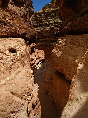
Canyons are inherently risky. Flash floods occur without notice on sunny days. Technical skills & surrounding topography knowledge required yet does not eliminate risk.
Canyoneering
Consensus
View 2
Grade3
WaterA
Risk
TimeII
Statistics
tap row or icons for details
Distance Round Trip 5 miles
Trailhead Elevation 3,724 feet
Elevation Gain 700 feet
Kokopelli Seeds 8.5
 Interest Off-Trail Hiking
unreported if dogs are allowed
editedit > ops > dogs to adjust
feature photo
Photos Viewed All MineFollowing
38  2011-05-01 Vaporman
30  2010-06-04 Forbesy
33  2010-05-01 Vaporman
10  2009-03-21 pseudalpine
Author
author avatar Guides 16,843
Routes 17,472
Photos 24
Trips 1 map ( 6 miles )
Age 28 Male Gender
Location HAZ, TrailDEX
Historical Weather
Trailhead Forecast
Expand Map
Preferred Mar, Apr, May, Oct
Sun  6:01am - 6:49pm
0 Route
 
0 Alternative


remove free decal offer

Guide Needed
Publish Full Detail Guide


Use +Add above to share photos and triplogs
Overview: Another sweet technical canyon in the Lee's Ferry area consisting of three rappels of 35ft, 75ft, & 25ft to reach the Colorado River.


  • Grand Canyon Use Area Boundaries - Dynamic Map


Check out the Triplogs.
Leave No Trace and +Add a Triplog after your canyon trip to support this local community.
WARNING! Hiking and outdoor related sports can be dangerous. Be responsible and prepare for the trip. Study the area you are entering and plan accordingly. Dress for the current and unexpected weather changes. Take plenty of water. Never go alone. Make an itinerary with your plan(s), route(s), destination(s) and expected return time. Give your itinerary to trusted family and/or friends.

 Permit $$
Special Use

Special
No NPS entrance fee. NPS backpacking permit required to camp below the rim.

Grand Canyon National Park
Details for each are occasionaly below numerous alerts
Entrance Fee
Overnight/Backpacking Permits
Grand Canyon Use Areas Map
Rim-to-Rim and Extended Day Hike/Run


 Directions
or
 Road
Paved - Car Okay

To canyon trip
On US89 west of Navajo Bridge, park near the bridge between mile markers 542 & 543.
page created by Vaporman on May 03 2010 7:09 pm
 90+° 8am - 6pm kills
helpcorrectionissue

end of page marker