When hiking several trails on a single "hike", log it with a generic name that describes the hike. Then link the trails traveled, check out the example.
WARNING! Hiking and outdoor related sports can be dangerous. Be responsible and prepare for the trip. Study the area you are entering and plan accordingly. Dress for the current and unexpected weather changes. Take plenty of water. Never go alone. Make an itinerary with your plan(s), route(s), destination(s) and expected return time. Give your itinerary to trusted family and/or friends.
Permit $$
None
Directions
Road
High Clearance possible when dry
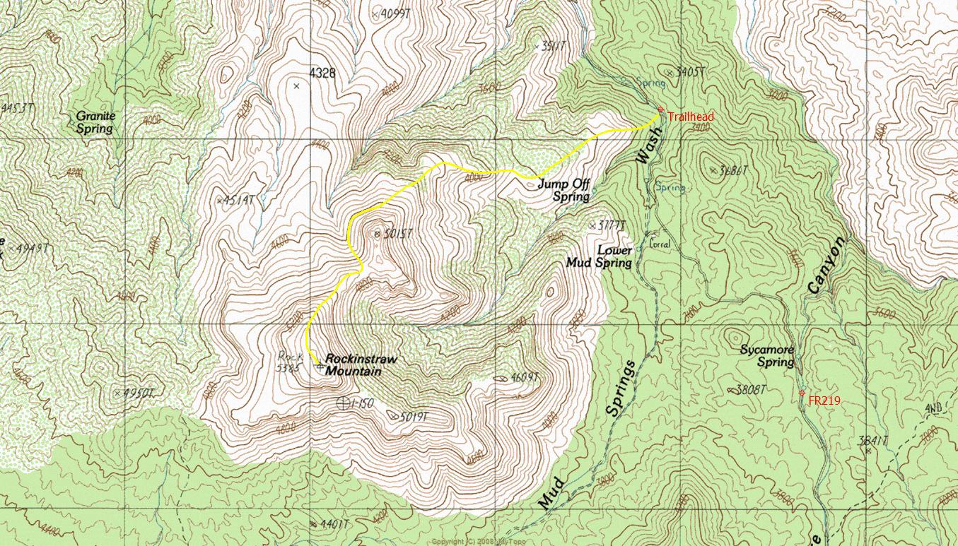
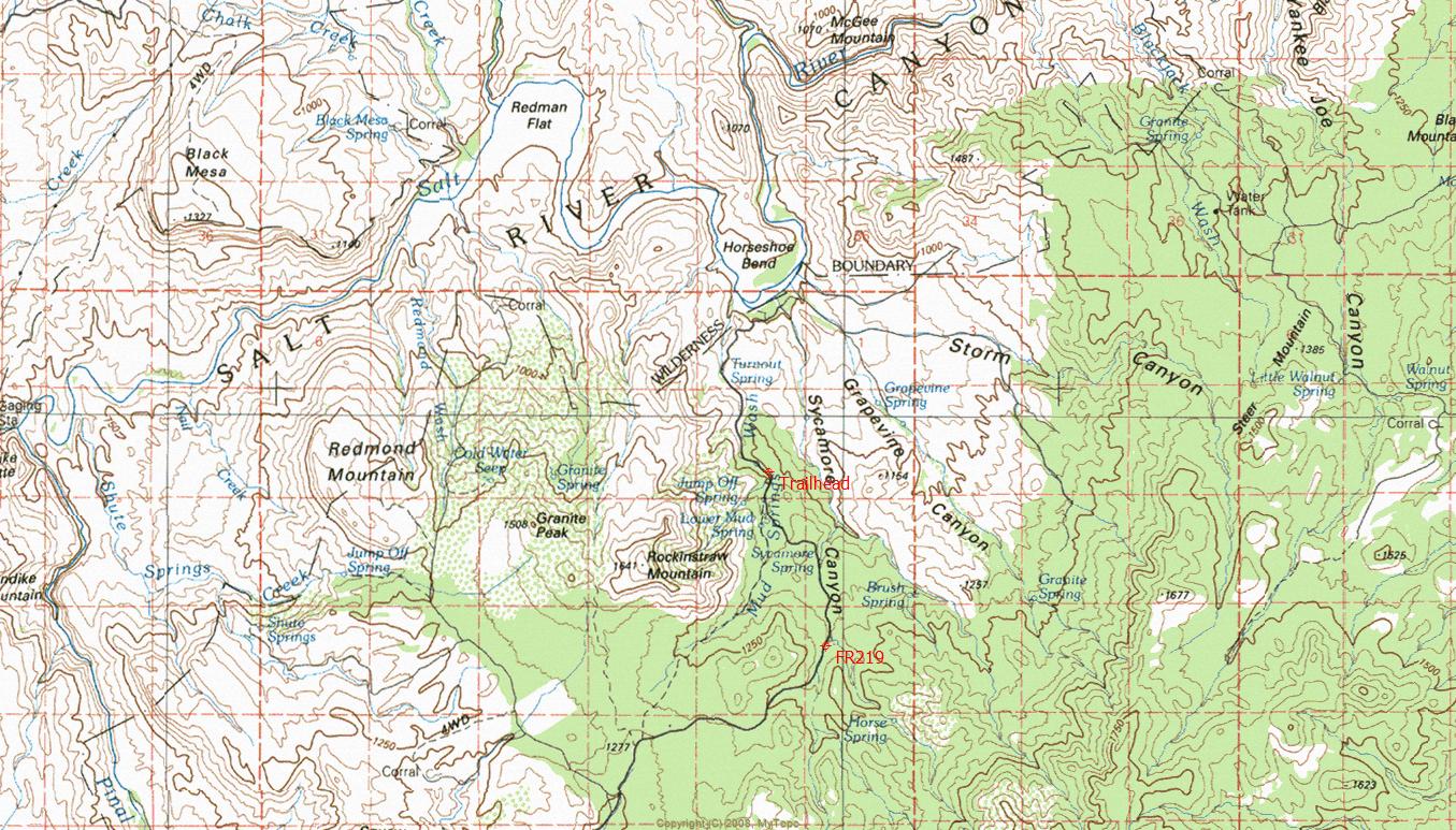
To hike From Mesa Arizona take Highway US 60 to Miami. Turn left at Highway 188 to Roosevelt Lake. Travel 4.5 miles north. The first 4.5 miles of highway 188 have two northbound lanes and two southbound lanes. Stay in the right lane while traveling north. The right lane ends at Wheatfields Road, which is where you will be exiting. Travel northwest on Wheatfields Road while paralleling highway 188 for 1.7 miles through a residential area. At 1.7 miles there is an abandoned slump-block building. Turn right at the slump-block building onto Hicks Road, which will soon go over a bridge crossing Pinal Creek. Pinal Creek is a wide sand wash. Once across the bridge, travel northwest on Hicks Road paralleling Pinal Creek for 2.3 miles to FR219. Just before reaching FR219 you will drive past a large well kept horse ranch on your left. At the beginning of FR219 there is a gate with a "Private Land Access Sign-In Book". FR219 is in a large sand wash. You will be driving through private land for about one mile. The private land ends at a cattle guard in the sand wash. Drive northeast along FR219 (Horseshoe Bend Road) from the gate for approximately 10.0 miles to the designated trailhead (see maps). There is no defined parking area.
 Route Editor


 Overview: Remote benchmark summit hike with vast 360-degree views.


