username
X
password
register
for free!
help


Wire Corral Draw Ridge, AZ

Guide 0 Triplogs  0 Topics
  0 of 5  
Fav
Wish
0
details
drive
no permit
forecast
map
stats
photos
triplogs
topics
location
2 0 0
Statistics
tap row or icons for details
Difficulty 2.5 of 5
Distance Round Trip 4.5 miles
Trailhead Elevation 3,197 feet
Elevation Gain 620 feet
Accumulated Gain 1,110 feet
Kokopelli Seeds 10.05
 Interest Off-Trail Hiking
feature photo
Photos Viewed All MineFollowing
2  2010-05-09 ssk44
Author
author avatar Guides 16,843
Routes 17,472
Photos 24
Trips 1 map ( 6 miles )
Age 28 Male Gender
Location HAZ, TrailDEX
Associated Areas
list map done
Globe Region
Historical Weather
Trailhead Forecast
Expand Map
Preferred Nov, Feb, Mar, Jan
Sun  5:59am - 6:40pm
0 Route
 
0 Alternative


remove free decal offer

 
Guide Needed
Publish Full Detail Guide


Use +Add above to share photos and triplogs
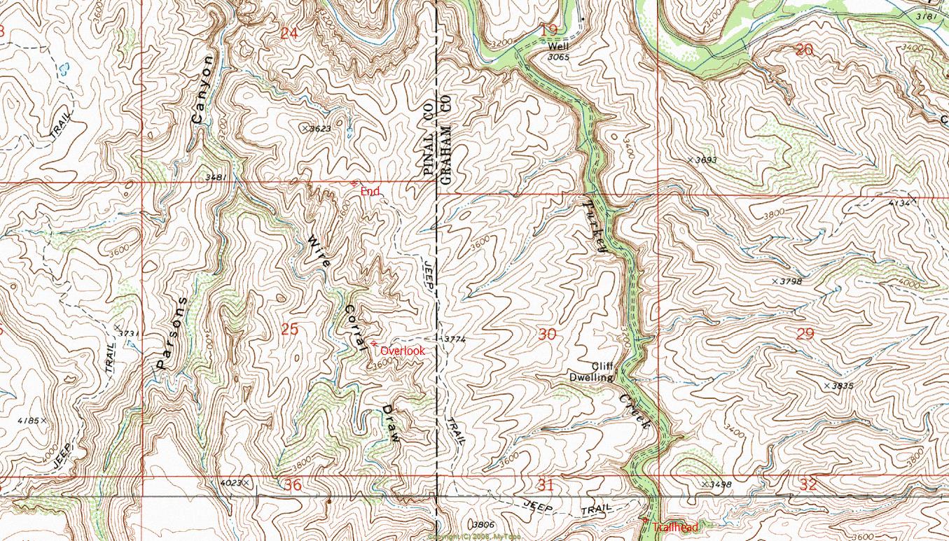
Overview: Abandoned roadbed route following the east rim of Wire Corral Draw. Hike ends at a remote overlook of Aravaipa Canyon. The entire hike is within the Aravaipa Canyon Wilderness.


  • guide related image guide related image
    guide related

Leave No Trace and +Add a Triplog after your hike to support this local community.
WARNING! Hiking and outdoor related sports can be dangerous. Be responsible and prepare for the trip. Study the area you are entering and plan accordingly. Dress for the current and unexpected weather changes. Take plenty of water. Never go alone. Make an itinerary with your plan(s), route(s), destination(s) and expected return time. Give your itinerary to trusted family and/or friends.

 Permit $$
None


 Directions
or
 Road
High Clearance possible when dry

To hike
Access is from Highway 70 northwest of Safford, via Klondyke Road to Turkey Creek. Dispersed camping is permitted along Turkey Creek.
page created by ssk44 on May 09 2010 6:25 pm
 90+° 8am - 6pm kills
helpcorrectionissue

end of page marker