username
X
password
register
for free!
help
  This is likely a great time to hike this trail!  Check out "Preferred" months below, keep in mind this is an estimate.
  

Tanks Canyon, AZ

Guide 1 Triplog  1 Topic
  5 of 5  
Fav
Wish
1
details
drive
permit
forecast
route  
stats
photos
triplog
topic
location
20 1 1
Canyons are inherently risky. Flash floods occur without notice on sunny days. Technical skills & surrounding topography knowledge required yet does not eliminate risk.
Statistics
tap row or icons for details
Distance One Way 4 miles
Trailhead Elevation 5,395 feet
Elevation Gain -800 feet
Kokopelli Seeds 5.33
 Interest Off-Trail Hiking, Seasonal Waterfall, Perennial Waterfall, Seasonal Creek & Perennial Creek
feature photo
Photos Viewed All MineFollowing
Will recalculate on button tap!
18  2012-03-03 ssk44
2  2010-05-13 ssk44
Author
author avatar Guides 16,832
Routes 17,472
Photos 24
Trips 1 map ( 6 miles )
Age Male Gender
Location HAZ, TrailDEX
Historical Weather
Trailhead Forecast
Radar Map
Expand Map
Preferred Apr, May, Oct, Nov
Sun  6:32am - 5:40pm
Official Route
 
0 Alternative


remove free decal offer

  Likely In-Season!
Expand Map
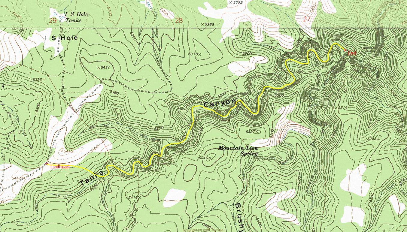
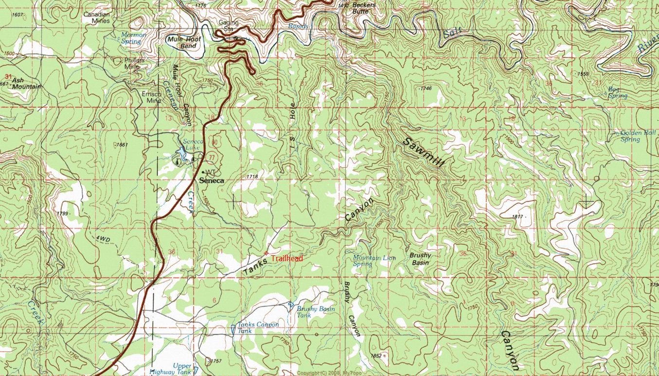
Overview: Rugged and scenic canyoneering route located within the San Carlos Indian Reservation. Canyon stats: -600 vertical feet over 3.5 miles


  • guide related image guide related image
    guide related


Check out the Official Route and Triplog.
Leave No Trace and +Add a Triplog after your canyon trip to support this local community.
WARNING! Hiking and outdoor related sports can be dangerous. Be responsible and prepare for the trip. Study the area you are entering and plan accordingly. Dress for the current and unexpected weather changes. Take plenty of water. Never go alone. Make an itinerary with your plan(s), route(s), destination(s) and expected return time. Give your itinerary to trusted family and/or friends.

 Permit $$
San Carlos Indian Reservation Recreation Permit required.
Price, info & locations at San Carlos - Permits


 Directions
or
 Road
High Clearance possible when dry

To canyon trip
Access is off US60 via SC-10 (South of Seneca Lake). WARNING: This is a remote location with no cell phone signal. Use caution and discretion during ALL activities. You're on your own!
page created by ssk44 on May 13 2010 10:24 am
helpcorrectionissue

end of page marker