Route Editor

| Guide | ♦ | 1 Triplog | 0 Topics |
details | drive | no permit | forecast | 🔥 route |
stats |
photos | triplog | topics | location |
| 5 | 1 | 0 |
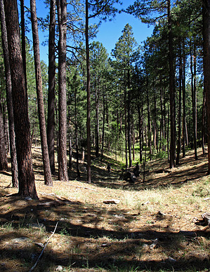
Half Miler by HAZ_Hikebot  Floyd Spring (now a dry spring), resides on a high point atop Dane Canyon in between the area of Dane Spring/Cabin and where the U-Bar Trail#28 crosses Dane Canyon. A nice forest drive on FR145-145A and a short "off-trail" hike to test your GPS skills in locating the source of Floyd Spring at waypoint N34.47637 W111.15524 and to view the scenic drops into lower Dane Canyon drainage from high above. Floyd Spring (now a dry spring), resides on a high point atop Dane Canyon in between the area of Dane Spring/Cabin and where the U-Bar Trail#28 crosses Dane Canyon. A nice forest drive on FR145-145A and a short "off-trail" hike to test your GPS skills in locating the source of Floyd Spring at waypoint N34.47637 W111.15524 and to view the scenic drops into lower Dane Canyon drainage from high above.Check out the Official Route and Triplog. Leave No Trace and +Add a Triplog after your hike to support this local community. | |||||||||||||||||||||||||||||||||||||||||||||||||||||||||||||||||||||||||||||||||||||||||