username
X
password
register
for free!
help
 This is likely a great time to hike this trail!  Check out "Preferred" months below, keep in mind this is an estimate. 
  

Pansy Lake Hike, OR

Guide 2 Triplogs  0 Topics
  4 of 5  
Fav
Wish
0
details
drive
permit
forecast
route  
stats
photos
triplogs
topics
location
23 2 0
Statistics
tap row or icons for details
Difficulty 2.5 of 5
Route Finding 2 of 5
Distance Loop 7.7 miles
Trailhead Elevation 3,568 feet
Elevation Gain 2,108 feet
Avg Time Round Trip 4.5 hours
Kokopelli Seeds 18.24
 Interest Seasonal Waterfall, Seasonal Creek, Perennial Creek & Peak
 Backpack Yes & Connecting
feature photo
Photos Viewed All MineFollowing
Will recalculate on button tap!
8  2018-11-20 keepmoving
15  2010-07-03 sagamihara_hiker
Author
author avatar Guides 15
Routes 265
Photos 3,881
Trips 366 map ( 2,529 miles )
Age 52 Male Gender
Location Sagamihara, Japan
Associated Areas
list map done
North Central Region
Historical Weather
Trailhead Forecast
Radar Map
Expand Map
Preferred Aug, Jul, Sep, Jun → 10 AM
Seasons   Summer to Autumn
Sun  5:36am - 6:37pm
Official Route & 1 Rt
 
0 Alternative


remove free decal offer
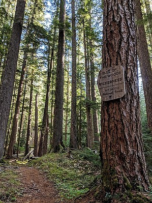
Panoramic Views from old lookout tower
by sagamihara_hiker

 Likely In-Season! 
This is one of the most exceptional hikes in the Bull of the Woods Wilderness. You can actually make as many hikes out of this one as you'd like to; ie Pansy Lake by itself, or Bull of the Woods Mtn and back without the loop; or whatever you imagination can create.


You begin a gentle climb through large standing timber, no doubt old growth. The trail crosses several small streams and is often lined with the wonderful Rhododendron. At about a mile you come to the junction to Trail #549. Keep right here to follow the trail to Pansy Lake, just .2 miles ahead. At the next fork, you can take the trail to the right that leads down to the lake and a small campground. After taking in the view of the lake, return to the main trail and take a right following the sign for Twin Lakes. After 0.8 miles you'll come to another junction. Turn left on trail #558 which climbs steeply 1.9 miles to a junction with trail #554. Turn left here and follow the trail 0.7 miles to the old lookout tower. It's not staffed anymore but you can climb up and treat yourself to panoramic views, everything from Mt. Rainier to the Three Sisters. After soaking in the views, continue on the trail (which is now trail #550) for 1.1 miles to a signed junction. Turn left here on trail #549 which goes 1.3 miles back to the Pansy Lake trail you first started on. Along the trail a short spur trail to the left takes you down to Dickey Lake, another small lake. At the junction with the Pansy Trail (#551), turn right and follow it 0.8 miles back to the trailhead.

2010-07-03 sagamihara_hiker


    Check out the Official Route and Triplogs.
    Leave No Trace and +Add a Triplog after your hike to support this local community.
    WARNING! Hiking and outdoor related sports can be dangerous. Be responsible and prepare for the trip. Study the area you are entering and plan accordingly. Dress for the current and unexpected weather changes. Take plenty of water. Never go alone. Make an itinerary with your plan(s), route(s), destination(s) and expected return time. Give your itinerary to trusted family and/or friends.

     Permit $$
    Information is listed below

    Mount Hood Forest
    more info


     Directions
    or
     Road
    FR / Dirt Road / Gravel - Car Okay

    To hike
    From Portland, take I-205 South to exit 12 and follow the signs to Estacada. Go straight through town, continuing 26 miles on Highway 224 to the bridge at Ripplebrook. Keep straight on what becomes FR 46 for 3.6 miles. Turn right on FR 63 and follow it for 5.6 miles. Turn right on FR 6340 at a sign for Pansy Basin Trail. Follow this road for 7.8 miles and fork right on 6341 for another 3.5 miles. Parking at a big pullout on the right. The trailhead is on the left. Northwest Forest Pass required.
    page created by sagamihara_hiker on Jul 03 2010 8:42 pm
     90+° 8am - 6pm kills
    helpcorrectionissue

    end of page marker