 Route Editor

| Guide | ♦ | 9 Triplogs | 0 Topics |
details | drive | permit | forecast | map |
stats |
photos | triplogs | topics | location |
| 131 | 9 | 0 |
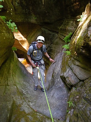
Canyons are inherently risky. Flash floods occur without notice on sunny days. Technical skills & surrounding topography knowledge required yet does not eliminate risk.
 Overview: A challenging technical canyon with 4-8 rappels up to 150ft that drops into West Fork of Oak Creek and then head downstream to the highway. Enjoy! =) Overview: A challenging technical canyon with 4-8 rappels up to 150ft that drops into West Fork of Oak Creek and then head downstream to the highway. Enjoy! =)
Check out the Triplogs. Leave No Trace and +Add a Triplog after your canyon trip to support this local community. | ||||||||||||||||||||||||||||||||||||||||||||||||||||||||||||||||||||||||||||||||||||


