username
X
password
register
for free!
help
   This is likely a great time to hike this trail!  Check out "Preferred" months below, keep in mind this is an estimate. 
  

Cerro Hueco, AZ

Guide 1 Triplog  1 Topic
  4 of 5  
Fav
Wish
0
details
drive
permit
forecast
map
stats
photos
triplog
topic
location
17 1 1
Statistics
tap row or icons for details
Distance One Way 0 miles
Trailhead Elevation 6,863 feet
 Interest Off-Trail Hiking & Peak
feature photo
Photos Viewed All MineFollowing
14  2010-09-18 ssk44
3  2010-07-05 ssk44
Author
author avatar Guides 16,843
Routes 17,472
Photos 24
Trips 1 map ( 6 miles )
Age 28 Male Gender
Location HAZ, TrailDEX
Associated Areas
list map done
Alpine Region
Historical Weather
Trailhead Forecast
Expand Map
Preferred Oct, Apr, May, Sep
Sun  5:54am - 6:39pm
0 Route
 
0 Alternative


remove free decal offer

   Likely In-Season! 
Guide Needed
Publish Full Detail Guide


Use +Add above to share photos and triplogs
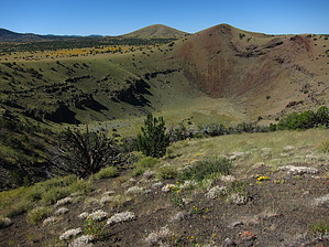
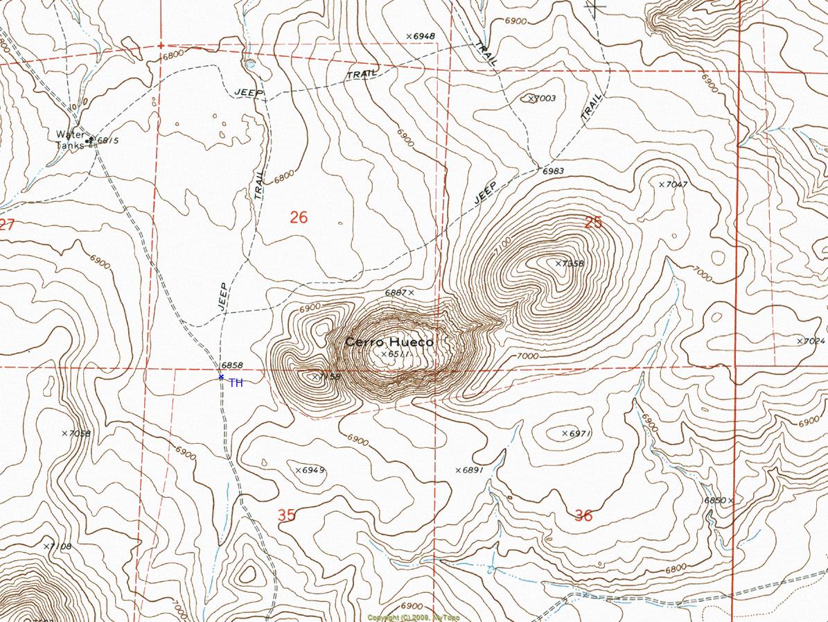
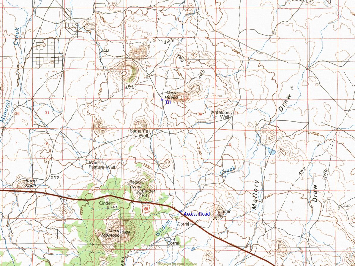
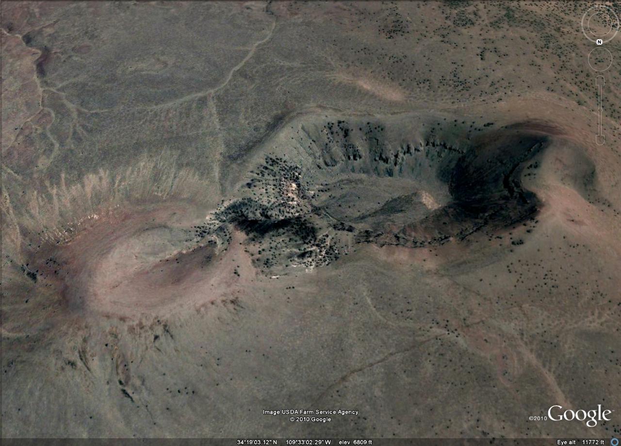
Overview: Unique large volcanic crater with a 1.50-mile circumference and a depth of 400 feet. Location is high plains grasslands.


  • guide related image guide related image guide related image
    guide related


Check out the Triplog.
Leave No Trace and +Add a Triplog after your hike to support this local community.

One-Way Notice
This hike is listed as One-Way.

When hiking several trails on a single "hike", log it with a generic name that describes the hike. Then link the trails traveled, check out the example.
WARNING! Hiking and outdoor related sports can be dangerous. Be responsible and prepare for the trip. Study the area you are entering and plan accordingly. Dress for the current and unexpected weather changes. Take plenty of water. Never go alone. Make an itinerary with your plan(s), route(s), destination(s) and expected return time. Give your itinerary to trusted family and/or friends.

 Permit $$
AZ State Recreational Land Permits
For hiking, driving & sightseeing purposes, you seek a recreational permit.
Under "Recreational Land Use" in the link above.
2022 - $15.00 individual
2022 - $20.00 family limited to two adults and children under the age of 18
Plus $1 processing fee
The permitting process is quick, you will be emailed your permit instantly.

Land Parcel Map


 Directions
or
 Road
High Clearance possible when dry

To hike
From the Highway 77 junction outside of Show Low, drive approximately 27 miles along Highway 60 to an unnamed non-maintained primitive road (Lat. 34 degrees/15'/39.58"/N & Long. 109 degrees/33'/18.83"/W). From Highway 60, drive approximately 4 miles north to the posted TH.
page created by ssk44 on Jul 05 2010 4:39 pm
 90+° 8am - 6pm kills
helpcorrectionissue

end of page marker