 Route Editor

| Guide | ♦ | 12 Triplogs | 0 Topics |
details | drive | permit | forecast | route |
stats |
photos | triplogs | topics | location |
| 574 | 12 | 0 |
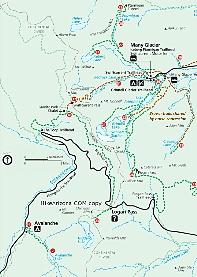
The Jewel of GNP by tibber While the Highline Trail is relatively flat, you should expect some fairly long, gradual climbs and descents.
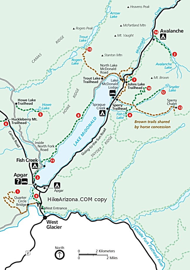
Once this is over you start going down ever so slowly. You have magnifcent views of the Garden Wall up and to your right (east) along with Mt Oberilne and Mt Cannon (south) to your left as well as a few different waterfalls off of Mt Oberlin and Logan Pass. Ahead Haystack Butte is coming into view. You continue on a slight downward walk and get to cross many little streams of water coming out of the mountainside. Eventually you know you have to start going up to get around that Haystack Butte but it seems irrelevant as you continue to soak in the views including the backside of Mt Gould and manage to make your way across the snowfields. It is interesting how the shape of Haystack Butte changes as you make your way around. This area has lots of Bear Grass and during blooming years, it is a site to see let alone walk through. As you climb the switchback for about 1/2 mile and 400 feet quickly to the backside of Haystack Butte, you will run into a good deal of snow if before the end of July. This area is sometimes referred to as Haystack Pass. You may want to take a quick break here and soak in the views before your gradual ascent to the highest elevation point on this trail. From the saddle of Haystack Pass the Highline Trail starts climbing for about a half mile maxing out at 7,300 feet. You can almost always see the trail ahead of you. Sometimes this is a good thing, sometimes not. Looking across the valley ahead to the west is the Livingston Range starting with Heaven's Peak at the right of McDonald Creek far below. For a good part of the summer Heaven's Peak and the Livingston Range are partially covered in snow. As you continue for a mile or so you come upon some seriously incredible views of Lake McDonald to the west (at almost 5 miles from the TH) open up while Mt. Cannon and Mt. Oberlin skirt the other side of the Lower McDonald Creek Valley. You also get a pretty good look at Swiftcurrent Mountain ahead (slightly to the north and east). In this same area you will come across what I call the "weeping wall" of the Highline Trail as you may need to negotiate around some water as it comes out of the mountain side just like the cars do on the "Weeping Wall" section of GTTSR. The Highline Trail continues to lose elevation as it passes through an area partially burned during a fire that occurred in 1967 (6300 acres). While not too many trees remain, you can still see a number of dead trees still standing. Soon, the Highline Trail heads east as it goes around a ridge. From here, views of Swiftcurrent Mountain and the scenic area around Granite Park Chalet are more visible; it is about 2.5 miles to the Chalet. The Highline Trail continues to gradually lose elevation flattening out in a short time. At almost 7 miles you come to a junciton where you can take a steep side hike on a trail through a somewhat shale-like area up to Grinnell Overlook via the Grinnell Glacier Overlook Trail. Per the sign at the junction the trail is .6 miles. It goes up at quite an angle and doesn't look like it has the best footing. From the junction with the Grinnell Glacier Overlook Trail, the Highline Trail starts going up towards the Granite Park Chalet for .8 miles. At the Granite Park Chalet you can rest up for the next portion of your hike. There are concessions available and if you've made reservations for a through hike, you can rest there for the evening. If you are on a day hike you can go back the way you came but most people choose the 4 mile hike down the Loop Trail. The Loop Trail has a separate hike description as it is a route one can take up and down to the Granite Park Chalet. The Glacier shuttle stops at the Loop TH on the GTTSR. Be sure and check the times altho there is usually a sign athe Chalet junction indicating the time of the last shuttle at both Logan Pass TH and The Loop TH. Fires of GNP: I happen to find this great link to Fires of Glacier National Park. It is a great presentation mostly highlighting the 2003 fires.
Check out the Official Route and Triplogs. Leave No Trace and +Add a Triplog after your hike to support this local community. One-Way Notice This hike is listed as One-Way. When hiking several trails on a single "hike", log it with a generic name that describes the hike. Then link the trails traveled, check out the example. | ||||||||||||||||||||||||||||||||||||||||||||||||||||||||||||||||||||||||||||||||||||||||||||||||||||||||||||||||||||||||||||||||||||||||||||||||||||||||||||||||||||||||||||||||||||||


