Overview
Connector Trail between the southern terminus of the Brin's Mesa Trail and the Soldier Pass Trail at the Devil's Kitchen Sinkhole.
The Cibola Pass Trail, which shortcuts the Jordan Trail, passes through the wilderness boundary, while the Jordan Trail does not, so mountain bikes must use the full Jordan Trail. Cibola Pass can be used by hikers and shorten the Jordan Trail stretch by 0.2 miles.
You can utilize both the Cibola Pass Trail and the Jordan Trail to create a 6-8 mile loop (depending on which trailhead is used) with the Brin's Mesa and Soldier Pass trails.
When hiking several trails on a single "hike", log it with a generic name that describes the hike. Then link the trails traveled, check out the example.
WARNING! Hiking and outdoor related sports can be dangerous. Be responsible and prepare for the trip. Study the area you are entering and plan accordingly. Dress for the current and unexpected weather changes. Take plenty of water. Never go alone. Make an itinerary with your plan(s), route(s), destination(s) and expected return time. Give your itinerary to trusted family and/or friends.
Permit $$
Red Rock Pass - may or may not be required. Go to Red Rock Pass then check "When is a Red Rock Pass Required?". If you have questions contact the Coconino forest service.
Directions
Road
Paved - Car Okay
To Jordan - Jim Thompson Trailhead Jim Thompson Trailhead ( Jordan )
From the Sedona Y (Junction 89A and 179) go north east, towards Uptown Sedona, for 0.3 miles. Turn left into Jordan Rd and follow Jordan Rd for 0.8 miles to a T intersection with Park Ridge Drive. Turn left on Park Ridge Drive to the end of the pavement and continue on a fairly bumpy dirt road (but passable for passenger cars) for about 0.7 miles to parking and trailhead.
Brins Mesa West
You may want to use this trailhead if you're planning to do a car shuttle hike between the west and east Brins Trail. From the Sedona Y (Junction 89A and 179) go west towards West Sedona and Cottonwood for 3.1 miles. At the Dry Creek Road light, turn right (north) and follow the paved Dry Creek Road for 2.1 miles. You'll be looking for a well marked turn-off to the right, which is variously labeled FR 152, Vultee Arch Road or Dry Creek Road. Whatever its name, it's the only dirt road going north west in the general area. Follow the quite bumpy road (but passable for passenger cars) for about 2.4 miles, past the Devil's Bridge Trail parking area. You'll get to the Brins Mesa Tr sign on the right and will find ample parking.
Soldiers Pass Trailhead
An alternate trailhead about 1.2 hiking miles away from the Jordan Road Trailhead. You may want to use it if you're going to do one of many loop hikes. From the Sedona Y (Junction 89A and 179) go west towards West Sedona and Cottonwood for 1.2 miles to the first light and turn right into Soldiers Pass Road. Follow the winding Soldiers Pass Road north for 1.5 miles to Rim Shadows Drive. There is a small brown trail sign there. Turn right and go on for less than 0.2 miles. The names of the roads are screwy around here, but there are little brown signs steering you to the parking area. The parking is on the left, up a gated drive (only open from 8am to 6pm!) with a limited number of parking spots.
From PHX (I-10 & AZ-51) 123 mi, 2 hours 16 mins From TUC (Jct 1-10 & Grant) 228 mi, 3 hours 56 mins From FLG (Jct I-17 & I-40) 29.3 mi, 41 mins
 Route Editor


 Overview
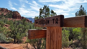


