username
X
password
register
for free!
help


The Rincon - White Canyon Wilderness, AZ

Guide 7 Triplogs  1 Topic
  4.5 of 5  
Fav
Wish
1
details
drive
no permit
forecast
map
stats
photos
triplogs
topic
location
195 7 1
Statistics
tap row or icons for details
Difficulty 4 of 5
Distance One Way 3.3 miles
Trailhead Elevation 2,622 feet
Elevation Gain 1,340 feet
Accumulated Gain 1,890 feet
Kokopelli Seeds 9.6
 Interest Off-Trail Hiking & Peak
unreported if dogs are allowed
editedit > ops > dogs to adjust
feature photo
Photos Viewed All MineFollowing
11  2025-01-24 fdv75
17  2023-12-05 fdv75
11  2019-03-20
The Rincon Rim
Oregon_Hiker
30  2019-03-20
Battle Axe-White Canyon Area
rwstorm
32  2019-03-20 Grasshopper
50  2015-10-31
The Rincon Battle Axe Butte Loop
CannondaleKid
29  2010-12-18 ssk44
5  2010-10-13 ssk44
Page 1,  2
Author
author avatar Guides 16,843
Routes 17,472
Photos 24
Trips 1 map ( 6 miles )
Age 28 Male Gender
Location HAZ, TrailDEX
Associated Areas
list map done
Globe Region
Historical Weather
Trailhead Forecast
Expand Map
Preferred Mar, Nov, Feb, Jan → 7 AM
Sun  6:01am - 6:44pm
3 Routes
 
1 Alternative


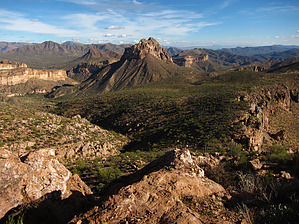
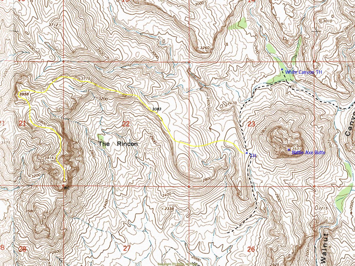
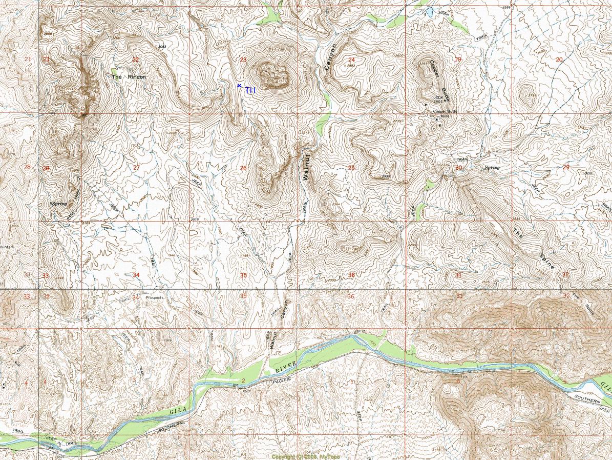
secluded reunion of mixed wavelengths
by HAZ_Hikebot

  
Overview
Dramatic off-trail ridgeline hike with rugged terrain and striking views. The entire route stays within the White Canyon Wilderness.


Warning
The last half-mile of this hike involves extreme terrain that demands respect and caution. 100-200 foot blind cliffs, overhanging fragmented edges, jagged ravines, narrow gullies, and loose shale are present. A poor judgment could result in death.
remove free decal offer
F-100F Accident Report Download 7.2mb pdf

2018-07-14 HAZ_Hikebot
  • S_45579-12817_1287007435-01.jpg S_45579-12817_1287007435-02.jpg S_45579-12817_1287007435-03.jpg
    guide related


Check out the Triplogs.

Note
This is a moderately difficult hike.
Leave No Trace and +Add a Triplog after your hike to support this local community.

One-Way Notice
This hike is listed as One-Way.

When hiking several trails on a single "hike", log it with a generic name that describes the hike. Then link the trails traveled, check out the example.
WARNING! Hiking and outdoor related sports can be dangerous. Be responsible and prepare for the trip. Study the area you are entering and plan accordingly. Dress for the current and unexpected weather changes. Take plenty of water. Never go alone. Make an itinerary with your plan(s), route(s), destination(s) and expected return time. Give your itinerary to trusted family and/or friends.

 Permit $$
None


 Directions
or
 Road
Strictly 4x4

To hike
Mesa - US60 - Superior - Highway 177 - Battle Axe Road - White Canyon - Unnamed 4x4 Road - Destination (Saddle)
page created by ssk44 on Oct 13 2010 4:03 pm
 90+° 8am - 6pm kills
helpcorrectionissue

end of page marker